
 Join The Club


Marine Weather
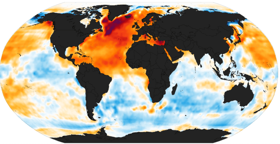
The Push To Identify Ocean Heat Waves Before They Happen
By Kendra Pierre-Louis (Bloomberg) –The world’s oceans are simmering. Some 48% of the ocean experienced marine heat waves in August, according to
By Kendra Pierre-Louis (Bloomberg) –The world’s oceans are simmering. Some 48% of the ocean experienced marine heat waves in August, according to

(Ocean Weather Service) – Each year there are, on average, about 6 hurricanes in the North Atlantic, 8 in the Eastern North Pacific and 17 Typhoons in
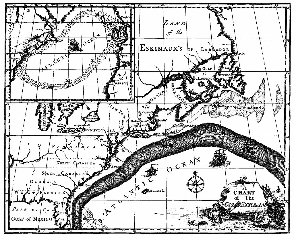
Crossing the Gulf Stream where ocean currents can exceed 2 knots takes some skill and if you try in under certain weather conditions, could be dangerous for
by: Horst von Bargen (Deutscher Wetterdienst) Meteorological satellites (geostationary at an altitude of about 36.000 km and sun-synchronous at a height of

by Brian K Sullivan (Bloomberg) In a week when heavy rains in Louisiana led to eight deaths and forced more than 20,000 people from their homes, the
by Brian K Sullivan (Bloomberg) Colorado State University edged up its seasonal Atlantic hurricane forecast to 15, three more than in an average year. The new
The Pacific Ocean is warm. Very warm. Last week, NOAA‘s U.S. Climate Prediction Center announced temperatures reached 3 degrees Celsius
![Top Hurricane Tracking Sites [Ranked]](https://gcaptain.com/wp-content/uploads/2012/08/699900main_sandy_360.jpeg)
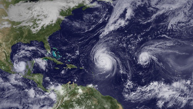
Editor’s NOTE: With Hurricane Sandy currently over Cuba and threatening Florida and the U.S. East Coast, here is a look at some of the top websites
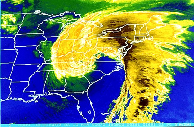
This week, back in 1993, was one of the most intense East Coast Storms ever seen. Early on March 13, 1993 an unusually severe extratropical low moved ashore
![Intense Storm Affecting North Atlantic Shipping Routes [UPDATE]](https://gcaptain.com/wp-content/uploads/2013/02/shutterstock_4906567.jpg)
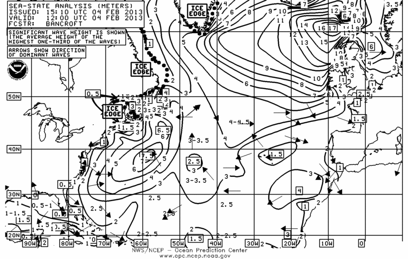
UDPATE The hurricane force storm that was over the western North Atlantic shipping lanes Feb. 23rd-24th has weakened and turned northward towards Greenland,
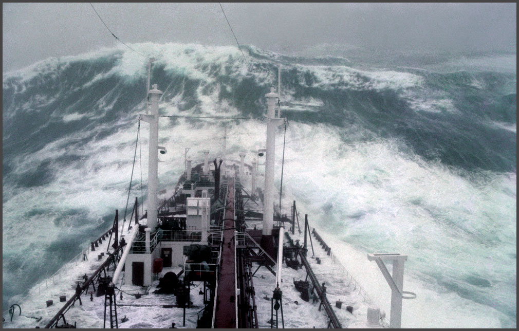
An intense hurricane force storm is forecast to move from south of Iceland towards the coast of Norway on Monday with a large area of winds forces 10-12 (50-70
![BOOM! Intense North Atlantic Storm Drops to 930 Millibars! [REVIEW]](https://gcaptain.com/wp-content/uploads/2013/01/NOAA-OPC-Surface-Forecast-12Z-25-January-20133.jpeg)
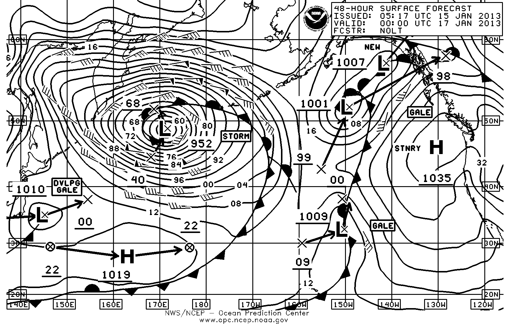
Last weekend saw an unusually intense hurricane force extratropical storm low over the North Atlantic. An active weather pattern started showing up on
16 January Update: A major hurricane force storm continues over the western North Pacific with winds up to 65 knots and significant wave heights up to 20
Applied Weather Technology, Inc. (AWT), announced today at SMM Hamburg its Fleet Decision Support System (FleetDSS). The new fleet management system is
The following article provided by the marine weather blog Ocean Weather Services blog and written by Fred Pickhardt, a professional marine meteorologist and

When the first hurricane emerges from the Atlantic Ocean or Gulf of Mexico this season, NOAA will use a new statistical model to help predict the start of the
By Fred Pickhardt, With two named tropical storms already on the books before the official start of the 2012 hurricane season I wanted to review what the
Getting updates from your weather routing service can be helpful but many mariners prefer to do their own forecasting at sea. The problem is the maps

The U.S. Integrated Ocean Observing System, or IOOS®, is a vast, coordinated network of people and technology working together to deliver data on our
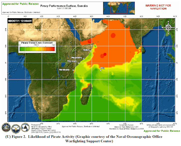
NATO’s Rear Admiral Hank Ort (NLD N) this week warned that pirate activity in the Gulf of Aden, Indian Ocean and Arabian Sea is likely to increase as
Essential maritime and offshore news, insights, and updates delivered daily straight to your inbox


Essential news coupled with the finest maritime content sourced from across the globe.
Sign Up
