
 Join The Club


News
Japan Announces Flag State Approval for Admiralty Digital Publications
PRESS RELEASE – Japan is the most recent addition to a growing list of Flag States to formally approve the United Kingdom Hydrographic Office’s range
PRESS RELEASE – Japan is the most recent addition to a growing list of Flag States to formally approve the United Kingdom Hydrographic Office’s range
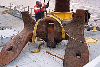
By Paul Cooper, Vice President of CARIS USA and John Hersey, ARGUS Project Manager for SURVICE Engineering: How is one sailboat captain helping improve
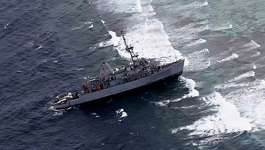
PEARL HARBOR, Hawaii – A U.S. Navy investigation to assess the circumstances surrounding the USS Guardian (MCM 5) grounding that occurred in Philippine

While in Hamburg last month for the SMM Expo, I met up with Steinar Gundersen, the CEO of ECDIS-provider MARIS, and Bhupesh Gandi, MARIS’ Asia
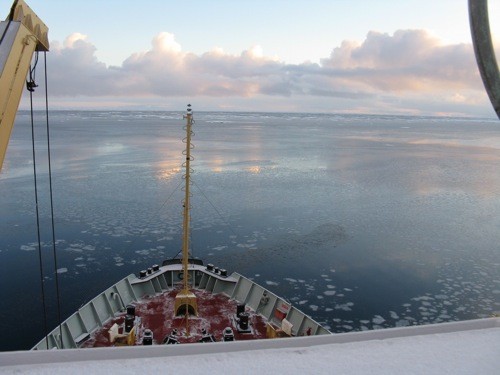
– By Captain Rich Madden It’s 0-dark-30 somewhere in the Gulf of Aden and we are Eastbound in the Internationally Recommended Transit Corridor
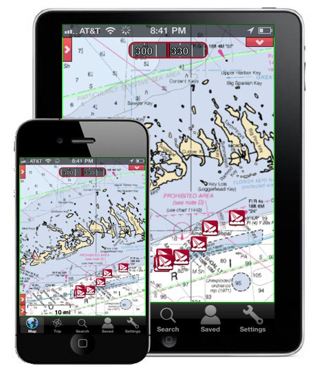
In just two short years, Apple’s iPad has grown to dominate the world of tablet computing with over 48 million units sold. Tomorrow Apple is set to
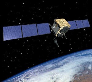
BEIJING (Dow Jones)–China has begun operating a homegrown satellite navigation service that is designed to provide an alternative to the U.S. Global
NOAA’s development of a new navigational chart processing system, designed to meet the changing needs of the maritime community, moves into initial
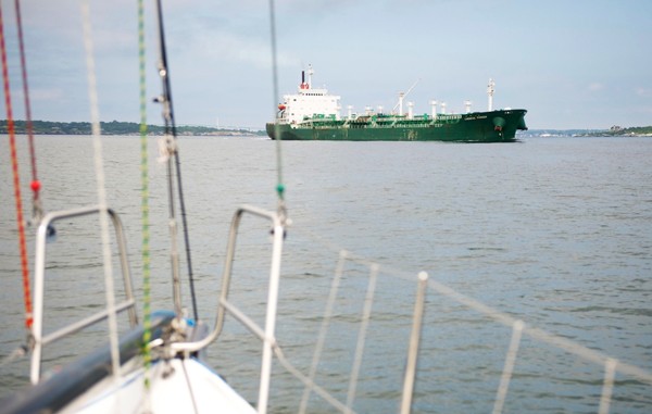
Ok folks, gCaptain was once again in another crossing situation with a tanker this past weekend. We seem to be pretty good at finding ourselves in these
NOAA Administrator Jane Lubchenco has appointed nine new members to the Hydrographic Services Review Panel, a federal advisory committee that gives NOAA
On the first day of the 15th session of the IMO Sub-Committee on Radiocommunications, Search and Rescue, a ceremony took place to celebrate the expansion of

The following article by CDR Michael Hendersen, Navigation Manager NOAA was originally published in the December 2010 edition of CAMM , Council Of American

Despite the availability of satellite navigation systems, and ships that are awash with electronics, maritime buoyage still matters, particularly in pilotage
The use of Unmanned Aerial Vehicles (UAV) has been a popular topic of discussion here at gCaptain and has been associated with a variety uses ranging from
I miss the ticks of the analogue gyro repeater. Today’s gyro compasses are more functional and easy to interface with modern electronic systems but they

Regulators and suppliers are going full steam for ECDIS; But are shipowners and officers onboard? Today and tomorrow hundreds of the ECDIS faithful are
Recently, the USCG issued a Marine Safety Alert warning operators to have policies in place on the use of cells phones and other devices that may distract crew
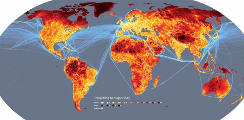
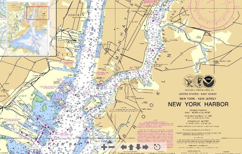
From the gCaptain archives… Here at gCaptain, we are a big fan of maps and when you came across this one, we couldn’t help but to post here on

Question: What is The most dangerous hour in shipping? Answer: 22:24 to 23:45 There are three watches aboard ship 00-04 (i.e. 0000 to 0400 and 1600 to 2200) is
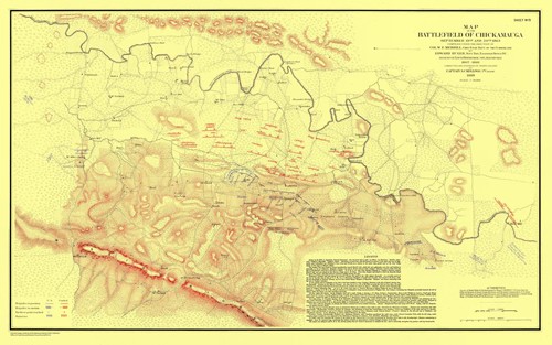
U.S. Coast Survey cartographers traveled with Union forces to produce battlefield maps during the Civil War (Map of the Battlefield of Chickamauga). Credit:
Essential maritime and offshore news, insights, and updates delivered daily straight to your inbox


Essential news coupled with the finest maritime content sourced from across the globe.
Sign Up
