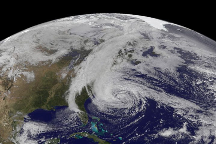
The Geostationary Operational Environmental Satellite 13 (GOES-13) captured this natural-color image of Hurricane Sandy at 1:45 p.m. Eastern Daylight Time (17:45 Universal Time) on October 28, 2012
This week mark’s the 1 Year Anniversary of “Superstorm Sandy” and to commemorate we’ll be taking a look back at some our best coverage from the historic weather event.
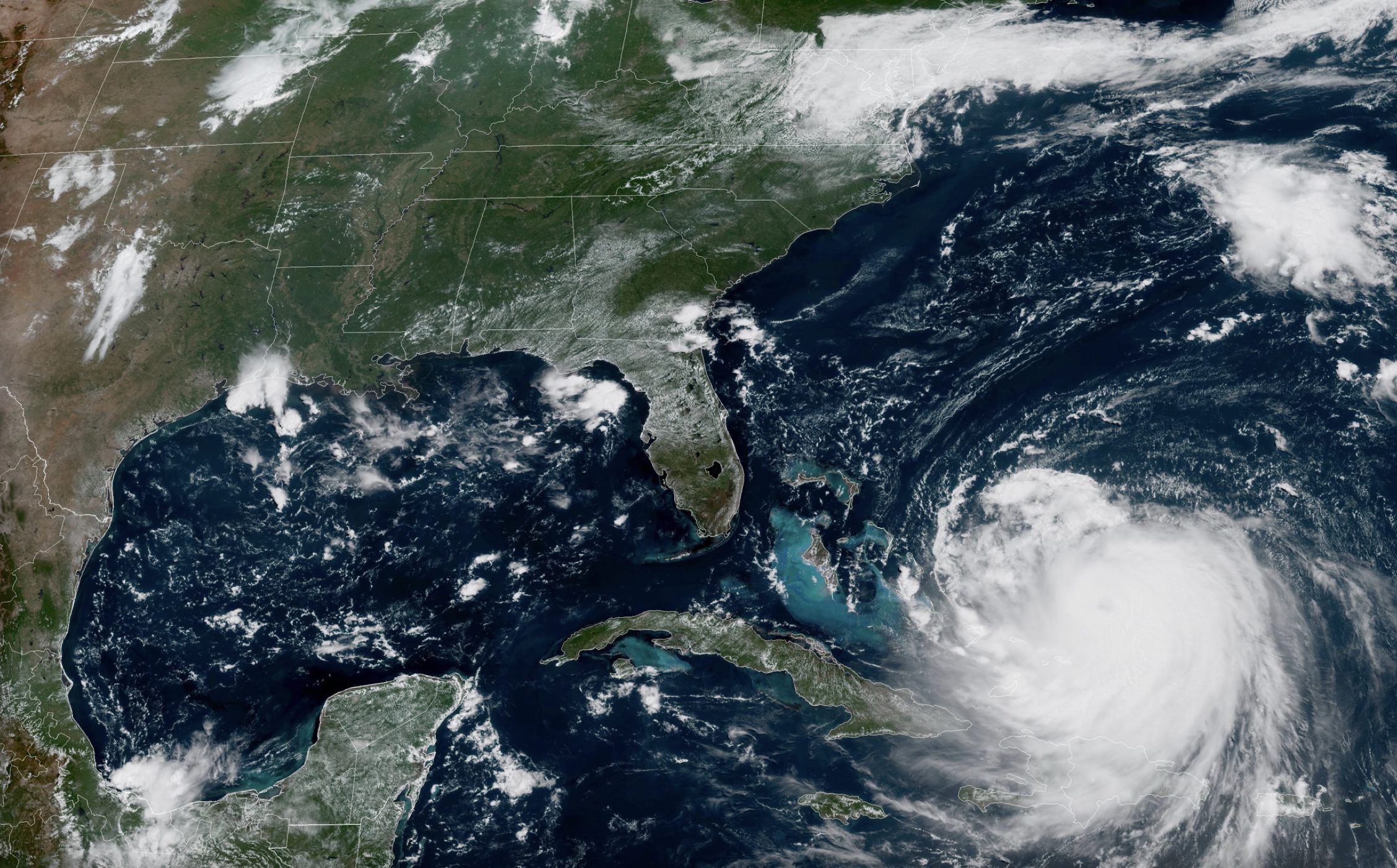
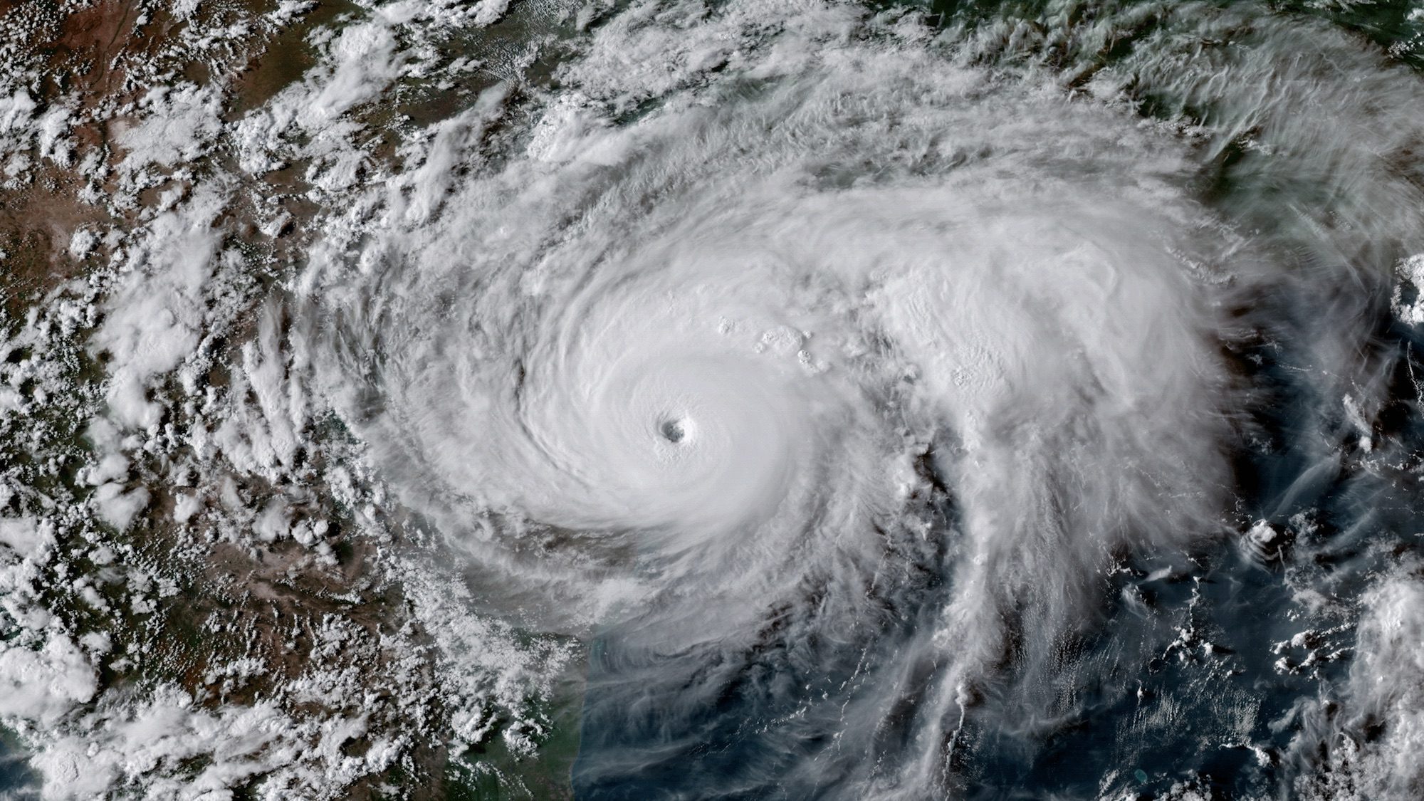
To kick things off, below is a time lapse animation showing Hurricane Sandy from the vantage point of geostationary orbit—35,800 km (22,300 miles) above the Earth. The animation shows images taken by NOAA’s GOES-14 satellite of Sandy on October 28, 2012, from 7:15 to 6:26 EDT. Light from the changing angles of the sun highlight the structure of the clouds. The “super rapid scan” images—one every minute from 7:15 a.m. until 6:30 p.m. EDT—reveal details of the storm’s motion.
NASA animation by Kevin Ward, using images from NOAA and the University of Wisconsin-Madison Cooperative Institute for Meteorological Satellite Studies.
Stay tuned for more…
Editorial Standards · Corrections · About gCaptain

 Join The Club