By Krishna Karra, Alex Longley and Verity Ratcliffe (Bloomberg) —
An oil slick extending more than 125 miles appeared in the Red Sea, satellite images show, a fresh environmental disaster in a waterway where commercial ships are under siege from attacks by Yemen’s Houthi militants.
The slick extends from about 60 miles northwest of the Yemeni city of Hodeidah and continues northbound, the pictures show. It appears in images from the Sentinel 2 satellite that were taken on July 16 and wasn’t previously present on July 14.
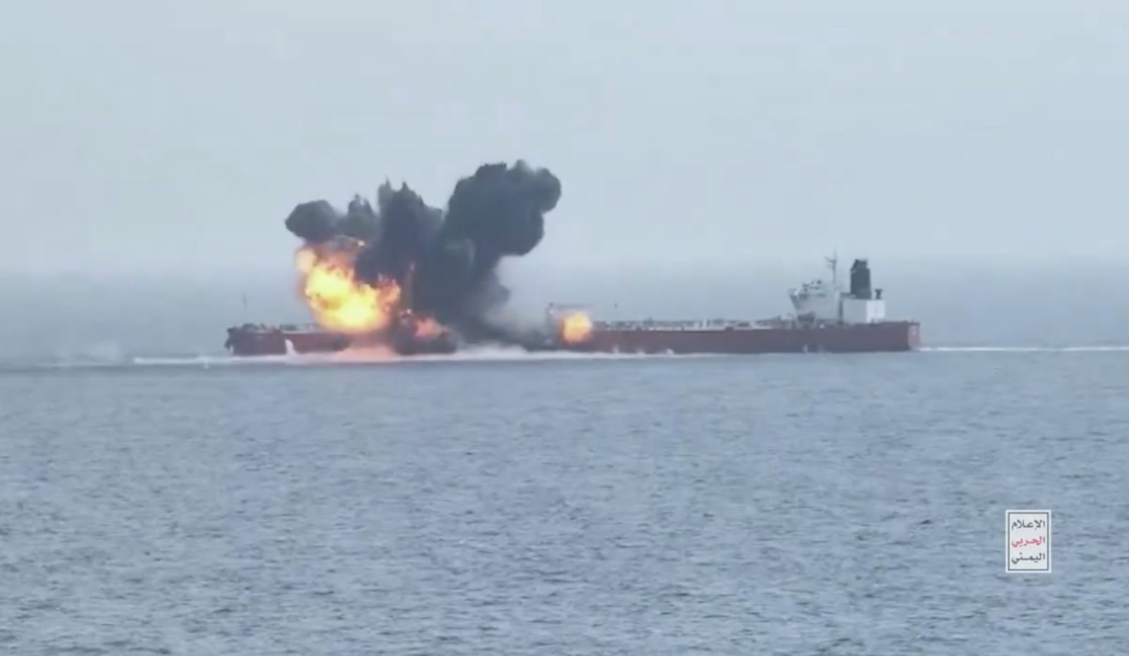
It wasn’t clear which vessel caused the spill, or whether it was a direct result of a Houthi attack, but multiple ships have been targeted in the region in recent days, including one — the Chios Lion — with a sea drone. That carrier was investigating a possible oil spill, the UK Navy said Tuesday.
Staying Away
The Chios Lion collected 90,000 tons, about 600,000 barrels, of fuel oil from Russia’s Black Sea port of Novorossiysk on July 2 and was heading to China, according to shipping information compiled by Bloomberg. Most seagoing merchant ships also use fuel oil for power.
Stealth Maritime, the vessel’s manager, said a small amount of damage was caused to the vessel and the crew is unharmed. The firm declined to comment on whether oil is spilling from the tanker.
The Houthis have been attacking vessels in the Red Sea for months in protest at Israel’s war with Hamas.
Although many ships are avoiding the area, instead sailing thousands of miles around Africa, some continue to run the gauntlet. Attacks ramped up last month, which was the most active so far this year, culminating in the sinking of a second ship with a sea drone.
Earlier in the year when the Houthis sank a vessel called the Rubymar there was a fertilizer spill. Other ships have been damaged and either continued to their destinations or awaited salvage by specialists.
Based on the shape of the spill, its color and the way it is spreading on the surface of the sea, it is likely fuel oil, according to Wim Zwijnenburg, a project leader at Netherlands-based PAX, who’s spent 10 years studying satellite images to identify the environmental impacts that conflicts cause.
Surface winds are pushing the slick to the south, and two large gyres in the surface currents are making the slick very convoluted, according to John Amos, CEO of the investigative nonprofit SkyTruth.
© 2024 Bloomberg L.P.

 Join The Club


