Initiative aims to increase the global coverage, quality, and accessibility of seabed mapping data through collaboration and the creation of a more integrated marine geospatial sector
The UK Hydrographic Office (UKHO) is inviting UK government organisations involved in seabed mapping who share common interests in optimising the UK’s national maritime assets to become a member of the newly unveiled UK Centre for Seabed Mapping.
The UK Centre for Seabed Mapping (UK CSM) is administered by the UKHO, and was submitted as a UK Government Voluntary Commitment to the United Nations at the UN Ocean Conference in Lisbon, Portugal, on 27 June 2022.
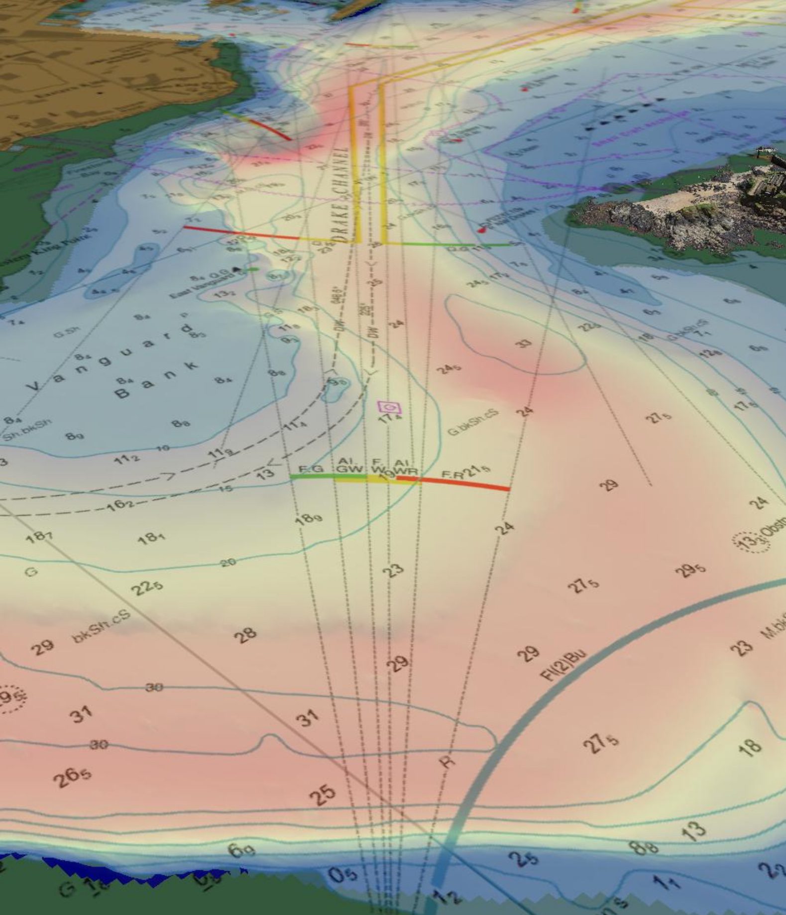
The UK CSM has a remit to increase the coverage, quality and access of seabed mapping data collected using public funds, as well as to better promote it as a critical component of national infrastructure. Created to spearhead a coordinated approach to the collection, management, and access of seabed mapping data – and to champion a more integrated marine geospatial sector in the UK – the UK CSM has established three initial working groups which members can join and contribute to: National Data Collaboration, International Data Collaboration, and Data Collection Standards.
These working groups will further the discussion and coordination of data accessibility, collection and collaboration, as well as progress work on data standards, by creating the conditions and developing infrastructure to enable the diverse community of marine geospatial stakeholders to come together to deliver significant, sustained, and strategic benefits to the UK – particularly in the context of the Integrated Review and the UK’s Global Britain vision.
Twenty two government agencies have already been involved in the inaugural Management Group meeting of the UK CSM and volunteered to participate on the working groups, an encouraging response which shows a great desire to work across industry and help to raise the profile and improve outcomes of seabed mapping.
Commenting on the announcement, David Parker, Head of Hydrographic Programmes at the UKHO, said: “We are happy to start welcoming UK-based public organisations with any seabed mapping remit to the UK Centre for Seabed Mapping and we are keen for all relevant organisations to join.
“This important and timely initiative, which supports the UK’s contribution and commitment to the United Nations Decade of Ocean Science for Sustainable Development running between 2021 and 2030, will meet the growing need for a more collaborative, cohesive, empowered, and better promoted marine geospatial community, and we are excited to work with organisations in the public sector to make this a reality.
“Quality marine geospatial data is essential for almost every activity undertaken in the marine domain, including maritime trade, environmental and resource management, shipping operations, and national security and infrastructure. Due to the UK’s role as a world leader in seabed mapping, there is a clear opportunity for us to establish a collaborative seabed mapping community which coordinates the collection, management, and access of publicly funded data. More interoperable and usable data will support more informed ocean governance and policy, which in turn will support greater innovation and prosperity.
“In line with the fulfilment of our public duty, our vision is for the UK CSM to become the key focal point for our seabed mapping community and a unified voice for policy support, with the capability to develop a network of stakeholders and to enable meaningful cross government coordination.”
The UK CSM will develop specifications which support UK and international standards for the collection of marine geospatial data. This will provide much needed consistency and interoperability in developing the marine geospatial ecosystem – in line with the “collect once, use many times” principle – and will provide the private sector with confidence of direction. The UK CSM will also improve and increase accessibility and enable free access to data whilst honouring intellectual property (IP) rights, national security, and good data governance.
Having a dedicated centre will also help stakeholders to understand what data collection activities are planned in the future and identify opportunities for collaboration, in turn removing duplication, and optimising economies of scale and the quality and quantity of data being collected under current public funding.
If you would like to know more about the membership process and how to join the UK CSM, contact the team at [email protected] or visit https://www.admiralty.co.uk/uk-centre-for-seabed-mapping
About the UK Hydrographic Office (UKHO)
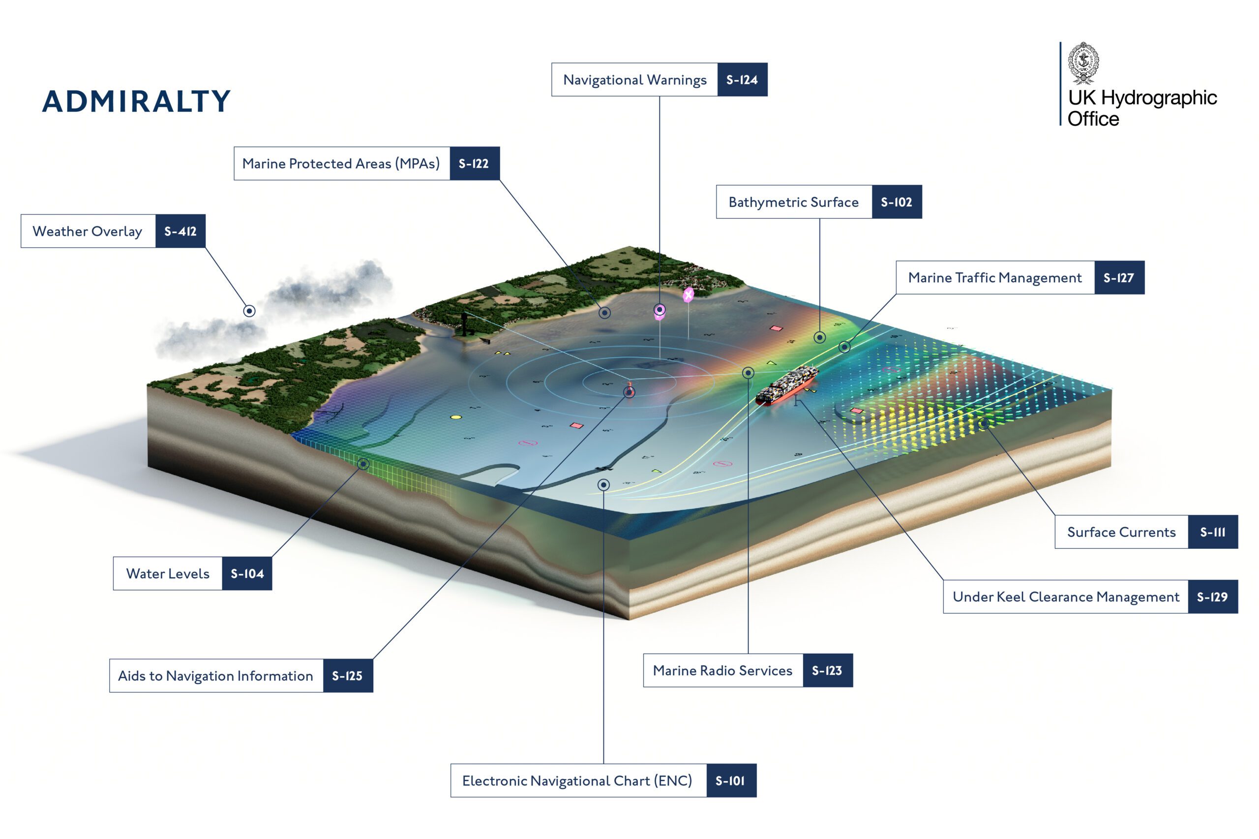
The UKHO is a leading centre for hydrography, providing marine geospatial data to inform maritime decisions. We work with a wide range of data suppliers and partners to support maritime navigation, safety, security and marine development around the UK and worldwide.
We make location-based information available through ADMIRALTY Maritime Data Solutions, our world-leading range of charts, publications and custom data sets. Our use of marine data and technology, combined with our expertise, ensures we continue to innovate and provide a wider range of solutions.
We source, process and provide access to location-based information, ranging from seabed to surface. This enables our partner organisations to make critical maritime decisions – informing the sustainable use and management of the marine environment and supporting the development of the blue economy.
Editorial Standards · Corrections · About gCaptain

 Join The Club