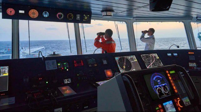
Seafarers have always relied on navigational equipment to steer their vessels safely across the oceans. However, the tools that modern mariners use compared to previous generations are, as expected, far more advanced as a result of today’s tech-driven world.
Where crew members once navigated by the stars using a magnetic compass, the 21st Century seafarer now has access to Electronic Navigational Charts that can receive near real-time updates via satellite connectivity – radically improving communication between ship and shore.
The days of solely relying on paper charts to plot the safest, most efficient course are behind us. Crews using the latest digital equipment and data can optimise their voyage, spot potential hazards such as coral reefs, icebergs and sandbars, and change course to avoid weather-related threats. Aside from enabling seafarers to uphold safety standards, this technology also helps them to address other industry challenges such as decarbonisation.
Steering shipping to a greener future
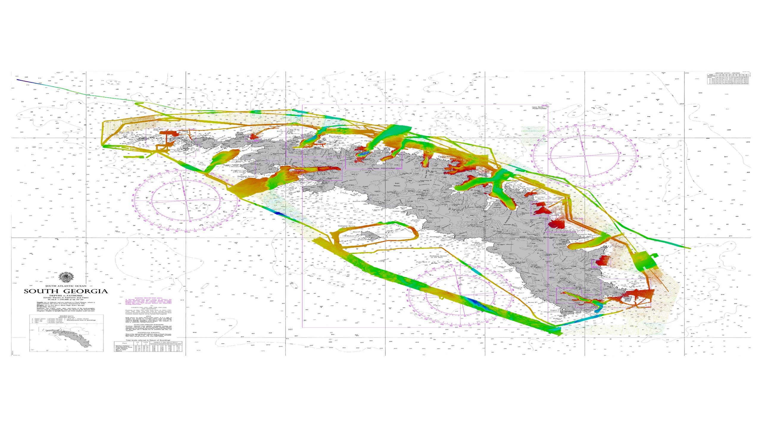
Better understanding of the marine context in which we operate is essential to protecting our oceans, coastlines and environment, as well as to decarbonising maritime operations. Cleaner fuels and novel propulsion technologies will play a significant role in reducing shipping’s carbon impact – but high-fidelity navigational data can also help to deliver significant operational efficiencies in the near term.
Data can help to unlock the latent efficiencies in passage planning, enhance voyage and route optimisation, expedite port operations, and enable ‘smarter steaming’ and Just-in-Time (JIT) arrivals. Studies show that by reducing speeds across the global fleet by 20% – which is a potential by-product of JIT – we may be able to reduce shipping’s carbon footprint by 34%. This means that the potential of smarter navigation, enabled by data-driven efficiencies, is a huge opportunity that the maritime industry must tap into.
Powering next-generation navigational systems
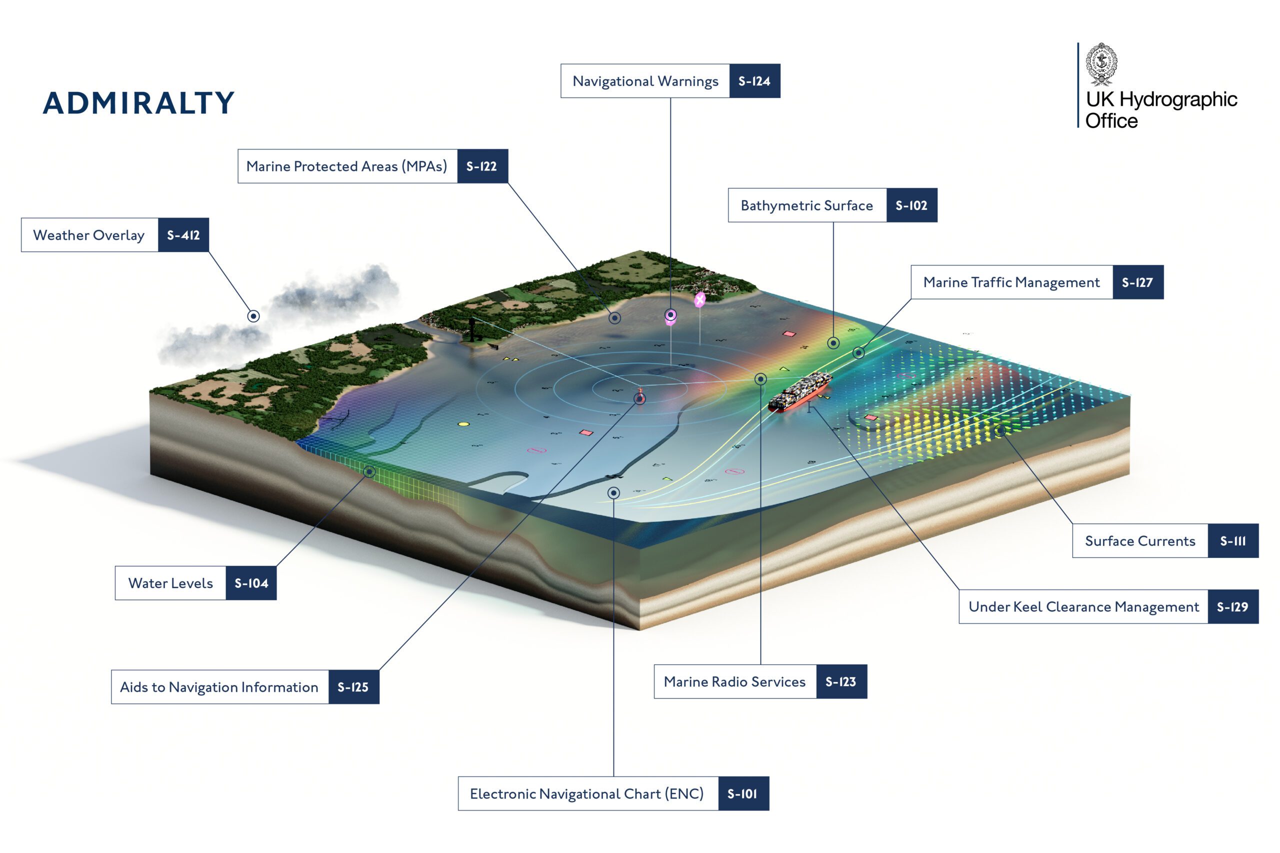
Tomorrow’s navigational solutions will be underpinned by S-100, the International Hydrographic Organization’s (IHO) new data standard. Through a single, coherent data framework, S-100 will transform the way mariners and ocean users view, share and use marine geospatial data – providing harmonised, seamless access.
The S-100 data standard will enrich the user’s view of their marine environment through clearer bathymetric, water levels and surface currents data. That information will subsequently give bridge teams numerous interoperable data sets and overlays to enhance all stages of the passage planning process. In the future, digital layers could even take the place of multiple nautical publications to aid weather routeing and voyage optimisation.
These next-generation solutions will be an integral part of the maritime future, delivering more accurate, timely and useable data for the mariner and telling them where they are rather than where they were. This enables seafarers to receive navigationally critical event-driven updates within minutes, rather than weeks or months, providing a demonstrable improvement in safety and operational efficiency.
The new standards are also the building blocks of the hydrographic industry’s latest wave of innovation, spanning voyage optimisation, green and digital shipping corridors, autonomous vessels, and more. Implementation of the IHO’s S-100 data standard has already begun, with the first S-100 based products and services expected to be carriage compliant from 2026 and mandated from 2029. Additionally, the first batch of S-100 series products and services are already on their way to being ready for deployment, with development, testing and trialling taking place.
Gaining trust in an uncertain world
The value of harnessing digital technology to support safe navigation comes from meeting the needs of the modern mariner. Tomorrow’s seafarer will likely require a different skillset from previous generations to operate vessels fitted with innovative AI platforms and systems.
Mariners will also need complete confidence in the systems they use when steering a ship safely and sustainably to their intended destination. The only way to give them that is to provide navigational data from a trustworthy source with a track-record of success. To that end, the UKHO continues to innovate to ensure its ADMIRALTY Maritime Data Solutions support navigation today and for generations to come.
By trusting the ADMIRALTY portfolio, users can navigate with confidence knowing they have access to the latest information to ensure the safety of their vessel, crew, cargo and environment. This data is compiled, assessed and verified by a world-class team of experts at the UKHO to provide users with the safety and commercially critical information they need.
To find out more about how ADMIRALTY products can help you navigate complexity and ensure safety, sustainability and profitability at sea, visit our website
Updated: August 11, 2023 (Originally published August 8, 2023)
Editorial Standards · Corrections · About gCaptain

 Join The Club