By Brian K. Sullivan and Lynn Doan
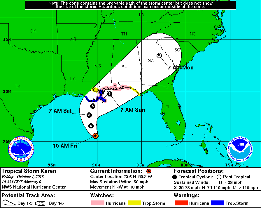
Oct. 4 (Bloomberg) — Tropical Storm Karen may bring more than 8 inches (20 centimeters) of rain, isolated tornadoes and power outages to the U.S. Gulf Coast, where it is expected to go ashore over the weekend, forecasters said.
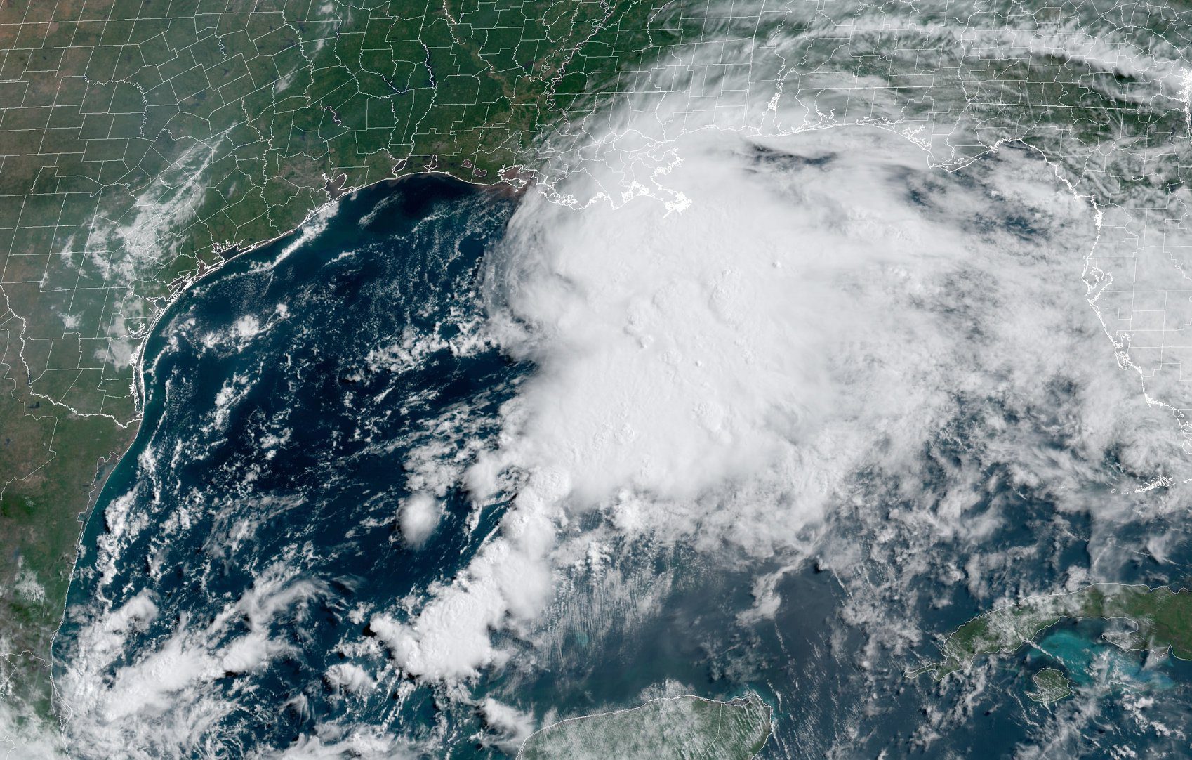
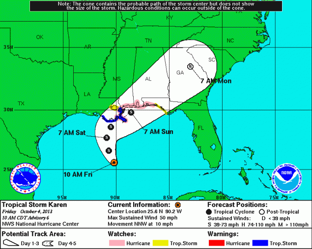
Karen, with top sustained winds of 60 miles (97 kilometers) per hour, was about 295 miles south of the mouth of the Mississippi River, moving northwest at 10 mph, according to a National Hurricane Center advisory at 4 a.m. New York time. The storm may re-intensify over the weekend.
The center’s tracking map forecasts Karen will make landfall as a tropical storm near the Florida-Alabama line tomorrow. The system may drive tides 3 to 5 feet above normal from the Mississippi to Mobile Bay, Alabama.
“It’s obviously the most exciting storm we’ve had this year in terms of U.S. impacts,” said Michael Schlacter, founder of Weather 2000 Inc. in New York. “It’s almost on the cusp of being a hurricane. The fact is, we can have a true hurricane right in the heart of the Gulf of Mexico.”
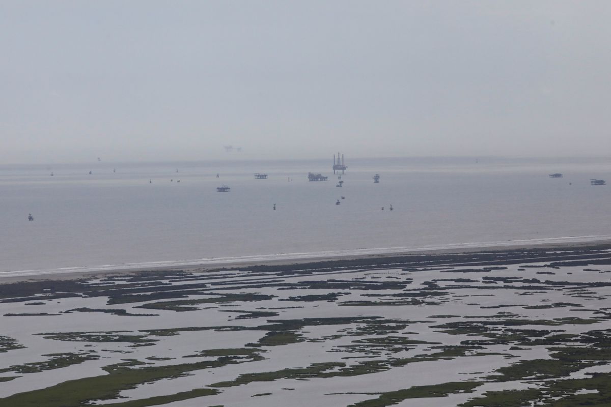
A storm becomes a hurricane when its top winds reach 74 mph, and if one gets into the Gulf, it can affect U.S. and Mexican oil and natural gas operations. The region is home to 23 percent of U.S. crude production, 5.6 percent of gas output and more than 45 percent of petroleum refining capacity, according to the Energy Department.
Gulf Evacuations
Anadarko Petroleum Corp. and Exxon Mobil Corp. were curbing energy production in the Gulf yesterday. Companies including BP Plc, Chevron Corp. and Royal Dutch Shell Plc began evacuating workers from operations in the storm’s path.
A hurricane watch, meaning storm conditions may arrive in two days, was posted from Grand Isle, Louisiana, to west of Destin, Florida. A tropical-storm warning is in effect from Grand Isle to the mouth of the Pearl River on the Louisiana- Mississippi Line.
New Orleans, the coast from Grand Isle to Morgan City, Louisiana, Lake Maurepas, Lake Pontchartrain and the area from Destin to Indian Pass, Florida, are under a storm watch.
As much as 7.8 inches of rain may fall across coastal Alabama and Florida, according to the U.S. Weather Prediction Center in College Park, Maryland. There’s a chance the storm could also touch off tornadoes, especially on its eastern side, said Bob Smerbeck, an expert senior meteorologist at AccuWeather Inc. in State College, Pennsylvania.
Karen is expected to drop heavy rain on Mexico’s Yucatan Peninsula and on western Cuba, according to the center.
Workers Recalled
The Federal Emergency Management Agency recalled workers furloughed by the government shutdown to help prepare for Karen, said Jay Carney, a White House spokesman.
Karen has encountered wind shear, which has exposed its core, according to a forecast analysis by Michael Brennan, a senior hurricane specialist at the center. Shear is when winds blow at varying speeds or directions at different altitudes. That can tear at the structure a tropical system needs to maintain strength.
“The satellite appearance of Karen remains less than impressive,” Brennan wrote. “Despite these negative factors, Karen continues to maintain its intensity.”
It may strengthen slightly before weakening as it nears the coast. It may still be close to hurricane strength by then, Brennan wrote.
Smerbeck said the shear may be enough to keep Karen from “blasting into a full blown hurricane” as it nears land.
Tracking where a storm goes is much easier than predicting its intensity, Schlacter said. Karen might encounter more shear and weaken quickly, or hit an eddy of warm water and flourish, he said.
After Karen goes ashore, it is likely to track up the eastern side of the Appalachian Mountains, bringing heavy rains to the region, Smerbeck said. The rain may reach the cities of the U.S. Northeast next week.
Copyright 2013 Bloomberg.
Editorial Standards · Corrections · About gCaptain
This article contains reporting from Bloomberg, published under license.

 Join The Club