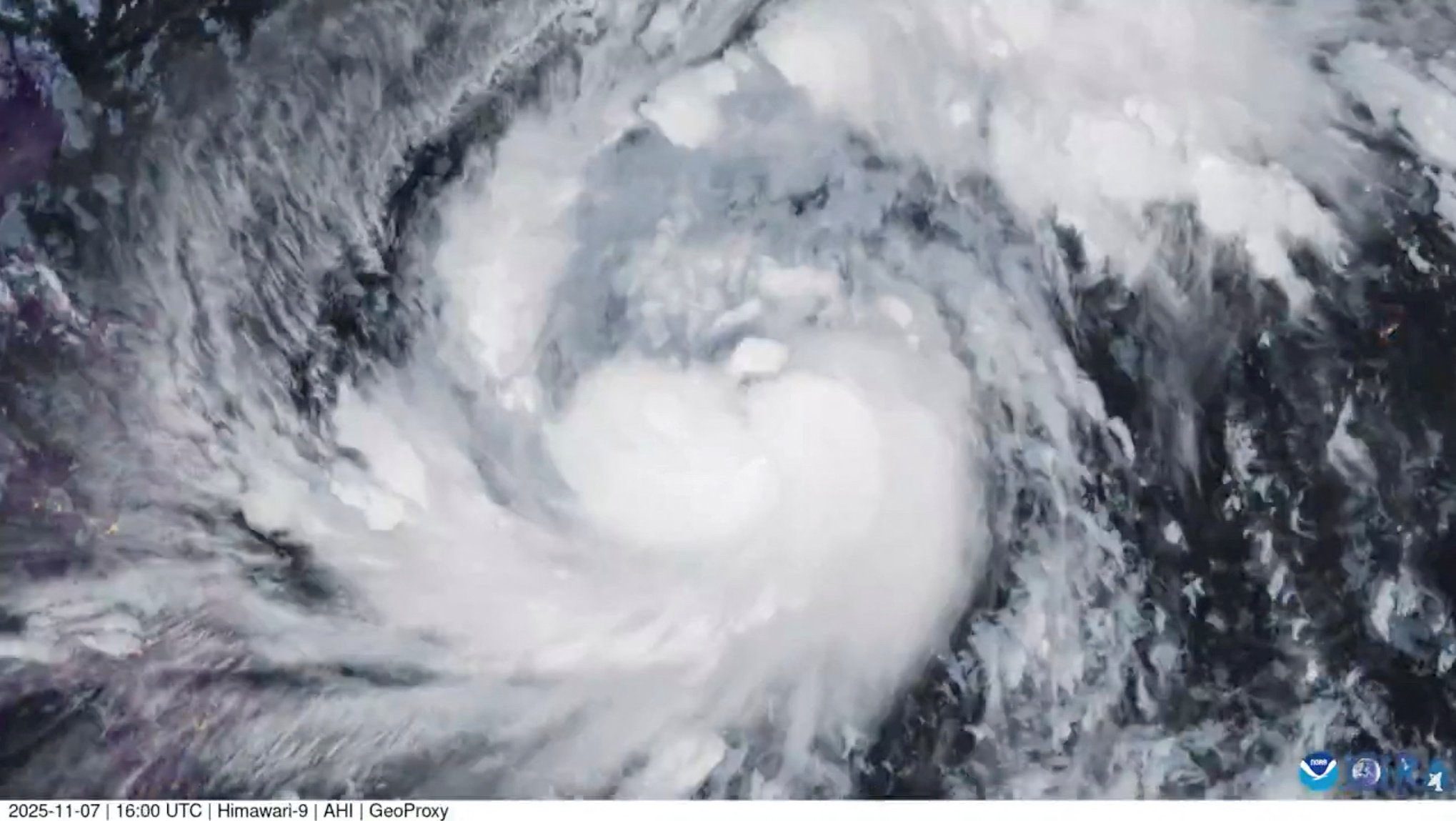
Typhoon Chanthu rapidly intensified has from a tropical depression to a Category 4 super typhoon over the north-western Pacific Ocean with maximum sustained winds of 135 knots (155 mph).
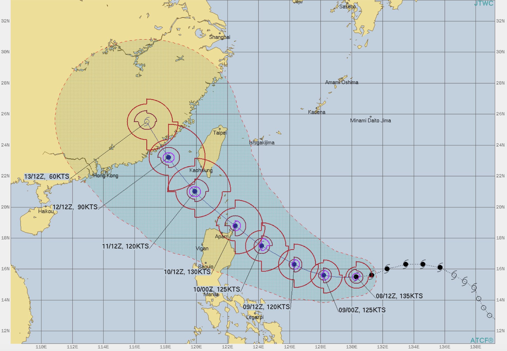
On its forecasted track, the storm is expected to continue to move to the northwest towards Taiwan’s southern coast on Saturday before slamming into eastern China.
An update today from the U.S. Navy’s Joint Typhoon Warning Center said the center of Chanthu was located approximately 675 nautical miles south-southeast of Kadena Air Base in Japan, moving westward at 10 knots. Maximum sustained winds have been clocked at 135 knots with gusts up to 165 knots (190 mph).
Watches and warnings are expected for Taiwan in the coming days.
Taiwan’s Central Weather Bureau chief, Cheng Ming-dean, said Canshu’s rapid rate of development has been even more explosive than Hurricane Ida. “This typhoon must be handled carefully,” he wrote in a Facebook post.
Updated: September 13, 2021 (Originally published September 8, 2021)
Editorial Standards · Corrections · About gCaptain

 Join The Club