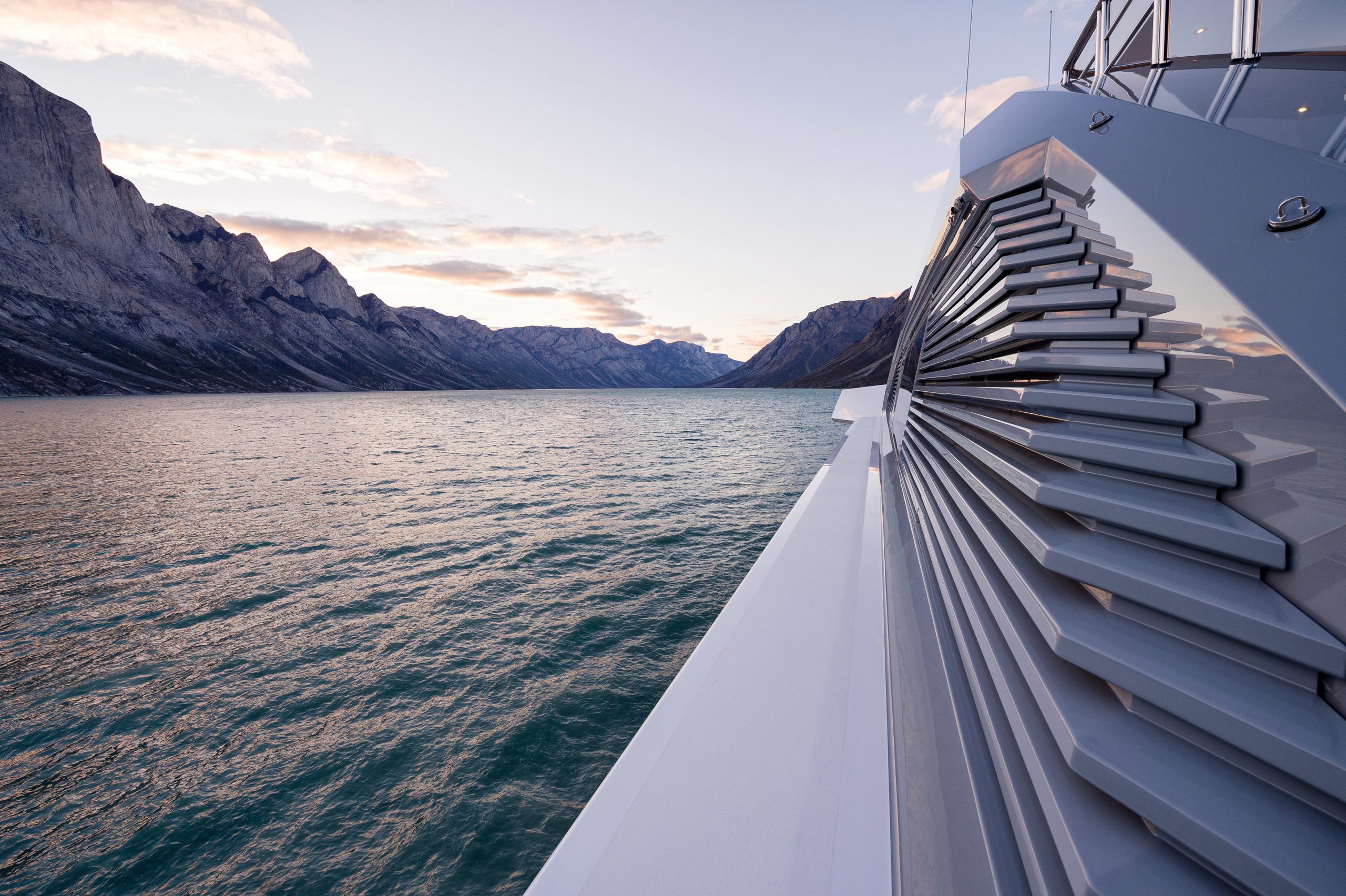
Every ship needs protection from the unknown. There are many potential dangers undetectable with traditional navigation tools. FarSounder Argos technology is a solution to fill in the gaps where other technologies fall short. The company is addressing the reality of these limitations to fulfil the navigational needs of all types of vessels.
The goal of the marine navigation technology industry is finding new ways to improve situational awareness to keep vessels safe. One innovative technology developed specifically with this goal in mind is Argos real-time 3D Forward Looking Sonar. For many mariners, including this type of state-of-the-art, proven technology into their workflow is a top priority.
A variety of technologies can help minimize navigation challenges all vessels face. Some of the biggest issues are that standard navigation technologies may often be unreliable, including GPS technology. Another is that chart data is oftentimes inaccurate or spotty thanks to mother nature and the sheer vastness of our oceans and waterways.
GPS may sound like an unlikely threat to safety given how integrated it has become into day-to-day navigation operations. However there have been multiple instances of significant GPS interference reported worldwide in the maritime domain. As you can imagine, the Maritime Administration advises the use of excess caution when operating under conditions of GPS disruption.
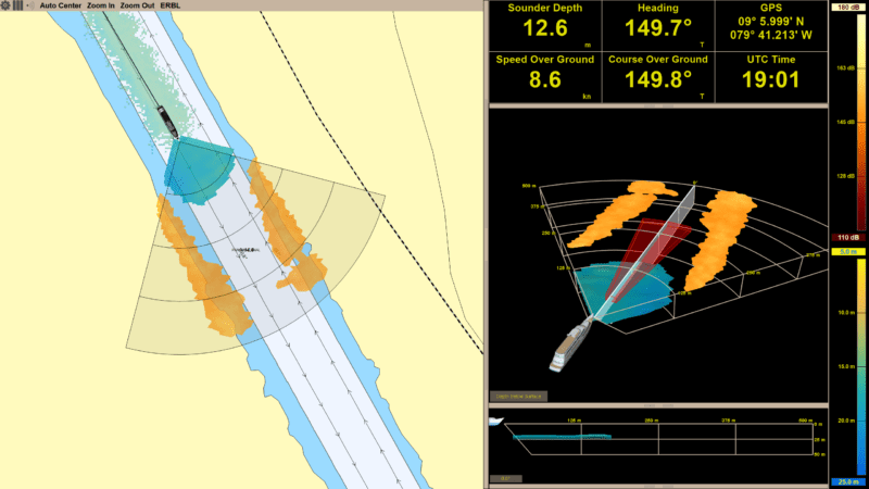
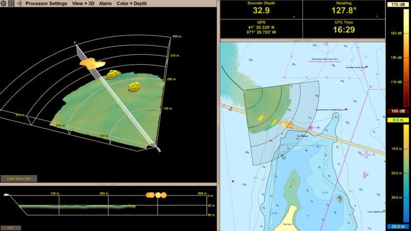
Situational awareness is always crucial for safe navigation, and particularly in a situation of GPS disruption. If the vessel is equipped with a FarSounder Argos 3D FLS, the vessel would have the ability to use the 3D FLS to reinforce the vessel’s position, even with GPS denial.
For example, if a reference was detected, navigation buoys or shoreline, at say 750m with both radars and sonar – that would reinforce confidence in the location. Of course, a radar system does not give any information about what is below the water line. Therefore, in addition to adding more redundancy to the procedure used to position the vessel and navigate, the Argos system would alert crew to any underwater navigation hazards that may not have been charted.
Another danger lurking under the surface is reefs. The ocean is shifting, growing and changing all the time. This fact has been brought to the forefront of the news recently when a coral reef that has been compared to the size of the Empire State Building was found off the northern coast of Australia at the northern tip of the Great Barrier Reef. Without recent survey data, there are no tools in the traditional navigator’s ‘toolbox’ that could have detected this hazard while cruising by.
Though this specific example is 40m deep at its shallowest point, there certainly could be others that are shallower and pose a risk to navigation. Navigating only using existing charts, GPS, radar and depth sounder in an area with uncharted, shallow reefs could have resulted in a collision.
In fact, in the past there have been notable reef accidents that bring this issue to life, namely the grounding of the USS Guardian. The ship struck Tubbataha Reef off the coast of the Philippines causing millions of dollars in damage to the ship and the environment. It was determined that inaccurate chart data was one of the main causes of the accident.
This accident is just one of many strikes with reefs and shallows that happen every year. Some are larger and more costly than others. If vessel operators are able to see navigation hazards under the water in real-time, they can change course appropriately and avoid the danger posed by the hazard. There are many tools navigators use, but 3D real-time forward looking sonar is an important piece of the puzzle that can protect the environment and vessels from damage, and save lives.
The added situational awareness provided by an Argos system is critical to challenging navigation areas including in uncharted and poorly charted areas, or tropical regions with the ever changing environment. As you can see, even if your itinerary does not include venturing off the beaten path, an Argos system is a valuable addition to your navigation toolbox and an added layer of safety to be seriously considered.
Don’t get caught in any of the sticky situations highlighted above without one! To learn more, visit www.farsounder.com.
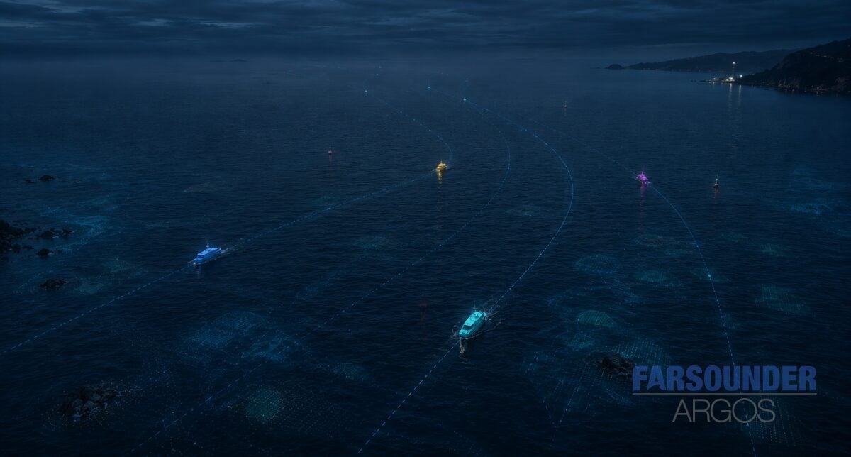
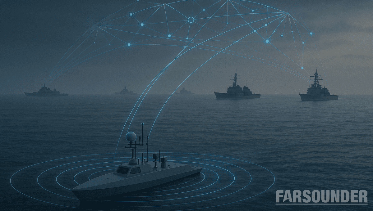
The maritime industry is undergoing rapid change. Advancements in autonomy are allowing uncrewed vessels to transit oceans with growing sophistication. A growing network of marine technologies is paving the way...
The next era of naval superiority will be decided by how effectively USVs integrate within broader fleet operations. Unmanned and autonomous systems are rapidly reshaping naval operations, advancing from experimental...
As unmanned and autonomous surface vessels (USVs) expand their role in the maritime sector, their missions are moving into increasingly complex and dynamic environments that often present unpredictable hazards. These...
May 19, 2025
Total Views: 1554
Get The Industry’s Go-To News
Subscribe to gCaptain Daily and stay informed with the latest global maritime and offshore news
— just like 104,677 professionals
Secure Your Spot
on the gCaptain Crew
Stay informed with the latest maritime and offshore news, delivered daily straight to your inbox
— trusted by our 104,677 members
Your Gateway to the Maritime World!
Essential news coupled with the finest maritime content sourced from across the globe.

 Join The Club