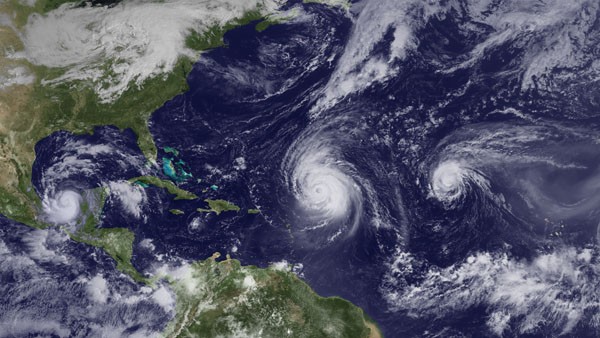
Hurricanes Karl, Igor and Julia over the Atlantic in 2010. Courtesy NOAA
By Brian K. Sullivan
May 23 (Bloomberg) — Warm Atlantic waters and favorable wind patterns may produce 13 to 20 named storms this year for the fourth above-average hurricane season in a row, the National Oceanic & Atmospheric Administration predicted.
Of those storms, seven to 11 may become hurricanes with winds of at least 74 miles (119 kilometers) per hour, and three to six may become major systems with winds greater than 111 mph, said Kathryn Sullivan, acting NOAA administrator.
There’s no way to tell now where those storms may strike, she said during a conference call with reporters.
“We can tell you your weather-risk exposure can be high and may be extremely high,” Sullivan said. “If you live along the shorelines, this is your warning.”
Last year, four systems struck the U.S., including hurricanes Isaac and Sandy, which together caused more than $52 billion in damage and killed at least 179 people. That marked three years in a row with 19 storms, the third-most in a single season.
The most named storms ever recorded in a season was 28 in 2005, the year of Hurricane Katrina. There were also 19 storms in 1995 and 1887, according to the National Hurricane Center. The 30-year average is 12. A system receives a name when its winds reach 39 mph.
The NOAA forecast is in line with one issued last month by researchers at Colorado State University that called for 18 tropical storms, nine of which may become hurricanes and four major systems.
Warmer Atlantic
Waters across the tropical Atlantic are currently 0.8 degree Fahrenheit (0.4 Celsius) warmer than normal, said Gerry Bell, lead seasonal hurricane forecaster for the U.S. Climate Prediction Center in College Park, Maryland.
In addition, waters in the Pacific Ocean are near normal in temperature, which make winds in the Atlantic more favorable for hurricane formation.
The Atlantic is also in a period when it is producing more storms. That began in 1995 and is expected to last for at least another 20 years.
“This year, regarding the factors for the hurricane season, there are no mitigating factors that would suppress the activity,” Bell said.
The six-month Atlantic season begins June 1 and runs through Nov. 30. Last year, two storms had formed before the starting day. Bell said there isn’t any indication that will happen again this year.
Season’s Peak
Hurricane activity begins to pick up about Aug. 20 and the statistical peak of the season occurs on Sept. 10, according to hurricane center data.
Sullivan said it’s impossible to determine this far ahead where hurricanes will land and whether the U.S. will be struck by a major storm. The U.S. hasn’t been hit by a Category 3 or higher system since 2005.
“Mother Nature may know that answer, but science does not know that answer,” Sullivan said.
With nothing to stop hurricane formation this year, people need to prepare now, said Joe Nimmich, the Federal Emergency Management Agency’s associate administrator for response and recovery.
“This is a very dangerous hurricane season,” Nimmich said.
Copyright 2013 Bloomberg.
Editorial Standards · Corrections · About gCaptain
This article contains reporting from Bloomberg, published under license.

 Join The Club