Unknown or poorly charted waters present many challenges to navigators causing concern for safety. Navigators really need a view of what is under the surface ahead of them right now. The best solution to provide that information is FarSounder’s Argos Forward Looking Sonar™. It provides real-time 3D images and more. Users get a full picture of the water depths ahead of them as well as the history of where they have been which is updated as they sail. This comprehensive data is evenbeing shared with global initiatives with the goal of providing the maritime community a complete map of the world’s oceans.
Advances in Mapping the Seafloor
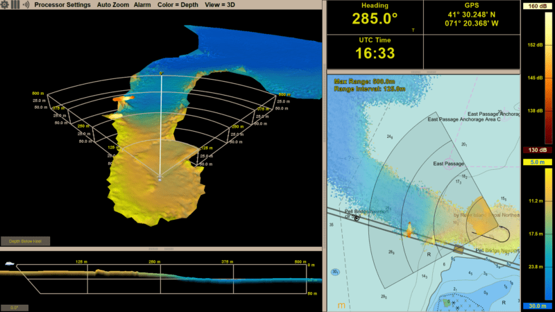
Local History Mapping™ (LHM) is an advanced, innovative software feature that allows users to generate a map of the seafloor as they navigate. This feature is included in all Argos Forward Looking Sonar models. With this feature, these forward facing sonar systems recall and display the user generated depth map (limited only by the amount of available hard drive space). The LHM information is shown in the user interface’s 3D Omni View as well as the Chart View. Uniquely, a single pass of an Argos sonar can generate a forward scan of the seafloor in real time which is updated with every ping. Upon returning to a location where LHM data has been collected, the user will see the bottom history in both views along with the real-time view of the seabed ahead of the vessel.
FarSounder’s display software includes both a 3D view of the sonar image as well as achart view with sonar, AIS, and ARPA overlays on standard S57/S63 format charts. Realtime forward looking information is available inside the sonar’s field-of-view (i.e the “pie wedge”) with Local History Mapping data stored indefinitely and displayed anywhere the vessel has previously transited.
The primary value proposition of Argos sonars has historically been in its real-time forward looking capabilities. The recent expansion of LHM capabilities and display now allows users further knowledge of their environment and make well-informed navigation decisions. The more information available about the environment below the surface, the easier it is to make sound navigation decisions. Combining history and real-time data adds unprecedented value in keeping the vessel and its passengers safe.
Crowdsourcing Hydrographic Data
The standard configuration of FarSounder’s Argos sonars is a stand-alone system which keeps all the data inside the software. However, FarSounder is a member of the IHO’s Crowdsourced Bathymetry Working Group and is an official trusted node for their Data Center for Digital Bathymetry (DCDB). Through this association, select FarSounder customers participating in the company’s Expedition Sourced Ocean Data Collection Program are able to contribute valuable measurements to the global community.
As part of this program, participants are sent a USB hard drive, which records all the raw signals received by their system. When the drive is full, it is sent back to FarSounder for compilation. All contributions to the IHO’s database are available for public use and can even be anonymized before submission for those participants with privacy concerns.
Contributions from vessels of all sizes are already contributing in this manner. FarSounder customers have collected data in various locations from the coast of Antarctica to the Arctic Ocean and many tropical routes in between. The need for such contributions is present worldwide.
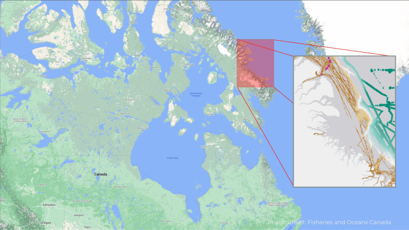
One example of using crowdsourced data from trusted sources is to help fill the gaps in traditional hydrographic surveys. The Canadian Hydrographic Service (CHS) recently produced an update to chart 7053 using data collected by a vessel equipped with FarSounder sonar and made available through the DCDB. In this case, the CHS had no survey data from this part of the Northwest Passage. Using the customer submitted recordings and metadata about the vessel, the CHS was even able to assess the quality and reliability of the measurements.
The Canadian Hydrographic Service does not have comprehensive official surveys in much of the Northwest Passage. The inset shows the location of Chart 7053 which incorporates depth measurements from trusted community contributions including some from a FarSounder customer. (image credit: Fisheries and Oceans Canada)
Of course, knowing what’s underwater ahead of your vessel is also paramount to safe navigation. Even in well charted areas, you might think that everything you need to know is already on your nautical charts. If so, you would be mistaken. The US has some of the best charts in the world yet according to the National Oceanic and Atmospheric Administration (NOAA) “about half of the depth information found on NOAA charts is based on hydrographic surveys conducted before 1940” and “in too many cases, the data is more than 150 years old. Sometimes, particularly in Alaska, the depth measurements are so old that they may have originated from Captain Cook in 1778.” Furthermore, only 52% of US waters have been mapped! Take a moment to think about the reliability of the chart data when you’re navigating in these “exotic” locations.
Seabed 2030 Initiative
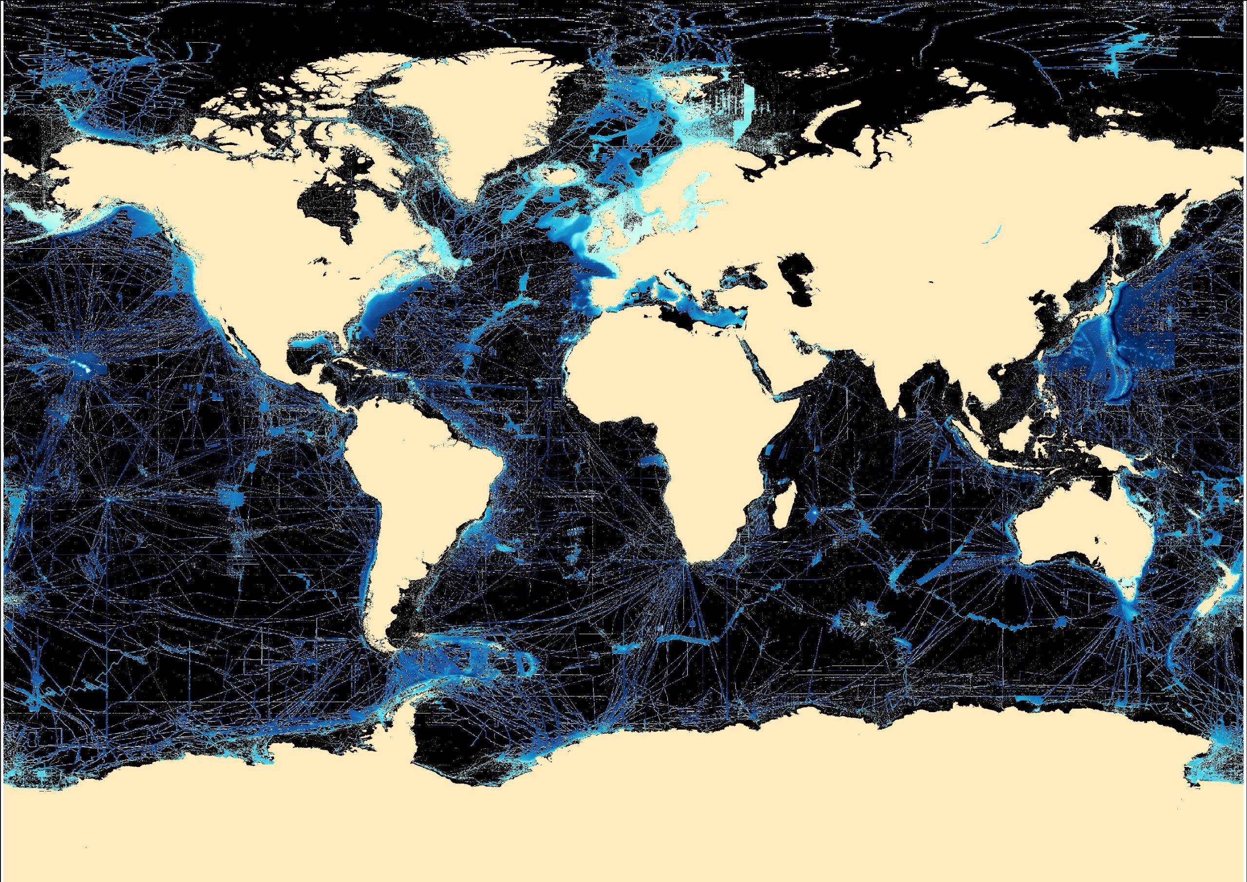
Crowdsourced data has many known uses and new applications for such data are being developed by engineers, scientists and hobbyists around the world. Through the DCDB, the FarSounder customer data is also shared with Seabed 2030. This is a global initiative by the Nippon Foundation and GEBCO to map the world’s oceans 2030 and make it available to all. According to Seabed 2030, as of January 2022, we’ve mapped less than 24% of the world’s sea floor. “We know the topography of the Moon and Mars in greater detail than that of our own planet.”
The most fundamental characteristic to ensure safety when sailing the oceans is knowing how deep the water is. Mapping the seafloor’s bathymetry is a critical key in safety and in scientific endeavors to understand ocean circulation, tides, tsunami forecasting, fishing resources, sediment transport, and environmental changes. It’s also important for commercial endeavors such as infrastructure construction, cable laying and pipeline routing.
Fortunately, most vessels have a wide range of navigation sensors they can use, in conjunction with their charts, to help them navigate such waters more safely. While navigating in these locations, vessels are able to be a part of the solution through this worldwide crowdsourcing initiative. They have the opportunity to contribute to the global community through recording their depth and position observations along the way.
Opportunities for Change
Operating in locations that are outside the standard, commercial shipping routes and can offer access to scientific observations which may otherwise not be made. It would be a shame to waste such opportunities, especially when they can be achieved with no significant cost while the vessel operates normally.
Mariners participation in crowdsourcing activities have an opportunity to provide unique and valuable contributions to the global community and expand the limits of our understanding of our world. FarSounder is proud to do their part in connecting their customers with the Seabed 2030 project. Keeping the oceans safe is a mutual goal for all and they are pleased to have the partnership in place to provide Seabed 2030 with bathymetric data. Participation in these types of initiatives is an easy way for mariners to contribute to the wider, global community, while operating in their “typical” manner.
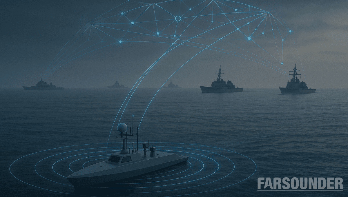
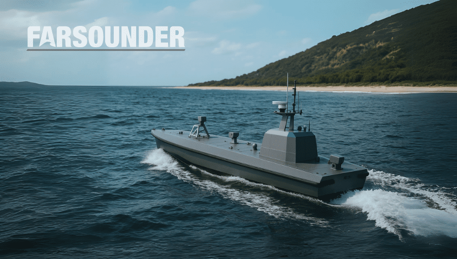
The maritime industry is undergoing rapid change. Advancements in autonomy are allowing uncrewed vessels to transit oceans with growing sophistication. A growing network of marine technologies is paving the way...
The next era of naval superiority will be decided by how effectively USVs integrate within broader fleet operations. Unmanned and autonomous systems are rapidly reshaping naval operations, advancing from experimental...
As unmanned and autonomous surface vessels (USVs) expand their role in the maritime sector, their missions are moving into increasingly complex and dynamic environments that often present unpredictable hazards. These...
May 19, 2025
Total Views: 1554
Get The Industry’s Go-To News
Subscribe to gCaptain Daily and stay informed with the latest global maritime and offshore news
— just like 104,677 professionals
Secure Your Spot
on the gCaptain Crew
Stay informed with the latest maritime and offshore news, delivered daily straight to your inbox
— trusted by our 104,677 members
Your Gateway to the Maritime World!
Essential news coupled with the finest maritime content sourced from across the globe.

 Join The Club