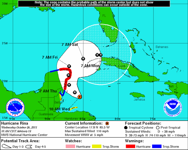
Hurricane Rina, now churning in the Caribbean north of Honduras, is expected to become a major hurricane as soon as late Tuesday and strike the eastern shores of the Yucatan Peninsula sometime Thursday before making a sharp eastward turn over the weekend toward the western end of Cuba, according to the National Hurricane Center.
Rina, now a Category 2 hurricane with winds of 100 miles per hour, is not expected to make a U.S. landfall or enter the oil-producing areas of the Gulf of Mexico, according to the NHC’s course projection. By 2 a.m. EDT Saturday, the NHC said, hurricane Rina should be just off the western tip of Cuba and 24 hours later should be reduced to tropical storm status as it moves over Cuba.
In its 8 a.m. EDT advisory, the NHC said Rina is about 215 miles southwest of Grand Cayman and moving to the west-northwest at 3 miles per hour.
(c) 2011 Dow Jones & Company, Inc.
Editorial Standards · Corrections · About gCaptain

 Join The Club


