By Brian K. Sullivan
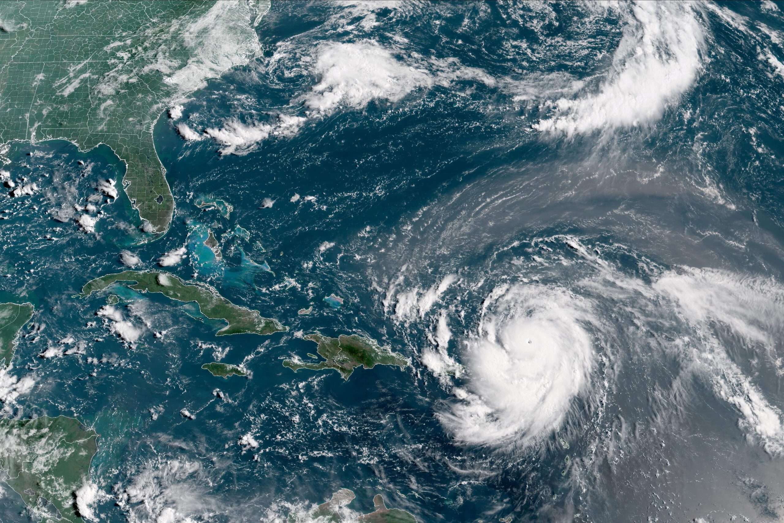
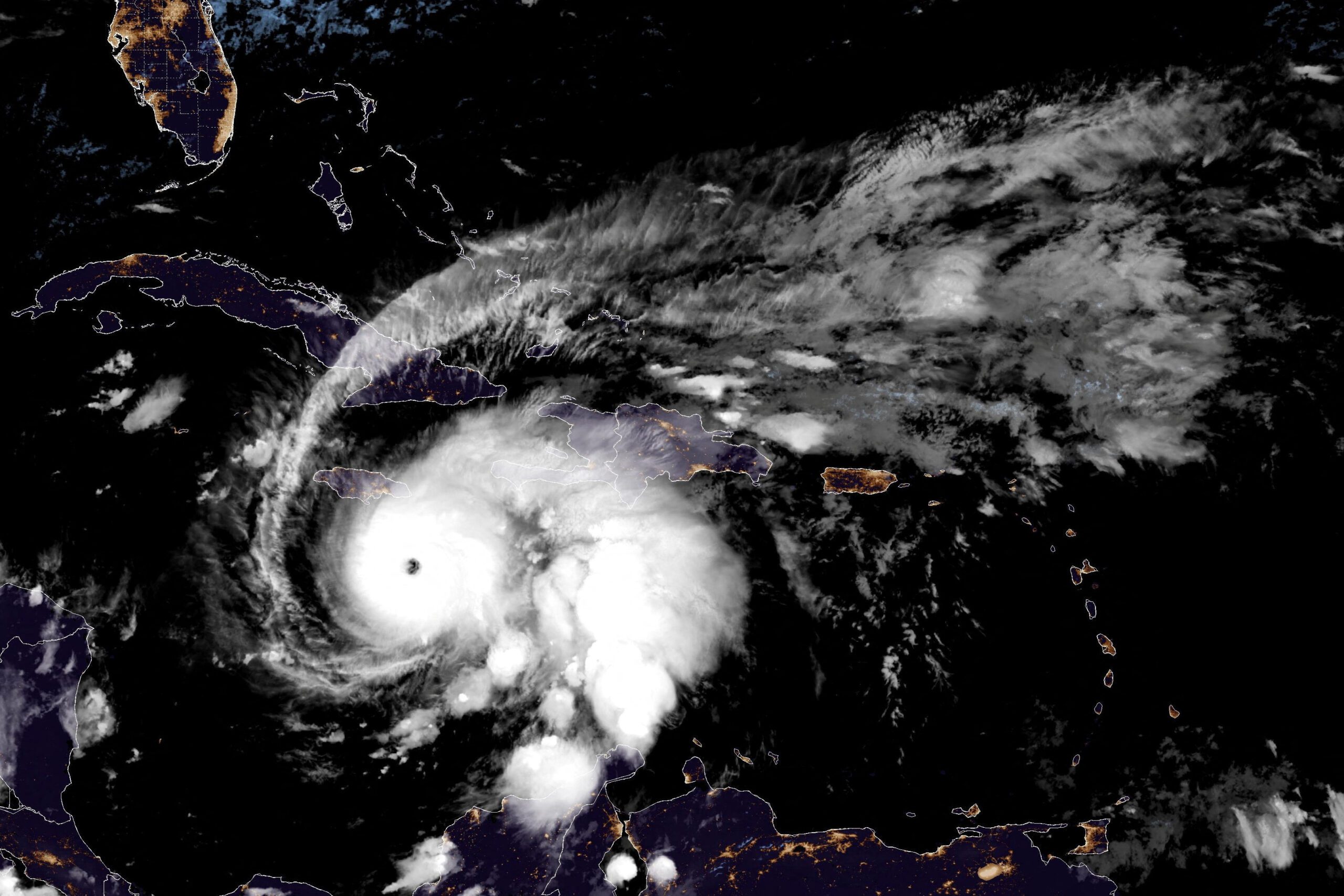
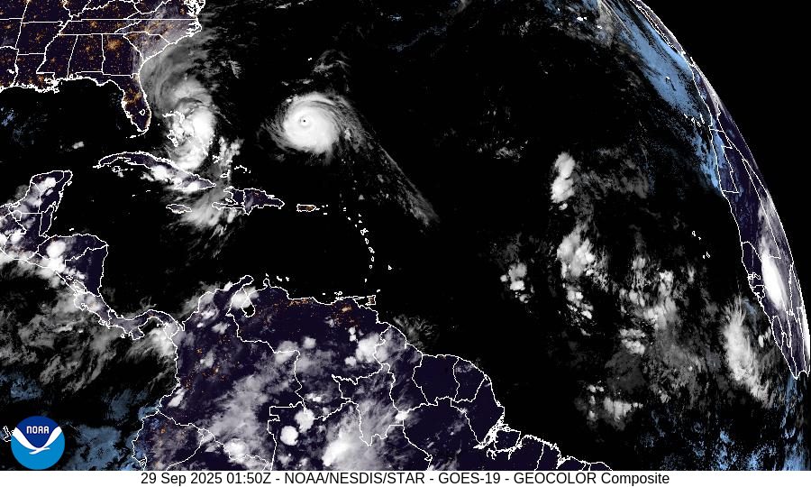
Aug 16, 2025 (Bloomberg) –Hurricane Erin strengthened on Saturday into a “catastrophic” Category 5 hurricane north of the Caribbean islands, reaching the top of the five-step, Saffir-Simpson scale.
Erin’s top winds, which have exploded from tropical storm strength early Friday, reached 160 miles per hour (257 kilometers) as the storm churned 105 miles north of Anguilla in the Leeward Islands, the US National Hurricane Center said in a special statement at 11:20 a.m. New York time.
Current forecasts show the dangerous storm staying away from the US East Coast as it tracks north through the western Atlantic over the coming week.
Read more: Hurricane Forecasts Are More Accurate Than Ever – NOAA Funding Cuts Could Change That
According to the latest forecast, the US East Coast, the heart of the Caribbean and even Bermuda are likely to be spared the worst Erin could unleash, even though its top winds are capable of ripping walls and roofs off houses, snapping trees, and causing widespread power outages.
That’s because the hurricane will remain off the US East Coast and pass between North Carolina’s Outer Banks and Bermuda sometime on Wednesday, likely causing dangerous surf and some wind and beach erosion along the seaboard, but sparing the region from a direct hit.
“The best-case scenario is it splits the uprights between Bermuda and the Outer Banks,” said Dan Pydynowski, a meteorologist with the commercial forecaster AccuWeather Inc.
Warm ocean water, the lack of major wind shear and its escape from dry air allowed Erin to rapidly intensify over the past day. At 8 a.m. Friday, Erin was a tropical storm with 70 mph winds, and by 8 a.m. Saturday it already reached Category 4 status with winds of 145 mph.
Read more: Record-Breaking 2024 Atlantic Hurricane Season Winds Down After Unprecedented Late-Season Surge
Rapid intensification means a storm’s winds increase by at least 35 mph in a 24-hour period, and can be dangerous because coastal residents and emergency crews may be caught by surprise. There have been numerous examples of storms rapidly intensifying, including Hurricane Milton, which struck Florida in October.
While Erin may remain out to sea, it will still bring heavy rain across many of the smaller Caribbean islands, as well as the Virgin Islands and Puerto Rico through Sunday. Isolated areas could get as much as 6 inches (15 cm), which may cause flash flooding and landslides throughout the hilly terrain on many of the islands.
© 2025 Bloomberg L.P.
Editorial Standards · Corrections · About gCaptain
This article contains reporting from Bloomberg, published under license.

 Join The Club