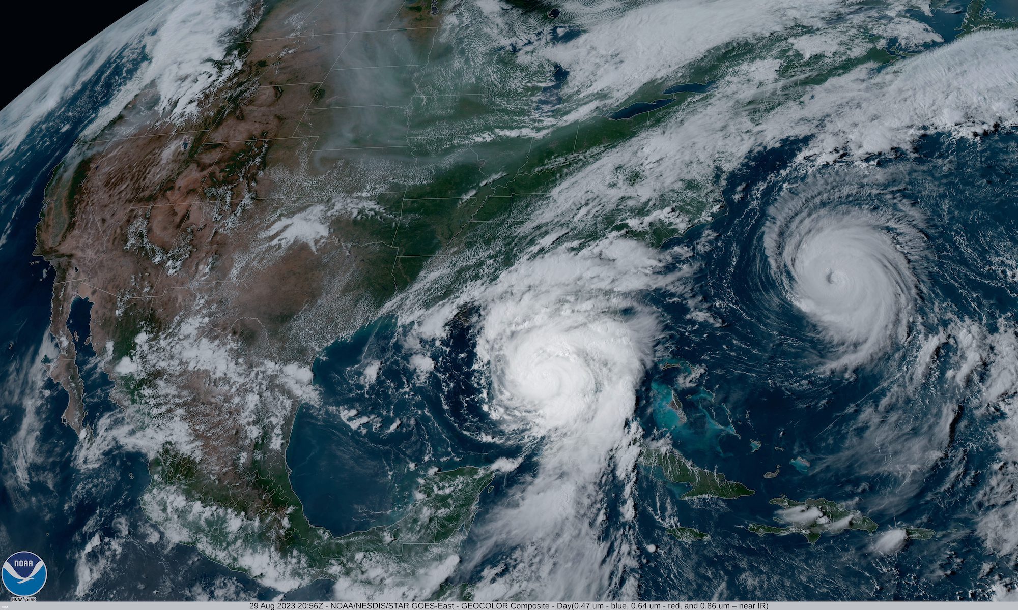
The National Oceanic and Atmospheric Administration (NOAA) National Weather Service forecasters have predicted that the 2024 Atlantic hurricane season will be more active than normal due to a combination of warmer-than-average ocean temperatures and shift to La Nina.
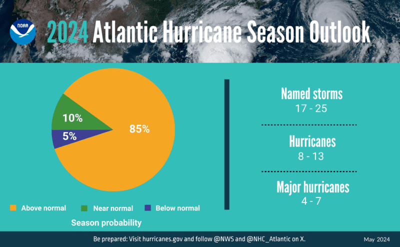
The hurricane season, which runs from June 1 to November 30, has an 85% probability of above-normal activity—the highest confidence forecasters have had in any above-average seasonal outlook—with a 10% chance of being near-normal and only a 5% chance of falling below-normal.
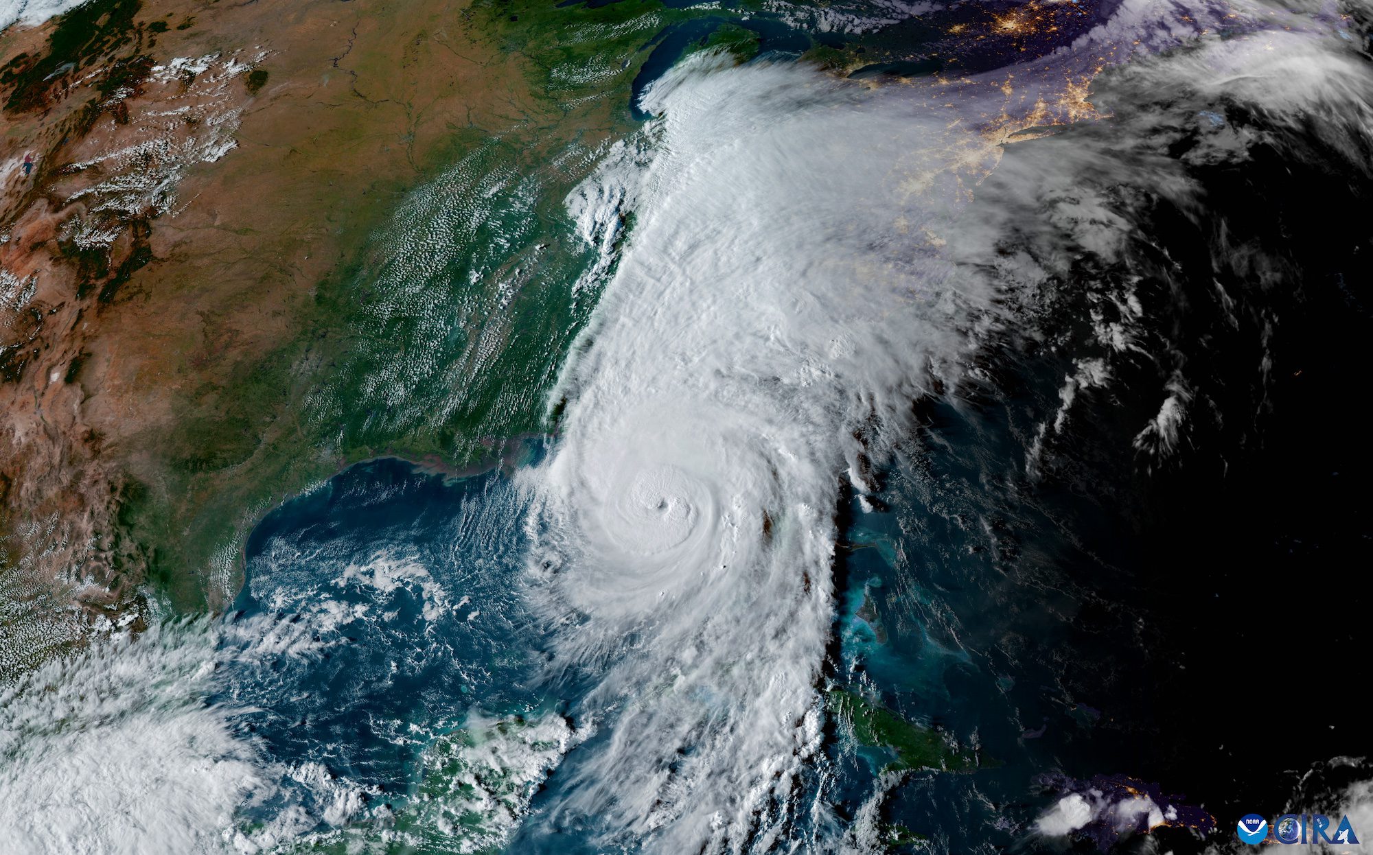
NOAA forecasters are predicting a range of 17 to 25 total named storms, with winds reaching at least 39 mph. Out of these, between 8 to 13 are anticipated to escalate into hurricanes, exhibiting winds exceeding 74 mph. Furthermore, 4 to 7 could potentially become major hurricanes, categorized as 3, 4, or 5, with wind speeds over 111 mph. Forecasters have 70% confidence in these predictions.
The prediction also reportedly marks the highest number of hurricanes ever forecasted by NOAA in its annual May forecast, exceeding the 2010 forecast of 14-23 storms.
Credit: NOAA
Several factors are contributing to this expected increase in hurricane activity. These include near-record warm ocean temperatures in the Atlantic Ocean, the development of La Nina conditions in the Pacific, reduced Atlantic trade winds, and decreased wind shear. All of these conditions are known to foster the formation of tropical storms.
NOAA scientists expect a quick transition to La Nina conditions, which tend to lessen wind shear in the tropics and are conducive to Atlantic hurricane activity. This, coupled with abundant oceanic heat content in the tropical Atlantic Ocean and Caribbean Sea, creates more energy to fuel storm development.
This hurricane season may also see an above-normal west African monsoon, leading to African easterly waves that seed some of the strongest and longest-lived Atlantic storms. Light trade winds will further enable hurricanes to grow in strength without disruption from strong wind shear and will minimize ocean cooling. The human-caused climate change is a significant contributing factor, warming our ocean globally and in the Atlantic basin, leading to sea level rise, which increases the risk of storm surge.
A strengthening El Niño is on track to become one of the strongest events in the historical record, raising fresh concerns for global shipping just days after the Panama Canal...
La Niña conditions have emerged in the equatorial Pacific and are expected to persist through the Northern Hemisphere winter, with forecasters predicting a 55% chance of transition to ENSO-neutral conditions...
The National Hurricane Center (NHC) achieved unprecedented accuracy in hurricane track forecasting during the 2024 Atlantic hurricane season, according to a preliminary forecast verification review by the National Weather Service....
March 7, 2025
Total Views: 162
Get The Industry’s Go-To News
Subscribe to gCaptain Daily and stay informed with the latest global maritime and offshore news
— just like 104,628 professionals
Secure Your Spot
on the gCaptain Crew
Stay informed with the latest maritime and offshore news, delivered daily straight to your inbox
— trusted by our 104,628 members
Your Gateway to the Maritime World!
Essential news coupled with the finest maritime content sourced from across the globe.

 Join The Club