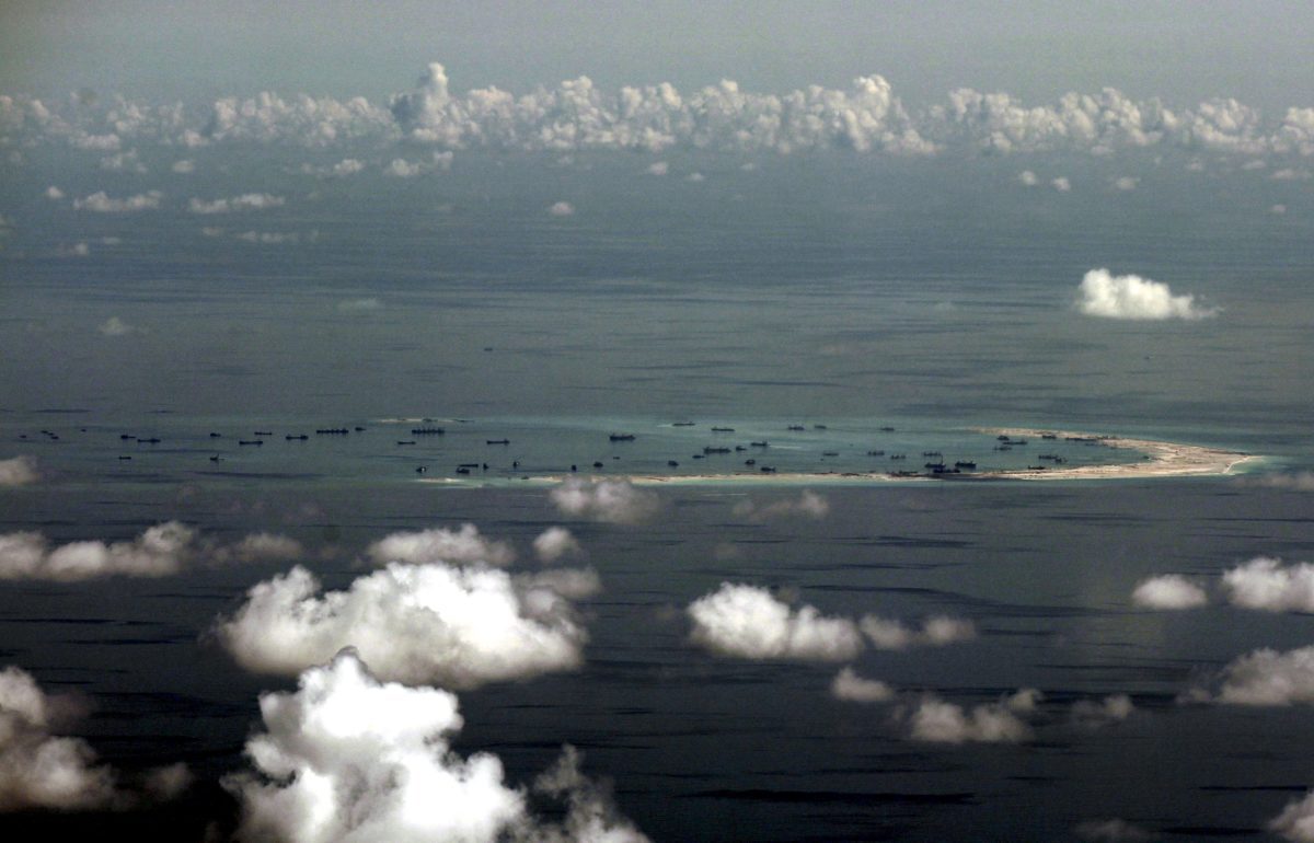
An aerial photo shows the alleged on-going land reclamation by China on mischief reef in the Spratly Islands in the South China Sea, west of Palawan, Philippines, in this May 11, 2015 file photo. REUTERS/Ritchie B. Tongo
By David Tweed
(Bloomberg) — China may be building a high-frequency radar installation in the disputed South China Sea, posing a bigger threat to the balance of power in one of the world’s busiest waterways than previously detected surface-to-air missiles, according to a report by the Center for Strategic & International Studies.
Construction of radar facilities at Cuarteron Reef, the southern-most of the features China claims in the Spratly Islands, appears to be nearly complete, Gregory Poling of CSIS’s Asia Maritime Transparency Initiative wrote. China sparked new questions about its intentions in the South China Sea after surface-to-air missiles were detected earlier this month on Woody Island, part of the Paracel Islands northwest of the Spratlys.
“This month’s deployment of HQ-9 surface-to-air missiles on Woody Island in the Paracels, while notable, does not alter the military balance in the South China Sea,” said Poling. “New radar facilities being developed in the Spratlys, on the other hand, could significantly change the operational landscape.”
China claims more than 80 percent of the South China Sea in a contest with five rivals. Washington is concerned that China’s ultimate goal is the ability to exclude it from what it considers international waters. Along with the development of new runways and air defense capabilities on the islands it occupies in the Spratlys, the radar “speak to a long-term anti-access strategy by China — one that would see it establish effective control over the sea and airspace throughout the South China Sea,” Poling said.
Freedom of Navigation
When asked about the missile deployment, Secretary of State John Kerry said last week that “there is evidence every day that there has been an increase of militarization of one kind or another.” While the U.S. takes no sides on the various claims, it has taken actions it says are aimed at ensuring the freedom of navigation. More than $5 trillion of goods transit the South China Sea each year. China Foreign Minister Wang Yi will be in the U.S. Tuesday to Thursday for talks at the invitation of Kerry.
China says U.S. freedom-of-navigation operations where it sails military vessels through territorial zones claimed by China and others amount to militarization of the region and add to tensions. China dismissed as “hype” media reports about the deployment of HQ-9 missiles on Woody island, where its military has had a presence for years.
Shooting Drones
Admiral Scott Swift, Commander of the U.S. Pacific Fleet, said last week the latest deployment of HQ-9 missiles was the third time that China had put them on the island, according to a report on U.S. Internet site Military.com. The missiles also have been used in exercises, notably to shoot down a drone, he said.
“There is no difference between China’s deployment of necessary national defense facilities on its own territory and the defense installation by the U.S. in Hawaii,” Foreign Ministry spokeswoman Hua Chunying said Monday. China contends that the islands it occupies “have been part of China since ancient times.”
White House spokesman Josh Earnest dismissed China’s analogy. “There is no other country that has a claim on Hawaii,” he said. “But yet when you consider the land features in the South China Sea, there are a variety of overlapping territorial claims that a variety of countries have made on those features.” Woody island is claimed by Taiwan and Vietnam.
China’s land reclamation on Cuarteron has expanded the reef to about 52 acres (210,400 square meters), according to Poling. Two probable radar towers have been built on the northern portion of the feature, and a number of 65-foot (20-meter) poles have been erected across a large section of the southern portion.
These poles could be a high-frequency radar installation, which would significantly bolster China’s ability to monitor surface and air traffic across the southern portion of the South China Sea, he said.
© 2016 Bloomberg L.P
Editorial Standards · Corrections · About gCaptain
This article contains reporting from Bloomberg, published under license.

 Join The Club