This post is brought to us by Peter Mello of Sea-fever.org (via NOAA), in two seperate installments. The first post a map of Ocean Energy Distribution Map from Chile Earthquake Tsunami (shown above). Peter writes:
8.2-foot tsunami wave expected to strike Hilo, Hawaii 11:05 a.m. local time (4:05 p.m. ET) according to the Pacific Tsunami Warning Center. Tsunami advisory extended to Oregon, Washington, parts of Alaska, coastal British Colombia by West Coast Alaska Tsunami Warning Center
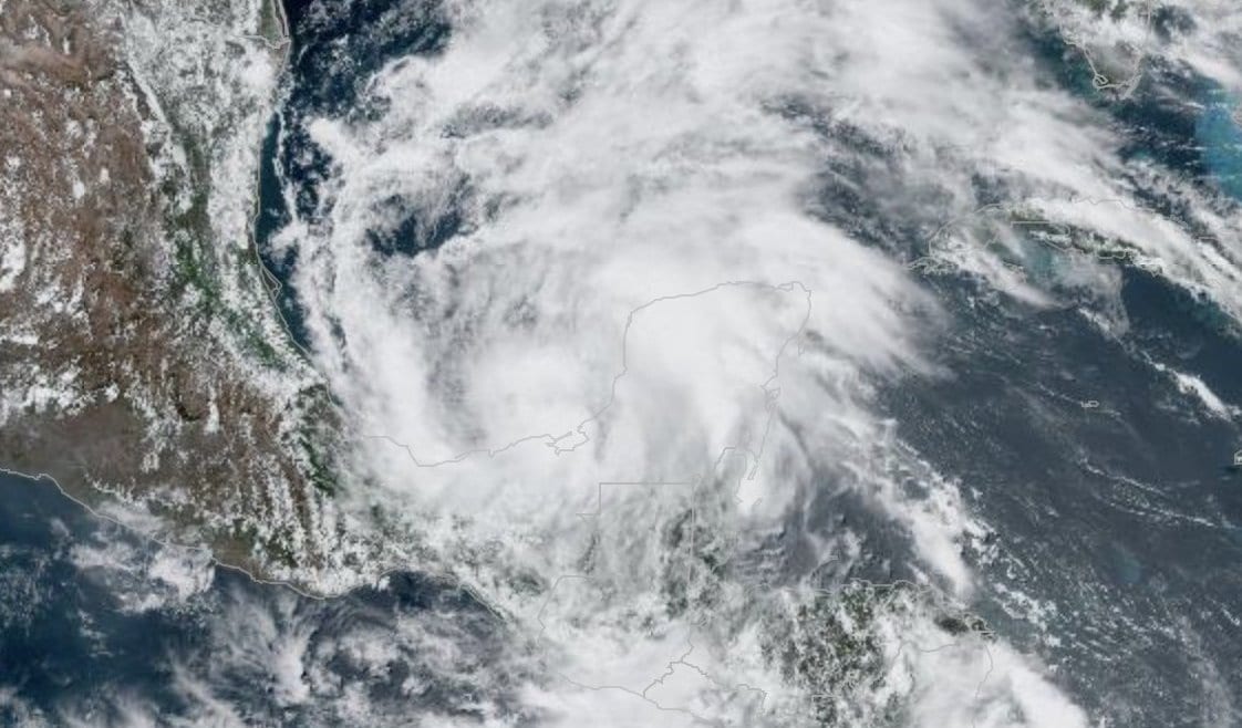
By Brian K. Sullivan (Bloomberg) –Tropical Storm Cristobal, now gaining strength in the southern Gulf of Mexico, could grow into a hurricane as it moves toward the Texas and Louisiana...
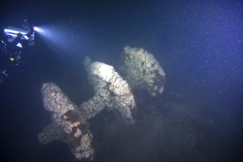
More than 153 years after it was lost in a violent collision at sea, government and university maritime archaeologists have identified the wreck of the ship Robert J. Walker.
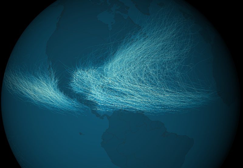
The Environmental Visualization Lab at the National Oceanic and Atmospheric Administration has released images depicting data for a total of 11,967 cyclones recorded from 1842 to 2012.
August 26, 2013
Total Views: 59
Get The Industry’s Go-To News
Subscribe to gCaptain Daily and stay informed with the latest global maritime and offshore news
— just like 107,158 professionals
Secure Your Spot
on the gCaptain Crew
Stay informed with the latest maritime and offshore news, delivered daily straight to your inbox
— trusted by our 107,158 members
Your Gateway to the Maritime World!
Essential news coupled with the finest maritime content sourced from across the globe.

 Join The Club


