U.S. Gulf of Mexico Energy Production to Resume After Storm Passes
HOUSTON, June 8 (Reuters) – Energy companies on Monday began preparations to resume oil and gas production in the U.S. Gulf of Mexico, a day after Tropical Storm Cristobal blew...

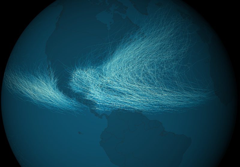
Cyclone frequency data map. Image credit: NOAA
The Environmental Visualization Lab at the National Oceanic and Atmospheric Administration has released these images showing worldwide tropical cyclone activity over a 170-year period.
The images depict data for a total of 11,967 cyclones recorded from 1842 to 2012 and are all assembled into a single database called IBTrACS. Along with track data the IBTrACS database also stores estimates for wind speed, which together make for some stunning visuals.
CYCLONE FREQUENCY (HI-RES HERE)
By coloring how many times any storm track overlapped another, certain patterns arise in the density of storms affecting a given area. For example, as you can seen from the images below the cyclone tracks overlapped the most in the western Pacific and Bay of Bengal (India), where typhoon season never ends since waters are always warm enough to sustain cyclone formation.
While frequency of track overlaps is much lower in the Western Hemisphere than in the Eastern Hemisphere, a related map showing storm intensity shows an interesting contrast.
CYCLONE INTENSITY (HI-RES HERE)
Again, by coloring the maximum sustained wind speed over the course of a storm’s life, certain patterns arise. As you can see the Northwestern Atlantic shows a much greater spread of strong storms, whereas in the Pacific the strongest cyclones seem to group near the Philippines.
NOAA notes that before the advent of the satellite era, hurricane tracks were constructed from ship reports and, although reliable, some storms were probably definitely missed. Today, geostationary satellites, such as NOAA’s GOES, have revolutionized the ability of meteorologists to track cyclones and not a single storm is missed. Wonder what the maps will look like 170 years from now?
via Gizmodo

Sign up for gCaptain’s newsletter and never miss an update

Subscribe to gCaptain Daily and stay informed with the latest global maritime and offshore news
Essential news coupled with the finest maritime content sourced from across the globe.
Sign Up