
 Join The Club


Blog
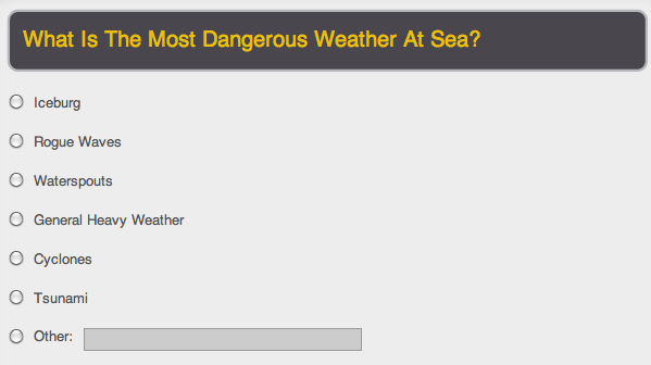
Poll – What is the most dangerous weather condition at sea?
[polldaddy poll=”919366″] Do you have a story about severe weather? Be sure to leave your comments below! Also, Check Out our previous
Stay up-to-date with the latest maritime ocean weather forecasts and marine WX reports. Get critical weather updates affecting shipping routes, offshore operations, and ocean areas.
[polldaddy poll=”919366″] Do you have a story about severe weather? Be sure to leave your comments below! Also, Check Out our previous
Recent Chesapeake Bay icebreaking footage courtesy of the Maryland Department of Natural
Check out this video of the Antarctic cruise ship, Clelia II, as it “limps” back to Argentina in heavy seas. The vessel, with 100 passengers and
With help from data collected by the GOES 13 weather satellite, NOAA has put together this video showing the entire 2010 Atlantic Hurricane season summed up in
The use of Unmanned Aerial Vehicles (UAV) has been a popular topic of discussion here at gCaptain and has been associated with a variety uses ranging from
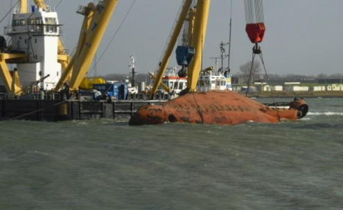
Photo By Ronald On November 11th the tug Fairplay 22 got underway to assist the ferry Stena Britannica in her transit to the Stena Terminal, Hoek van Holland,
http://www.youtube.com/watch?v=VJcJVxxAFvY The video above shows the a giant sink hole as it rips apart and literally swallows the Amazonian port of
Fryderyk Chopin-Tall-Training-Ship The Fryderyk Chopin lost both its masts when it was hit by gale-force winds about 100 miles southwest of the English coast
Similar to the Atlantic Hurricane season, the Western Pacific is under constant threat of devastating typhoon’s nearly year-round. This threat has lead
For those of you that have been following this blog long enough know that cruise ships + foul weather = bad news for the passengers and crew. Although the
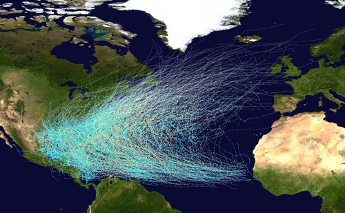
Click image for high resolution A few weeks ago we showed you ship tracks seen from space. Here is another interesting image of hurricane and tropical storm
The Genesis and Rapid Intensification Processes mission, or GRIP, will use 15 cutting edge instruments, a Global Hawk UAV, a McDonnell Douglas DC-8 and a

Forum member and unofficial gCaptain weather guru, Fredwx, points us to an interesting article detailing NASA’s Genesis and Rapid Intensification
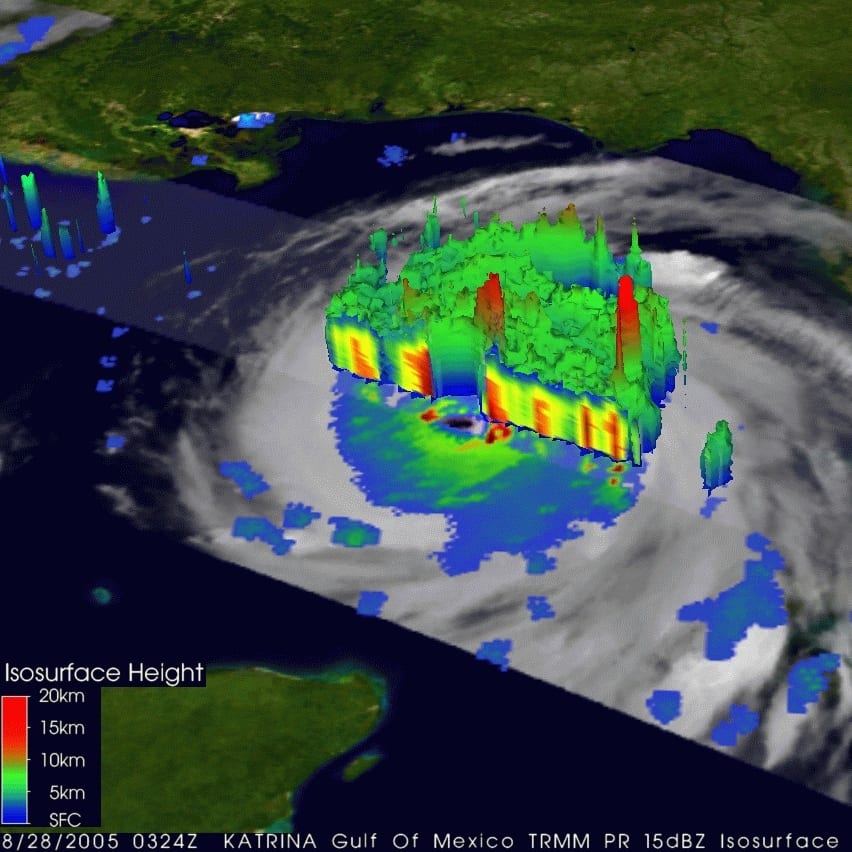
Hurricane Alex on June 30, 2010. Image via NOAA’s EVL website With Gulf Coast residents already feeling the effects of the first named storm of the
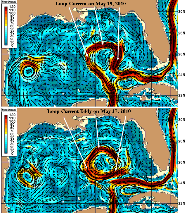
Earlier this week we showed how NASA was keeping on eye on the Gulf of Mexico’s Loop Current. Today, Dr. Jeff Master’s of Weather Underground

An “active to extremely active” hurricane season is expected for the Atlantic Basin this year according to the seasonal outlook issued today by

By Nina Larson (AFP) STOCKHOLM — Around 50 ships, including large ferries carrying thousands, were stuck in the ice in the Baltic Sea, with many unable
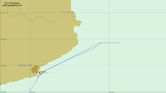
Shown above, AIS provider VT Explorer plots the cruise ship Louis Majesty’s path as it encountered rough sea’s on March 3rd, 2010 (click image for
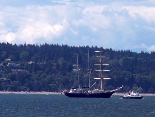
Image via Digital Journal According to reports, all 64 students aboard the Canadian flagged tall ship Concordia which san 300 miles off the Brazilian coast
Storm Surge and Flooding Prediction Dropped in New Scale NOAA’s National Weather Service will use a new hurricane scale this season called the
Essential maritime and offshore news, insights, and updates delivered daily straight to your inbox


Essential news coupled with the finest maritime content sourced from across the globe.
Sign Up
