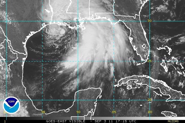
JEAN LAFITTE, Louisiana—The center of Tropical Storm Lee stretched across the central Gulf Coast early Sunday, dumping torrential rains that threatened flooding in low-lying communities in a foreshadowing of what cities further inland could face in coming days.
At 8 a.m. Eastern time, Lee had maximum sustained winds of 45 mph, the U.S. National Hurricane Center said. The storm is crawling to the northeast at 3 mph with a turn to the east-northeast expected Sunday night.
By Sunday, at least 6 to 10 inches of rain had fallen in some spots along the Louisiana and Mississippi coasts, and the National Weather Service warned there was a threat of extensive flooding and flash floods because of the storm’s slow movement inland.
The flash flood threat could be more severe as the rains moves from the flatter Gulf region north into the rugged Appalachians, National Hurricane Center specialist Robbie Berg said.
Closer to the Gulf, the water is “just going to sit there a couple of days,” he said. “Up in the Appalachians you get more threat of flash floods — so that’s very similar to some of the stuff we saw in Vermont.”
Vermont is still cleaning up and digging out dozens of communities that were damaged and isolated by heavy rain from Hurricane Irene last week that quickly overfilled mountain rivers.
Lee could dump up to 20 inches of rain in scattered spots.
No injuries were reported so far from the storm. But even before Lee swept ashore, there were scattered instances of water entering low-lying homes and businesses in Louisiana’s bayou country — a region of fast-eroding wetlands long vulnerable to hurricanes and tropical storms. The storm prompted evacuations in bayou towns such as Jean Lafitte. Thousands were without power.
Coffers were suffering at many coastal businesses that depend on a strong end-of-summer weekend. Alabama beaches that would normally be packed were largely empty, and rough seas closed the Port of Mobile. Mississippi’s coastal casinos, however, were open and reporting brisk business.
The storm was denting offshore energy production. The Bureau of Ocean Energy Management, Regulation and Enforcement said 237 oil and gas production platforms and 23 drilling rigs have been evacuated by Lee. The agency estimates that about 60 percent of the current oil production in the Gulf and almost 55 percent of the natural-gas production has been shut in.
In Alabama, rough seas forced the closure of the Port of Mobile.
In the open Atlantic, Katia has regained hurricane status again, according to the National Hurricane Center.
Katia has shifted between tropical storm and hurricane status while moving across the open Atlantic, Berg said. He says the storm strengthened recently and now has maximum sustained winds of about 75 mph, the lowest-level Category 1 storm.
At 5 a.m. Eastern time, Katia’s center was about 370 miles northeast of the Northern Leeward Islands and it was moving 12 mph toward the northwest.
Berg said Katia poses no threat to land over the next 48 hours, but he urged those on the East Coast and in Bermuda, a British territory in the mid-Atlantic, to remain watchful but not be alarmed.
(c) 2011 Dow Jones & Company, Inc.
Editorial Standards · Corrections · About gCaptain

 Join The Club