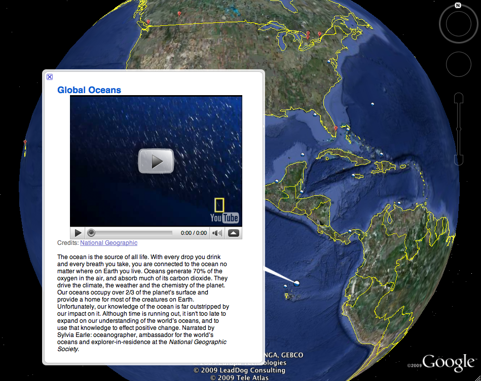
Ocean in Google Earth


Yesterday, Google unveiled its newest version of Google Earth at the California Academy of Sciences in San Francisco. Google Earth 5.0 introduces a number of new features, but most notably Ocean in Google Earth. Finally, you to explore what makes up two thirds of our planet – the ocean. Google tells us what you can do with ocean in Google Earth:
- Dive beneath the surface and visit the deepest part of the ocean, the Mariana Trench
- Explore the ocean with top marine experts including National Geographic and BBC
- Learn about ocean observations, climate change, and endangered species
- Discover new places including surf, dive, and travel hot spots and shipwrecks
To help make this project possible, Google teamed with a number of scientists and organizations including NOAA, NASA, National Geographic Society, BBC, Monterey Bay Aquarium, Scripps Oceanography and many more.
For more on this newest version of Google Earth, be sure to check out the Official Google Blog and Google’s Lat Long Blog, which will be doing in-depth posts on the number of new features with Google Earth 5.0.
Now check out these videos explaining a little more:
Explore the Ocean in Google Earth 5.0
What’s New in Google Earth 5.0
Just when researching this new version of Google Earth, we were contacted by the folks at EarhNC, a leading provider of value-added Google Earth Nautical Content. They offer a “huge library of free nautical content to add to the ‘Ocean’ experience including charting, fishing and dive sites, weather, photos, videos, and more.”
Be sure to check out their post on how to “Get More from Google Ocean with EarthNC.”
Finally, you can download this newest version of Google Earth HERE
Unlock Exclusive Insights Today!
Join the gCaptain Club for curated content, insider opinions, and vibrant community discussions.
Be the First
to Know


Join the 108,796 members that receive our newsletter.
Have a news tip? Let us know.


 Join The Club


