 Over the years we’ve shared dozens of amazing products – from gifts for the working sailor to small stocking stuffers – in our Holiday Gift Guides and we have received a few emails asking what, apart from our own merchandise, single gift idea is our favorite. The answer: BelowTheBoat 3D WoodCharts! The brainchild of artist Robbie & Kara Johnson, wood charts are nautical works of art suitable for hanging on any wall from the an executive boardroom of a shipping conglomerate to the galley of a small schooner. In fact we have the Channel Islands wood chart hanging at gCaptain Headquarters!
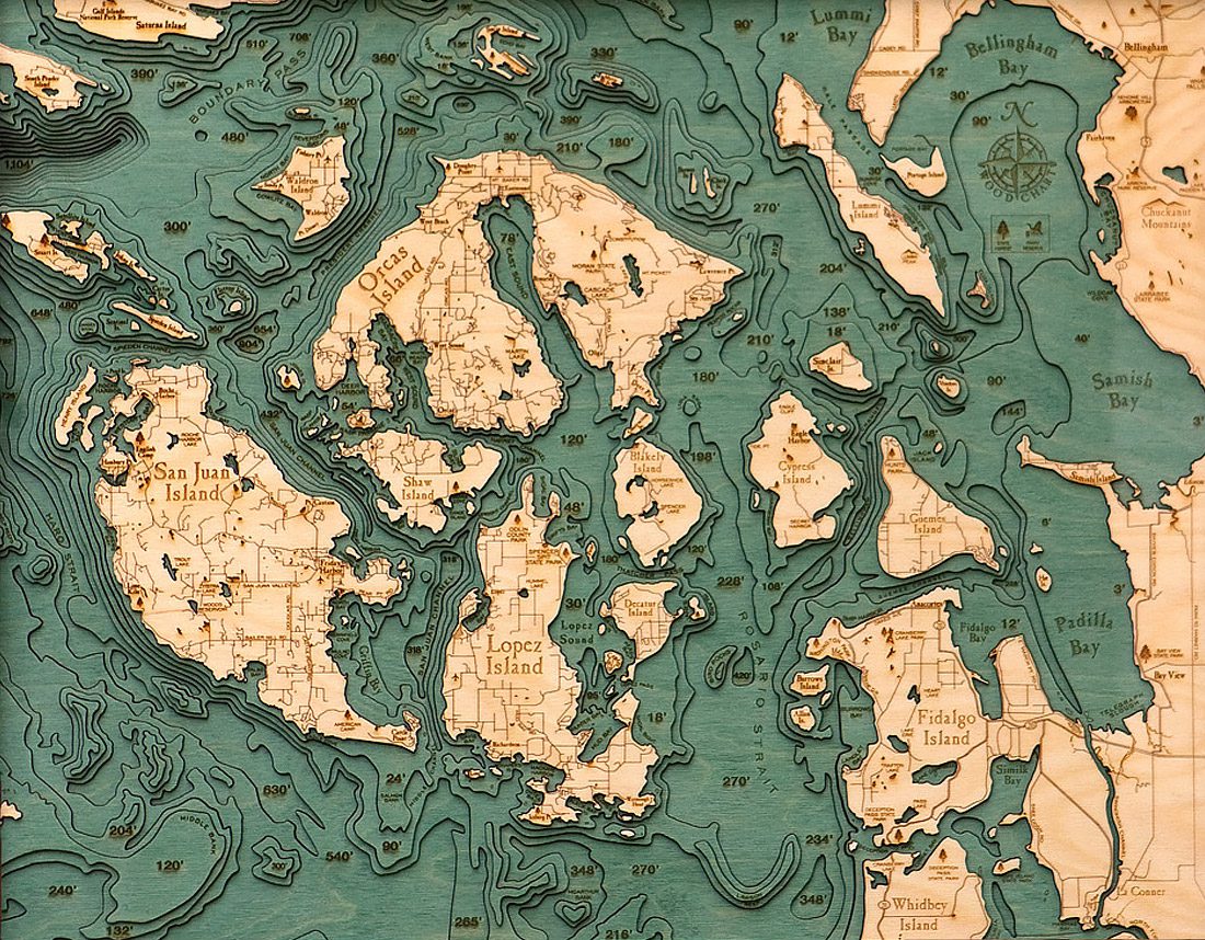
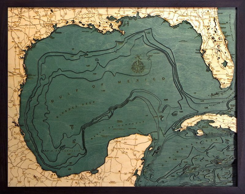
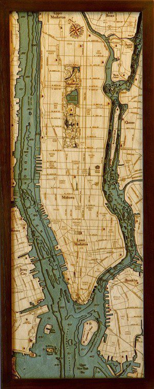
Robbie and Kara start with a bathymetric chart (the underwater equivalent of a topographic map), the contours are laser-cut into sheets of Baltic birch and glued together to create a powerful visual depth. Select layers are hand-colored blue so it’s easy to discern land from water, major byways are etched into the land, then the whole thing’s framed in a custom, solid-wood frame and protected seamlessly with a sheet of durable, ultra-transparent Plexiglas.
The result is stunning, exposing the often-overlooked, under-explored, awe-inspiring world that lies below. To those familiar with the floor of the ocean it’s a beautiful reminder of the deep channels, sharp drop-offs, and mountainous landscapes that are otherwise hidden from view. To the uninitiated, it’s wonderfully eye-opening; as though the world has suddenly taken on a fourth dimension.
Wood Charts are available now for selected harbors mostly in US waters but if your favorite area of the word is not yet available then contact Robbie directly… if enough mariners request the same chart then it will likely be available by next christmas.
Available with express shipping for $140 to $350 via Amazon.
Editorial Standards · Corrections · About gCaptain

 Join The Club