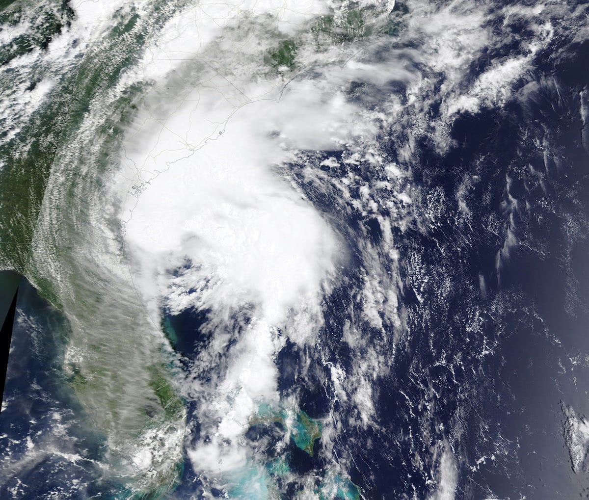
Update (Jan 14) – The intense and dangerous North Pacific storm continues to pack winds to 90 knots and wave heights to 50 feet (15.2 meters) this morning. From NOAA OPC’s post this morning:
The 0600 UTC GOES-W enhanced infrared satellite image along with a portion of the 06Z OPC Pacific surface analysis shows a powerful 948-mb hurricane force low pressure system in the central Pacific. In addition, the 0849 UTC ASCAT wind retrievals from this morning showed an impressive wind field with values up to 90 knots (~104 mph) in the strong cold advection in the south quadrant of the low center. The 0542 UTC AltiKa altimeter pass from that same area was equally spectacular with values up to 50 feet!
As a reminder, a system is classified as “hurricane force” when the winds are equal to or greater than 64 knots (~74 mph).”
Please visit the OPC’s Pacific page on the main website for additional analysis and forecast products:
http://www.opc.ncep.noaa.gov/Pac_tab.shtml“
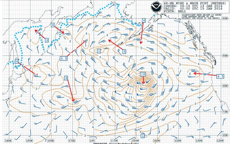
NOAA Wave Height Forecast 00UTC 15 January 2016
(Jan 13) – A quick update this morning – The developing storm over the central North Pacific is still forecast to reach 948 MB over the next 18-24 hours with winds increasing 65-90 knots and seas building over 16 meters (52 feet) up to 240NM west and south of the center. By 00Z/15thseas may continue to build as high as 18 Meters (59 feet) as the storm enters the eastern North Pacific.
This storm is tracking through the main North Pacific shipping lanes and all shipping interests should stay well clear of this one.
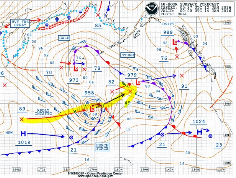
January 12, 2015 Forecast:
A developing gale low over the western North Pacific, east of Japan will deepen rapidly over the central North Pacific reaching 958 MB by 00z/14th and 949 MB by 00Z 15th.
This will be a dangerous storm as it travels ENE across the primary North Pacific shipping lanes. Winds are forecast to be an unheard of 65-90 knots with seas building 10-16 meters (32-53 feet) within 36-48 hours within 300 NM south and southwest of the center. Shipping interest should avoid this area.
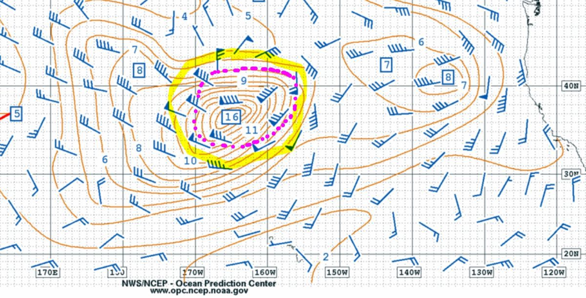
NOAA OPC Wind and Wave forecast for 12Z 14 Jan 2016 shows a large area of Storm force winds (outlined in yellow) with a very large area of hurricane force winds (Fuschia). Winds forecast to 90 knots with seas to 16 meters!
Three Australian plants that provide about 8% of the world’s liquefied natural gas have had their output curbed by a cyclone, in a further blow to mainly Asian buyers reeling from the halt of shipments from Qatar.
HOUSTON, Aug 6 (Reuters) – The U.S. National Oceanic and Atmospheric Administration (NOAA) on Thursday increased its prediction for the number of tropical storms expected this year to as many...
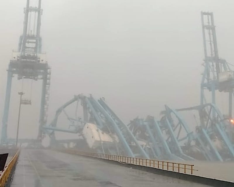
Aug 5 (Reuters) – Three cranes collapsed at India’s largest container port on the outskirts of Mumbai due to strong winds on Wednesday, police and port officials said. Heavy rainfall...
August 5, 2020
Total Views: 212
Get The Industry’s Go-To News
Subscribe to gCaptain Daily and stay informed with the latest global maritime and offshore news
— just like 107,447 professionals
Secure Your Spot
on the gCaptain Crew
Stay informed with the latest maritime and offshore news, delivered daily straight to your inbox
— trusted by our 107,447 members
Your Gateway to the Maritime World!
Essential news coupled with the finest maritime content sourced from across the globe.

 Join The Club