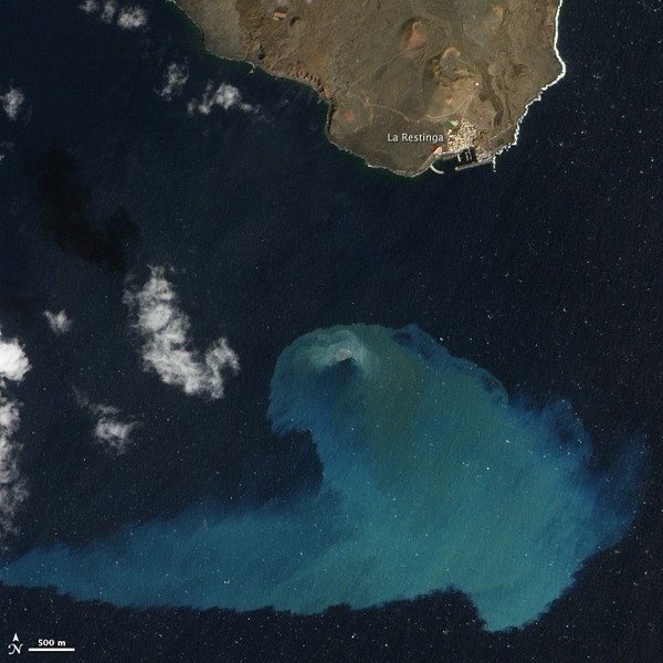
Four months after it began, the underwater volcanic eruption off El Hierro Island persists. This natural-color satellite image, collected on February 10, 2012, shows the site of the eruption, near the fishing village of La Restinga. Bright aquamarine water indicates high concentrations of volcanic material. Immediately above the vent is a patch of brown water that can resemble a turbulent hot tub when the eruption is strongest. The video of the eruption shows the activity in more detail.
This image was acquired by the Advanced Land Imager (ALI) aboard the Earth Observing-1 (EO-1) satellite. The eruption is just off the southern coast of El Hierro, the youngest of the Canary Islands. El Hierro is about 460 kilometers (290 miles) west of the coast of Morocco and Western Sahara.
According to El Hierro Digital measurements of the sea floor by the Instituto Oceanográfico Español showed that the volcano’s summit is now only 120 meters (390 feet) beneath the ocean surface—10 meters (30 feet) higher than it was in mid January. The height of the erupting cone is about 210 meters (690 feet) from the former ocean bottom, with a total volume over 145 million cubic meters (512 million cubic feet) of new material.
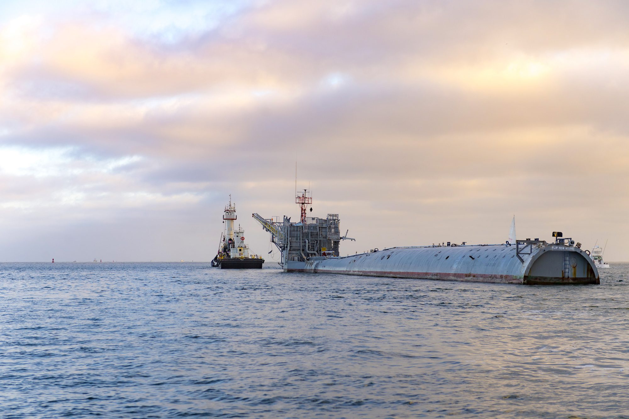
In a quiet corner of the Pacific last August, a vessel unlike any other was making what many thought was its final voyage. R/P FLIP (Floating Instrument Platform), the U.S....
What is the definition of misery? Answer: Seasickness One of the first questions I get asked when a landlubber finds out I work at sea is, “Do you get seasick?” In...
Containerization is the reason we have a thriving global marketplace, but where did it all begin? The idea of it was actually conjured up on a busy dock in Hoboken,...
May 17, 2020
Total Views: 707
Get The Industry’s Go-To News
Subscribe to gCaptain Daily and stay informed with the latest global maritime and offshore news
— just like 104,716 professionals
Secure Your Spot
on the gCaptain Crew
Stay informed with the latest maritime and offshore news, delivered daily straight to your inbox
— trusted by our 104,716 members
Your Gateway to the Maritime World!
Essential news coupled with the finest maritime content sourced from across the globe.

 Join The Club