Join The Club


Blog
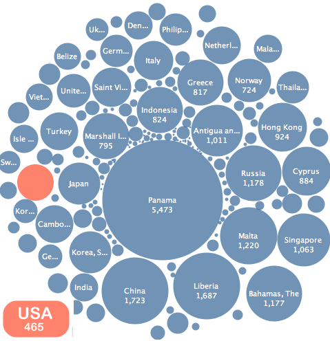
Maritime Flags of Convenience Visualized
We recently decided to get to work on some maritime visualizations. Above is a bubble graph I created representing the number of ships registered to each flag state. This graph...