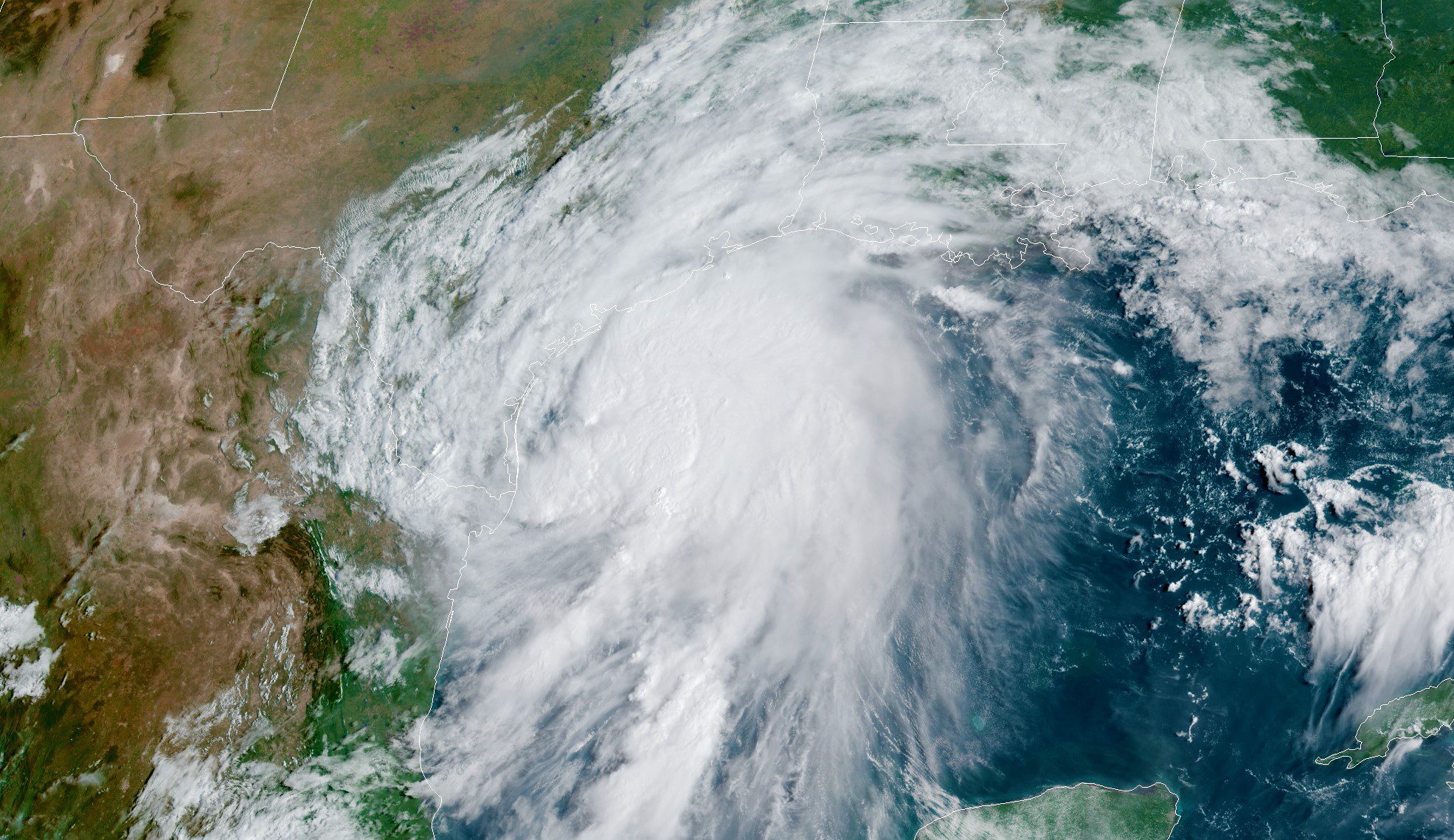
The U.S. Coast Guard has set port condition Yankee for the Port of Corpus Christi from Rockport, Texas, to the Colorado River Locks in Matagorda, Texas, as Tropical Storm Nicholas continues to move ashore.
Coast Guard Captain of the Port set port condition X-Ray, effective 5:45 p.m. Sunday, which was upgraded to Yankee as of 10:15 a.m. Monday. Port condition Yankee is set when hurricane-force winds are possible within 24 hours. During port condition Yankee, all affected ports are closed to inbound vessel traffic greater than 500 gross tons. Vessel movement shall be restricted, and all movements must be approved by the respective COTP.
Mariners are reminded there are no safe havens in these conditions and ports are safest when the inventory of vessels is at a minimum. All ocean-going commercial vessels and ocean-going barges greater than 500 gross tons should have made plans departing the port.
For planning purposes, in port condition Zulu the port is closed, and all port operations are suspended. All vessels greater than 500 gross tons without permission to remain in port should have departed or be prepared to depart prior to the setting of port condition Zulu.
Pleasure craft are advised to seek safe harbor. Drawbridges may not be operating if sustained winds reach 25 mph or when an evacuation is in progress. Port facilities are advised to review their heavy weather plans and take all necessary precautions to adequately prepare for the expected conditions.
Mariners can view the latest port updates on the Coast Guard’s Homeport site.
The National Weather Service National Hurricane Center has issued a Tropical Storm Warning from the mouth of the Rio Grande, at the U.S.-Mexico border, to Sabine Pass, Texas. A Hurricane Watch is in effect for Port Aransas to San Luis Pass Texas. Storm Surge watches and warnings are also in place.
Tropical storm conditions are expected within the warning area in southern Texas through the next few hours and will spread northward within the warning area through tonight.
At 10 a.m. CDT on Monday, the center of TS Nicholas was located over the western Gulf of Mexico about 45 miles northeast of the mouth of the Rio Grande River, moving toward the north near 12 mph. This general motion is expected to continue today, followed by a turn toward the north-northeast on Tuesday. The center of Nicholas is forecast to pass near or just offshore of the coast of south Texas Monday morning and move onshore along the coast of south or central Texas late Monday afternoon or evening.
Data from the reconnaissance aircraft indicate that maximum sustained winds remain near 60 mph with higher gusts. Tropical-storm-force winds extend outward up to 115 miles from the center. The minimum central pressure recently measured by the aircraft is 1002 mb (29.59 inches).
Strengthening is forecast to occur today, and Nicholas could reach the northwest Gulf coast as a hurricane. Weakening is anticipated on Tuesday and Wednesday while Nicholas moves over land.
Nicholas is expected to produce storm total rainfall of 8 to 16 inches, with isolated maximum amounts of 20 inches, across portions of the middle and upper Texas coastal areas through the middle of the week.
Editorial Standards · Corrections · About gCaptain

 Join The Club


