The Joint Maritime Information Center (JMIC) has reported that regional threat levels remain SIGNIFICANT amid ongoing strikes between Iran and Israel, with maritime threat levels ELEVATED due to potential impacts on shipping and infrastructure.
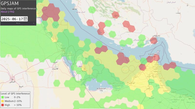
In its latest update as of June 18, JMIC highlighted persistent electronic interference affecting GNSS (Global Navigation Satellite Systems) systems, particularly around the Port of Bandar Abbas and throughout the Strait of Hormuz (SoH) and Arabian Gulf regions. Despite these challenges, commercial traffic through the Strait of Hormuz continues to maintain normal flow rates, with JMIC dismissing media speculation about potential blockades.
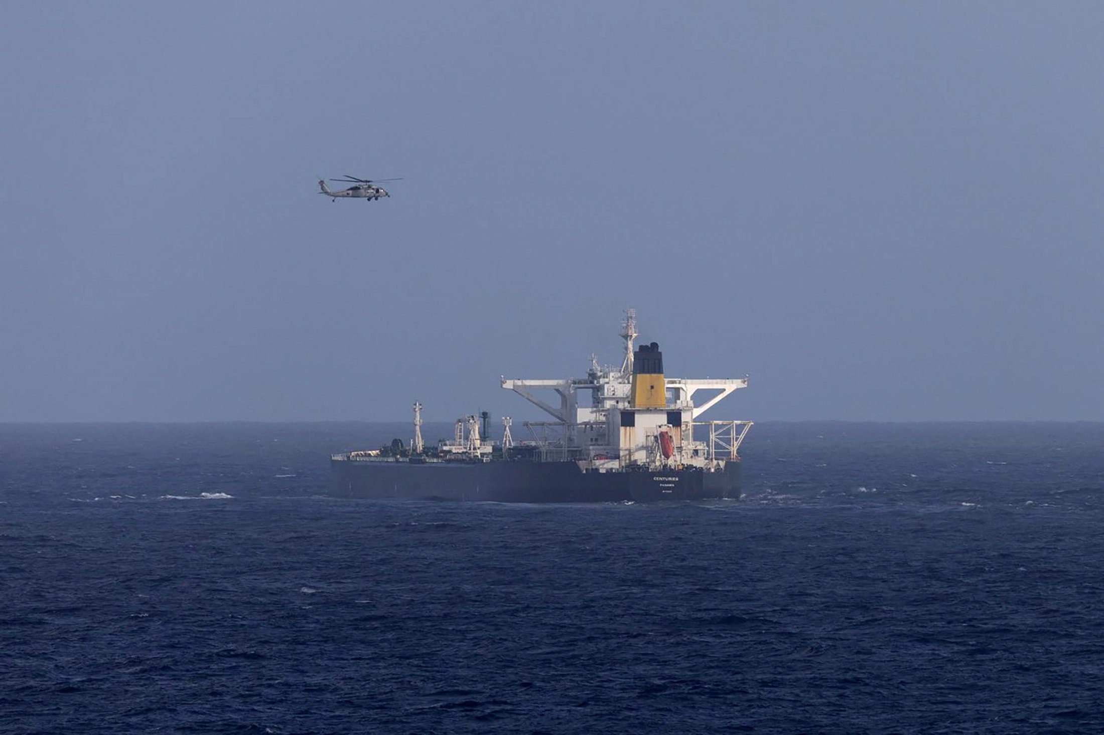
The report comes nearly a week after Israel began military strikes in Iran on June 12 and a significant incident where two tankers collided in the Gulf of Oman early Tuesday. The Very Large Crude Carrier (VLCC) Front Eagle, carrying 2 million barrels of Iraqi crude bound for China, collided with the Suezmax tanker Adalynn approximately 15 nautical miles off Fujairah—an incident that multiple sources—including the shipowner Frontline, JMIC, and UAE—have contributed to navigational error.
According to TankerTrackers’ assessment, the incident occurred when the Front Eagle, traveling southbound at 13.1 knots, executed a starboard turn and struck the Adalynn’s port quarter as it proceeded southeast toward the Suez Canal.
While both vessels reported fires, there were no injuries reported. The UAE Coast Guard successfully evacuated all 24 crew members from the Adalynn. The UAE’s energy ministry on Wednesday attributed the collision to “navigational misjudgment,” explicitly avoiding any connection to the recent surge in electronic interference in the region.
GNSS Interference Map. Source: gpsjam.org via JMIC
The incident highlights growing concerns about navigation safety in the region. According to shipping analysis firm Windward, nearly 1,000 ships in the Gulf have been affected by mass interference since the start of the Iran-Israel conflict. Recent tracking data has shown unusual positioning errors, with vessels appearing to be in impossible locations. The Front Eagle itself appeared to be onshore in Iran just days before the collision.
Ships in the region use AIS (Automatic Identification System) transmitters, similar to GPS, to broadcast their location and other vital data. The current interference, classified as “jamming,” disrupts these crucial navigation signals. The practice has become increasingly common in conflict zones, including the Black Sea during Russian attacks on Ukrainian ports, the Taiwan Strait, and waters near Syria and Israel.
Despite these challenges, JMIC reports that vessel traffic through the Strait of Hormuz remains stable, with data showing an average of 114 vessels (1,000 GT and above) transiting daily as of June 2024. The organization continues to monitor the situation closely and plans to provide daily updates.
The U.S. Coast Guard is waiting for additional forces to arrive before potentially attempting to board and seize a Venezuela-linked oil tanker it has been pursuing since Sunday, a U.S. official and a source familiar with the matter told Reuters.
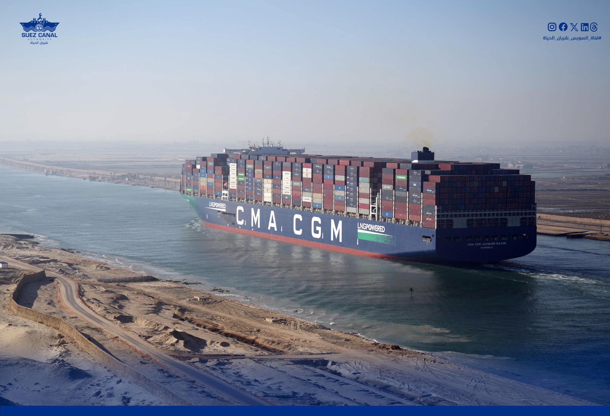
After nearly two years of disruption, ships from two of the world’s biggest container lines are once again sailing through the Suez Canal—a small but meaningful step toward restoring one of...
Venezuela's state-run oil company PDVSA has started filling up tankers with crude and fuel oil it has in storage as inventories mount amid moves by the U.S. to seize Venezuela-linked ships, according to company documents and shipping data.
17 hours ago
Total Views: 2008
Get The Industry’s Go-To News
Subscribe to gCaptain Daily and stay informed with the latest global maritime and offshore news
— just like 107,722 professionals
Secure Your Spot
on the gCaptain Crew
Stay informed with the latest maritime and offshore news, delivered daily straight to your inbox
— trusted by our 107,722 members
Your Gateway to the Maritime World!
Essential news coupled with the finest maritime content sourced from across the globe.

 Join The Club