by John Konrad (gCaptain) As Super Typhoon Hinnamnor is bearing down on Japan, the North Atlantic Ocean has experienced the quietest months of July and August since 1941. However, that could change as a new storm develops in the Caribbean and meteorologists predict a stormy fall season.
Named storms have skipped August in the Atlantic only three times on record – 1997, 1961, and 2022 – but meteorologists are monitoring a disturbance that’s moving west. It could gather strength and set off a string of late-season storms.
For the first time since 1941, the Atlantic has had no named storm (e.g., tropical storm or #hurricane) activity from July 3rd-August 30th. pic.twitter.com/9taf4ShfvV
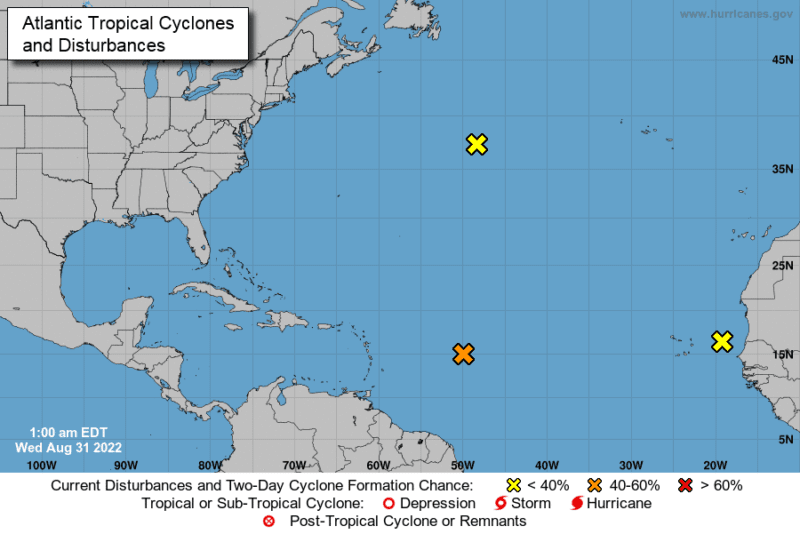
The National Hurricane Center reports a low-pressure system 850 miles east of the Lesser Antilles in the Caribbean Sea. There’s a 50% chance it will develop into a tropical storm by Friday, and an 80% likelihood within five days. The National Hurricane Center says the chances that the storm would come close to the United States is ‘very low’ at this time but it could plague islands and ships in the Caribbean.
“We will have to monitor the situation in the next couple of days to see where it develops in order to know more if it remains at sea,” said Maria Torres, a spokeswoman for the US National Hurricane Center.
Only three North Atlantic storms have been named this year. Hurricane Bonnie was the worst of the trio but it was only a tropical cyclone until it made the crossover from the Atlantic to the Pacific Ocean, the first to do so since Hurricane Otto in 2016.
Tropical Storm Colin, the most recent named storm, dissipated during the 4th of July weekend.
Hurricane Bonnie was the first Atlantic tropical storm to cross into the Pacific since Hurricane Otto in 2016
Bernie Rayno, a meteorologist at AccuWeather, told CNBC this morning that tropical storms need three main things to develop:
Warm water
Vertical wind shear
A moist unstable atmosphere
“So far this year, the atmosphere has been dry which has contributed to a slower season,” said Rayno. “But there is still plenty of time for severe weather to form.”
"We've only had two years where we haven't had any named August storms. That happened in 1961 and also in 1997," says @accuweather Chief Video Meteorologist @AccuRayno. "For the first time since 1941 in World War II, we haven't had a named storm from July 3 through August 30." pic.twitter.com/yzz8RR2KSy
“We’ve had a pattern over the last seven years that fostered Hurricane development, but not this year.” Acuweather’s Dan Kottlowski, told the New York Times. “But it’s still highly possible that strong hurricanes will form in the latter part of September to October.”
This month, NOAA is asking mariners to remain vigilant. The agency predicts that the North Atlantic could see 14 to 20 named storms, including up to 10 hurricanes–which would make this the seventh year in a row with an above normal season. This is because current conditions in the Atlantic basin indicate that August may be the calm before the storm.
The 2024 Atlantic hurricane season is drawing to a close on November 30, marking a year of extraordinary storm activity that defied typical patterns. With 18 named storms, including 11...
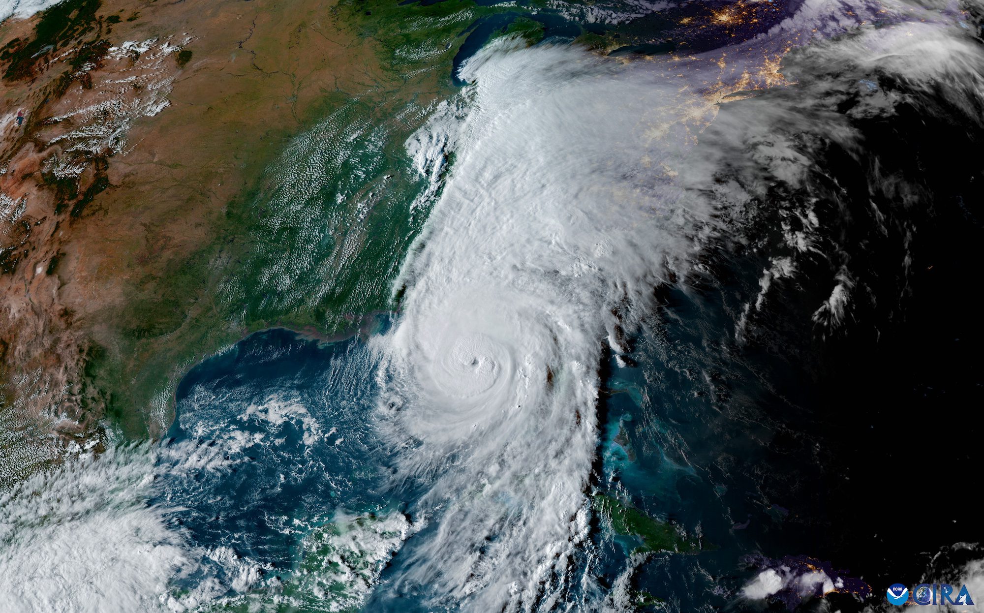
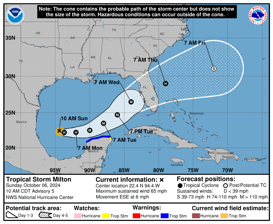
Tropical Storm Milton is rapidly intensifying as it moves across the Gulf of Mexico, prompting major concerns for the west coast of Florida. The National Hurricane Center (NHC) reports that...
By Sarah Morland July 3 (Reuters) – Powerful Hurricane Beryl was the 2024 Atlantic season’s first hurricane and the earliest storm on record to reach the strongest possible ranking of...
July 3, 2024
Total Views: 2107
Get The Industry’s Go-To News
Subscribe to gCaptain Daily and stay informed with the latest global maritime and offshore news
— just like 107,372 professionals
Secure Your Spot
on the gCaptain Crew
Stay informed with the latest maritime and offshore news, delivered daily straight to your inbox
— trusted by our 107,372 members
Your Gateway to the Maritime World!
Essential news coupled with the finest maritime content sourced from across the globe.

 Join The Club