By CW4 Michael W. Carr, US Army Watercraft Master (Retired)
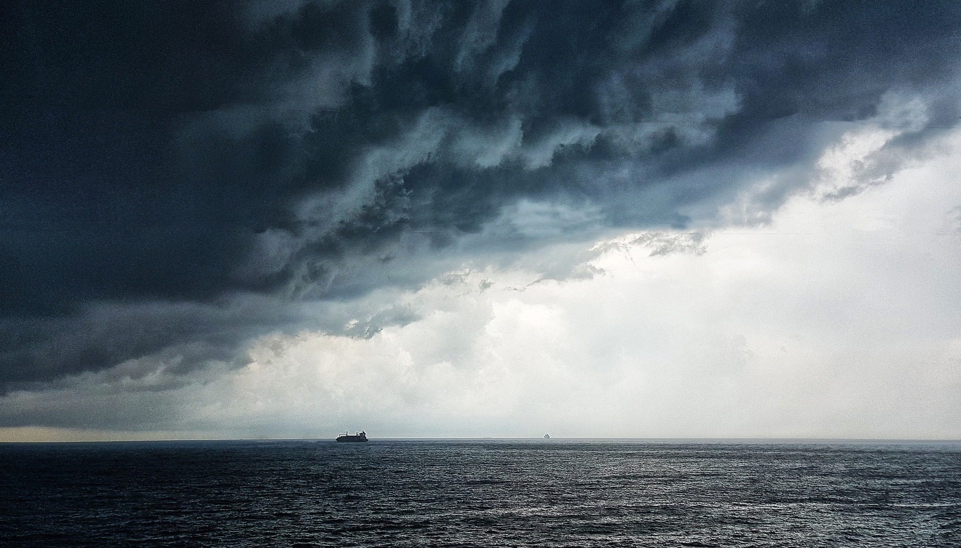
I sailed out of Port Fourchon as Chief Mate on Crowley’s American Salvor. Reading of Seacor Power’s capsizing brought memories of the many squalls, strong and shifting winds, rapidly building seas, and spontaneous weather events which I experienced in the Gulf of Mexico.
Many factors contribute to dramatic weather in the Gulf; shallow depths, influx of heat from the Gulf Stream loop current, being surrounded by flat land which heats and cools diurnally and permits winds to blow offshore, mixing with cooler and moisture laden Gulf air. These factors comprise the first rule of marine weather:
“A change in temperature equals a change in air density which will cause an event.”
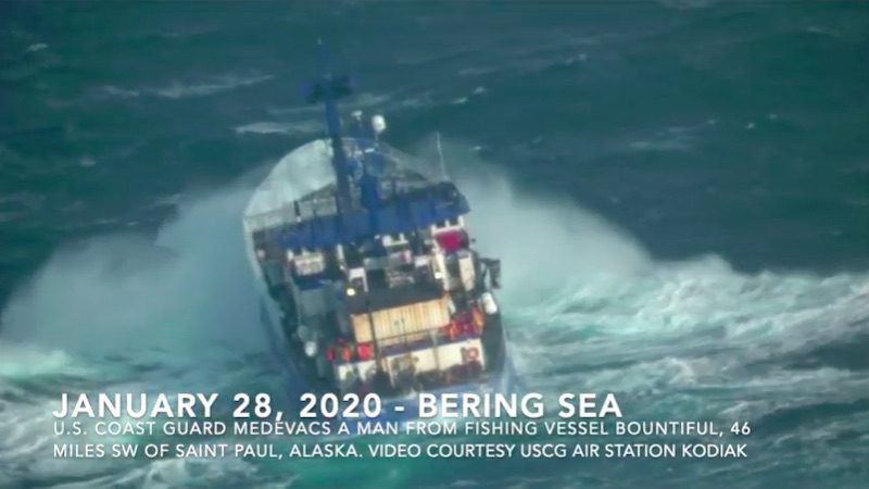
An event is wind. Wind builds seas, and often overlooked is that wind force increases by a factor of four (4) as wind speed doubles. A 20-knot wind produces four (4) times the force of 10 knots. Sixty knot winds, for example, produces a pressure of 14.4 lbs. per square foot, while 20 knots produce only 1.6 lbs. per square foot. No need to be a mathematician to realize how dangerous 60 knots wind are against your vessel, in addition to the huge seas such winds produce.
There were nights in the Gulf when there was no wind, and then within minutes we would feel air temperature increase, indicating an approaching cold front (Air temperature increase, and is thus heated, as a cold front compresses the air ahead of the approaching front). Within minutes winds would increase from calm to 30, 40, 50 knots and then shift direction quickly as the front passed over us, demonstrating that “A change in temperature indicates a change in air density which causes an event (wind)”.
Understanding and operating a vessel in the complex marine environment requires visualizing where your vessel lies within synoptic weather features. You need to identify location of cold, warm, occluded and stationary fronts relative to your vessel, to visualize location of isobars, high and low-pressure systems, and their trend. How fast are fronts moving, are the highs and lows increasing or decreasing in pressure? What is occurring at the 500-mb level? Location of upper-level troughs and ridges?
Our NWS Ocean Prediction Center provides access to marine weather charts. These charts are updated every 6 hours (https://ocean.weather.gov/mobile/mobile_atl.php) and are presented as easily viewed black and white formats as Analysis, and 24-hour, 48-hour, 72 hour and 96- hour products. When examining these charts mariners should visualize the current and forecast weather. Place your vessel’s position on the current chart, and visualize your planned route. Ask yourself “Is what I see around me (wind speed, direction, temperature) consistent with the analysis, and how are these conditions forecast to change?
Use your ship’s radar to track frontal movement and be aware of air temperature changes and wind direction. Your surroundings provide subtle, yet critical clues to the present and forthcoming weather.
On Crowley’s American Salvor we would routinely engage in complex diving operations, setting four anchors over pipelines and subsea structures. Once in position and having set our anchors I would spend my time scanning the radar (using various ranges), observing the horizon, wind direction and speed, and feeling for changes in air temperature.
Seacor Power’s capsize and the death of too many mariners should encourage the Coast Guard and NTSB to examine both the events and weather on the day of the tragedy, but also examine how we teach and educate mariners in the subject of marine weather. Are we providing the necessary skills, understanding, and tools necessary for mariners to analyze and forecast weather and make appropriate & correct operational decisions in our complex maritime environment?
Editorial Standards · Corrections · About gCaptain

 Join The Club