Saildrone, a leading autonomous vessel company, has successfully completed a groundbreaking ocean survey mission in remote areas off California and Alaska’s Aleutian Islands, mapping over 45,000 square kilometers of previously unexplored seafloor in a bid to address significant gaps in ocean exploration and mapping.
Saildrone, based in Alameda, California, develops and operates a fleet of uncrewed surface vehicles (USVs) equipped with a variety of sensors and instruments to collect ocean data for scientific and commercial applications.
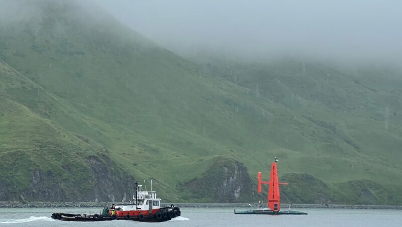
The company on Tuesday said its Saildrone Surveyor, which it describes as the world’s largest uncrewed ocean mapping vehicle, completed the uncrewed survey around the Aleutian Islands and off the coast of California. The months-long survey was part of a multi-agency public-private partnership funded by the National Oceanic and Atmospheric Administration (NOAA) and the Bureau of Ocean Energy Management (BOEM), aimed at addressing ocean exploration gaps in remote areas with USVs.
During the missing the, the Surveyor made two pit stops in Dutch Harbor, Alaska. Copyright 2023 SAILDRONE. All Rights Reserved.
The US Exclusive Economic Zone (EEZ) is one of the largest in the world, but it is largely still unmapped, unobserved, and unexplored. Alaska, in particular, is the least mapped region of the US EEZ.
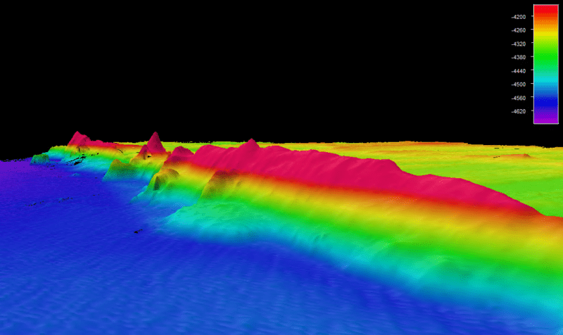
The Saildrone Surveyor SD 1200 sailed across the North Pacific to the survey area in July 2022, mapping 16,254 sq km of unknown seafloor around the Aleutian Islands over 52 days. The Surveyor also carried technology from the Monterey Bay Aquarium Research Institute to sample environmental DNA (eDNA), providing crucial insights into marine biodiversity and ocean health.
Despite challenging conditions in the Aleutian region, including 35-knot winds and wave swells over 5 meters, the Surveyor collected high-quality data, which will be used to optimize dive targets during upcoming expeditions on NOAA’s research vessel Okeanos Explorer.
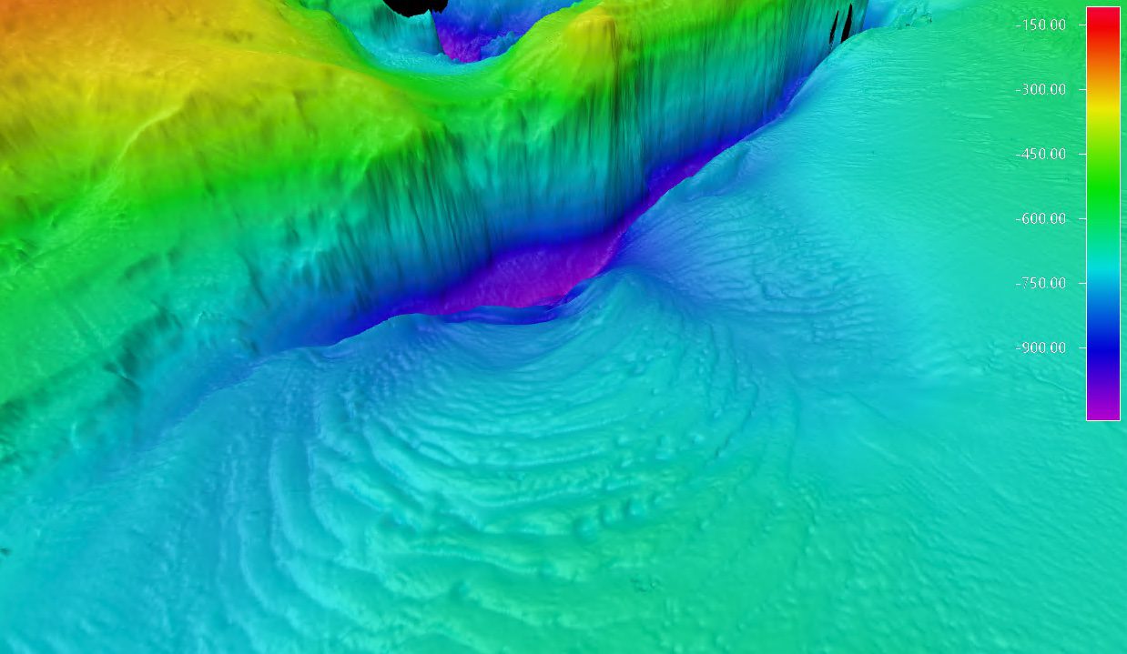
California Ridge. Copyright 2023 SAILDRONE. All Rights Reserved.
The second half of the mission off the coast of California involved mapping an additional 29,720 square kilometers of the US EEZ and discovering a previously unknown seamount standing approximately 1,000 meters high. Saildrone said identifying such seamounts improves our understanding of the physical processes of the ocean and identifies areas needing further exploration as unique habitats.
The project was operationally managed through NOAA’s Ocean Exploration Cooperative Institute (OECI) and the University of New Hampshire. The data collected around the Aleutian Islands will be publicly available through NOAA’s National Centers for Environmental Information.
Saildrone says its Surveyor class vehicles are increasingly in demand, with an additional four Surveyor-class ocean mapping vehicles to be built by Austal USA in Mobile, AL, this year. The mission proves that long-endurance USVs provide a viable option to achieve the goals of the National Ocean Mapping, Exploration, and Characterization Strategy. This is the future of ocean mapping.
Saronic has launched its newest autonomous surface vessel, expanding its rapidly growing lineup with a 52-foot platform designed for defense, security and commercial maritime missions as the Texas-based company continues...
The maritime industry has spent the better part of a decade debating whether autonomous ships represent genuine commercial progress or elaborately funded engineering theatre. That debate has not been entirely...
How automation, AI, and the decline of traditional watchkeeping are reshaping seafarer welfare By Paul Morgan (gCaptain) – The modern ship has never been more advanced. Engine rooms now run...
March 23, 2026
Total Views: 1643
Get The Industry’s Go-To News
Subscribe to gCaptain Daily and stay informed with the latest global maritime and offshore news
— just like 104,563 professionals
Secure Your Spot
on the gCaptain Crew
Stay informed with the latest maritime and offshore news, delivered daily straight to your inbox
— trusted by our 104,563 members
Your Gateway to the Maritime World!
Essential news coupled with the finest maritime content sourced from across the globe.

 Join The Club