Relying heavily on chart data and standard navigation tools for safe navigation is risky. Vessels will find themselves in dangerous situations due to lack of data. This is particularly relevant in polar regions. These areas are poorly charted at best and at worst are mostly uncharted territories.
Those who travel to these areas are looking for a solution to this issue. The process of updating charts is underway through Hydrographic Organizations around the world. But it will be many years before usable data will be available in most of these remote areas. So what can be done now to allow Captains and crew to rest easy. What they really need is to see what is under the water in front of their vessel right now.
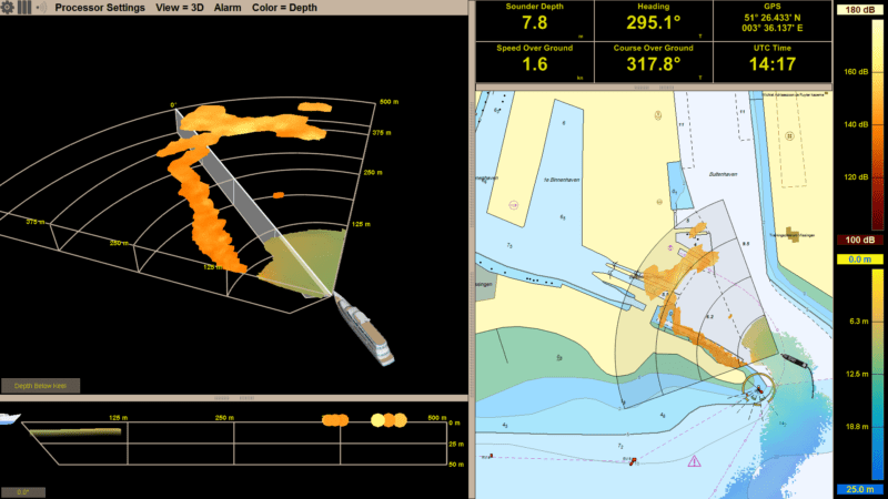
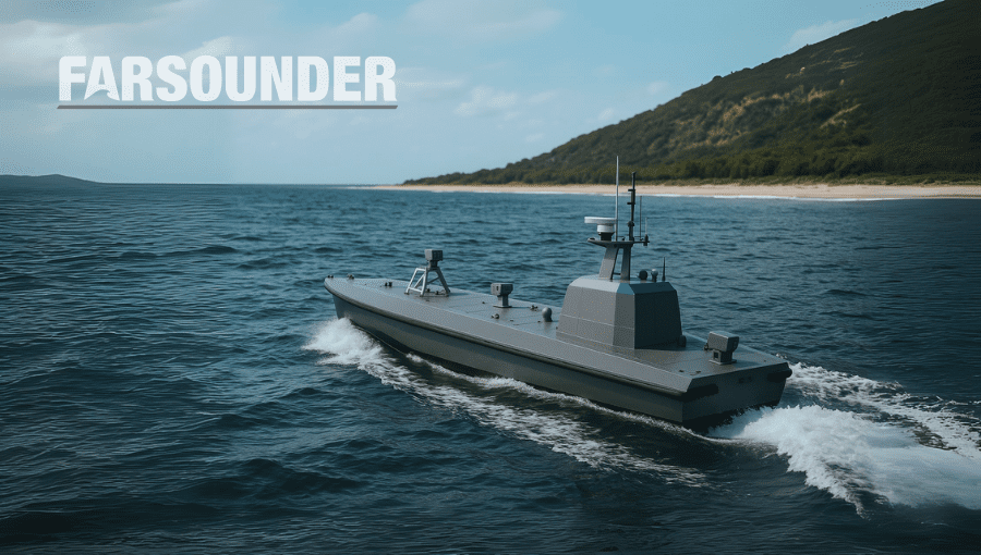
Some operators have found Argos Forward Looking Sonars can give them the clear situational awareness they are striving for.
“I traveled around Greenland using the FarSounder sonar which proved quite useful in several challenging instances. The system clearly showed a shoreline, which was incorrectly shown on the chart, and helped us avoid a grounding. It also showed growlers and bergy bits when traveling up the fjords. I will not travel to areas of ice again without the FarSounder Argos systems.”
Captain Walter Wetmore
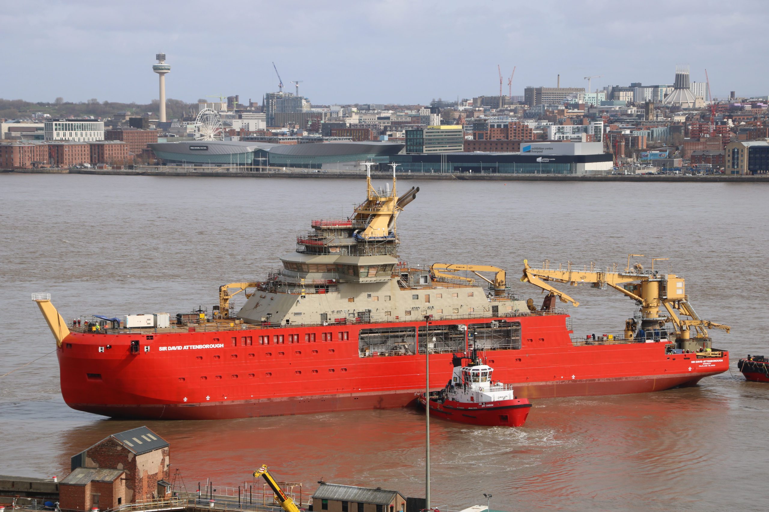
Expedition Cruise ships have used the systems extensively to navigate the arctic and Antarctic. This is not limited to just Ice Explorer Class vessels, but full Ice Breakers as well, including Ponant’s latest innovative ship Le Commandant Charcot and the British Antarctic Survey’s Sir David Attenborough. For most expedition ice class vessels, a through the hull standard mount works well. However, because of the potential of impact to the sonar during the icebreaking, those two icebreakers vessels have chosen to install their sonars on a hoist.
It is needless to say how valuable seeing under the water in these uncharted regions would be for these exploration vessels and anyone venturing into these waters. Even for those vessels not traveling directly through ice, there are still many uncharted areas and risks that would be mitigated by seeing in front of the vessel under the water in real-time. The sea is alive and changing. In addition, traditional navigation tools such as GPS at times show inaccurate data. By having an Argos installed, operators can see exactly what is under the surface ahead lessening the chance of an accident exponentially.
Another interesting piece of information to have for navigating the polar ares, the IHO has developed a Zone of Confidence technique and a related tool. Category Zone of Confidence (CATZOC) are the values used to highlight the accuracy of data presented on charts. This would help navigators make decisions on when they should slow down and be more careful. This is very useful to show the trends, but again, it doesn’t complete the data needed to stay and feel safe.
FarSounder’s mission is to further the goal of keeping vessels and marine life safe from harm. Some members of the FarSounder technical team are part of the NOAA/IHO’S Crowd Sourced Bathymetry Working Group and the Argos sonars have been deemed to provide accurate data to contribute to their growing database. A subset of FarSounder’s customers collect data in uncharted regions and send it in to be included, only with the customers’ permission, in this initiative.
It will be advantageous to your vessel or fleet in helping minimize risks while transiting in polar regions and other challenging seas, by expanding the navigator’s toolbox to include a 3D navigation grade forward looking sonar. Learn more about this revolutionary technology by attending their webinar on February 17th at 11am EST.
The maritime industry is undergoing rapid change. Advancements in autonomy are allowing uncrewed vessels to transit oceans with growing sophistication. A growing network of marine technologies is paving the way...
The next era of naval superiority will be decided by how effectively USVs integrate within broader fleet operations. Unmanned and autonomous systems are rapidly reshaping naval operations, advancing from experimental...
As unmanned and autonomous surface vessels (USVs) expand their role in the maritime sector, their missions are moving into increasingly complex and dynamic environments that often present unpredictable hazards. These...
May 19, 2025
Total Views: 1555
Get The Industry’s Go-To News
Subscribe to gCaptain Daily and stay informed with the latest global maritime and offshore news
— just like 104,535 professionals
Secure Your Spot
on the gCaptain Crew
Stay informed with the latest maritime and offshore news, delivered daily straight to your inbox
— trusted by our 104,535 members
Your Gateway to the Maritime World!
Essential news coupled with the finest maritime content sourced from across the globe.

 Join The Club