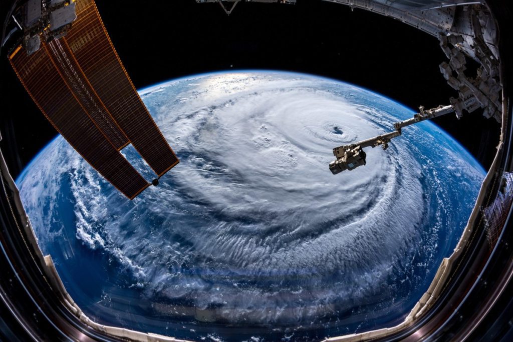
FILE PHOTO: Hurricane Florence is seen from the International Space Station as it churns in the Atlantic Ocean towards the east coast of the United States, September 10, 2018. NASA/Handout via REUTERS
With Hurricane Florence continuing on a collision course with the U.S. mid-Atlantic coast, officials are warning of life-threating conditions consisting of hurricane-force winds, massive storm surge, and an obscene amount of rainfall.
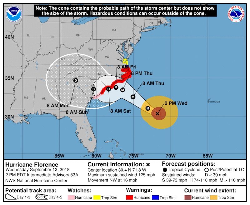
As of 2 p.m. ET, Hurricane Florence was located about 435 miles (700 km) southeast of Wilmington, North Carolina, moving toward the west-northwest near 17 mph. On the forecast track, the center of Florence is expected to approach the coast of North Carolina or South Carolina on Thursday and Friday before moving slowly near the coastline through Saturday.
A reconnaissance aircraft on Wednesday found that Florence was packing maximum sustained winds of 125 mph, with higher gusts, making it a category 3 hurricane on the Saffir-Simpson Hurricane Wind Scale. While this slight downgrade from the 130 mph winds (Cat 4-strength) observed over the last few days, the downgrade negligible for anything (or anyone) caught in its path.
Forecasts are calling for some weakening is expected to begin by late Thursday, Florence is still forecast to be an extremely dangerous major hurricane when it nears the U.S. coast on Friday.
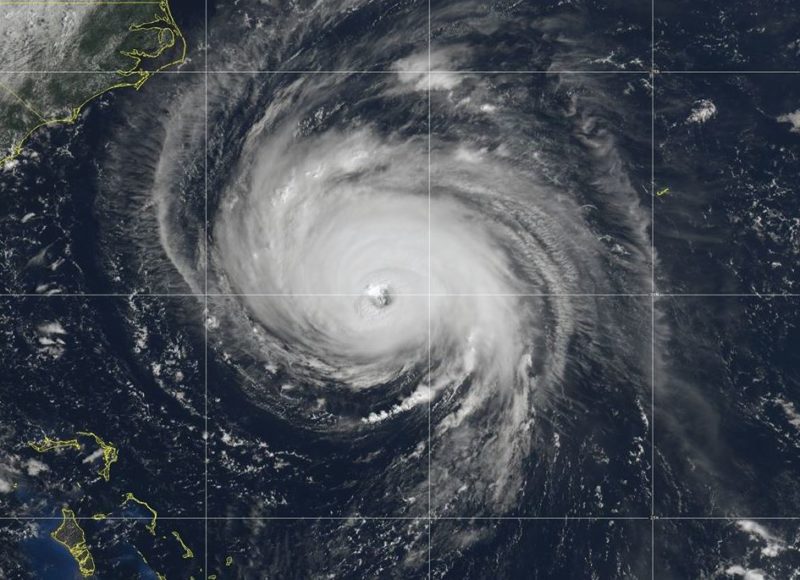
What’s striking about Hurricane Florence is not just its intensity, but also it’s vast size. Florence is estimated to be about 400 miles in diameter, roughly equivalent to the size of Arizona – the sixth largest state by area. To make matters worse, the aircraft data also indicate that Florence’s inner-core wind field has expanded, with the 50-kt winds extending outward up from the eye by about 100 nautical miles to the northeast.
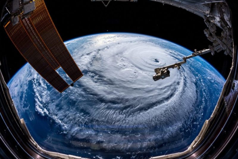
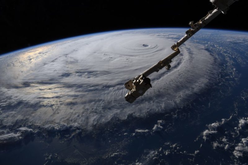
In order to get a true sense of just how large Hurricane Florence is, it’s best to take a look from above. Check out these photos taken Wednesday from aboard the International Space Station, orbiting about 245 miles from above Hurricane Florence’s eye.
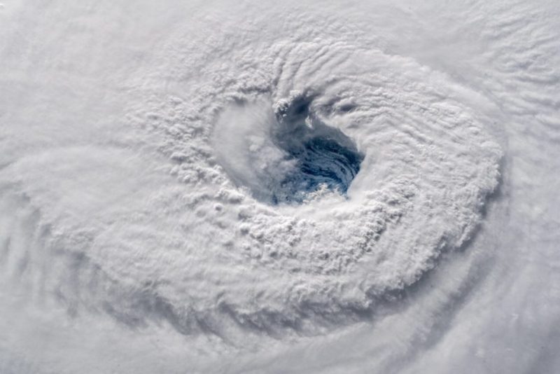
Photo courtesy Alexander Gerst, an EU scientist on the International Space Station. Via TwitterPhoto: Alexander Gerst / TwitterAn up-close shot of Hurricane Florence’s eye. Photo: Alexander GerstISS Astronaut Ricky Arnold tweets: “#HurricaneFlorence this morning with Cape Hatteras #NorthCarolina in the foreground. The crew of @Space_Station is thinking of those who will be affected.”
(Southern Boating) – The Cajun Navy has entered popular vernacular, but what do we know about the group? The famed Cajun Navy came to be when a Former Louisiana state...
By Lydia Mulvany and Sheela Tobben (Bloomberg) — The Port of Wilmington in North Carolina remains shut in the aftermath of Hurricane Florence, freezing shipments of everything from fertilizer to textiles. Florence...
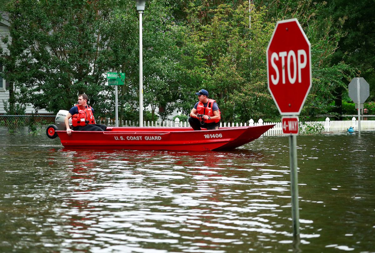
By Patrick Rucker FAYETTEVILLE, N.C., Sept 16 (Reuters) – Deadly storm Florence’s historic rainfall is testing the best efforts by many North Carolina cities to bolster their defenses against flooding...
September 16, 2018
Total Views: 22
Get The Industry’s Go-To News
Subscribe to gCaptain Daily and stay informed with the latest global maritime and offshore news
— just like 105,149 professionals
Secure Your Spot
on the gCaptain Crew
Stay informed with the latest maritime and offshore news, delivered daily straight to your inbox
— trusted by our 105,149 members
Your Gateway to the Maritime World!
Essential news coupled with the finest maritime content sourced from across the globe.

 Join The Club