Click image for interactive map
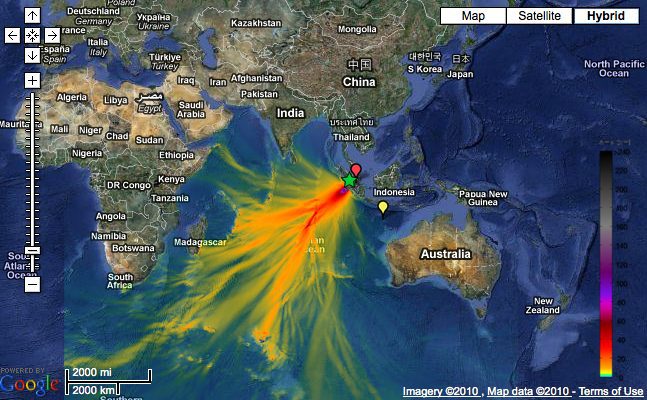
Tsunami Event – October 25, 2010 Mentawai, Indonesia
The Indonesia tsunami event was generated by a Mw 7.7 earthquake (3.484°S, 100.114°E ), at 14:42:22 UTC, 240 km (150 miles) W of Bengkulu, Sumatra, Indonesia (according to the USGS). In a little under 2 hours, the tsunami was first recorded at DART® buoy 56001 and in a little under 3 hours, the tsunami was recorded at DART® buoy 56003. Forecast results shown below were created with the NOAA forecast method using MOST model with the tsunami source inferred from DART® data. The tsunami waves first arrived at Padang (approximately 270 Km from the earthquake epicenter ), at 15:47 UTC, about 65 minutes after the earthquake. The DART data and model inversion indicate that the tsunami may be larger than the earthquake magnitude of 7.7 suggests.
Modeling Results Links
Model results comparison with sea level data Links
[Source NOAA]
Updated: August 26, 2013 (Originally published October 29, 2010)
Editorial Standards · Corrections · About gCaptain

 Join The Club