gCaptain Weekly – Episode 1
In this first episode of gCaptain Weekly, John Konrad and Sal Mercogliano discuss some of the top maritime stories of the week:
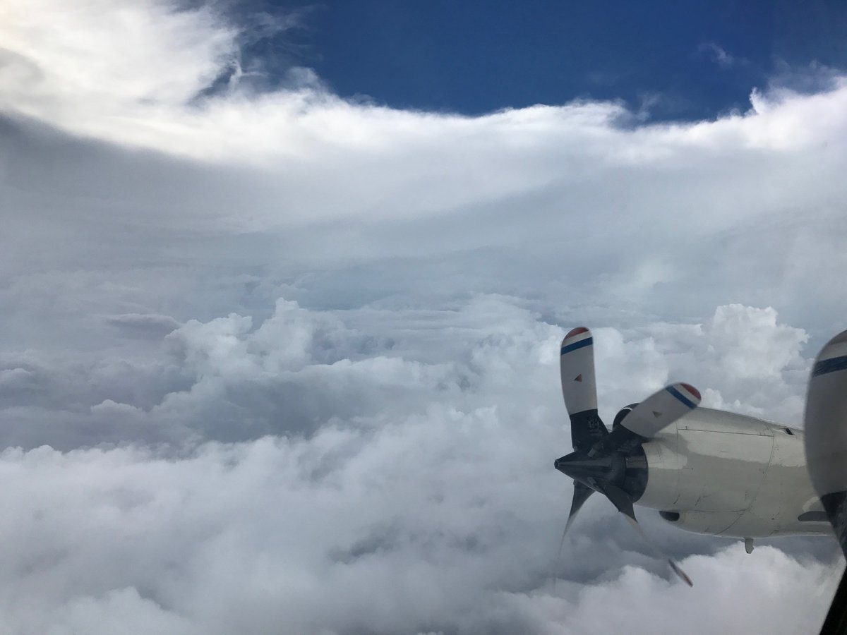
Inside the eye of Hurricane Irma, September 5, 2017. Credit: NOAA
Some amazing footage from inside the eye of Hurricane Irma filmed aboard NOAA Hurricane Hunter aircraft. The videos were captured Tuesday morning during a flight through Irma’s eye after the storm had reached Cat 5 strength with 185 mph winds.
In the video below you can see how eerily-calm it is within the well-defined the eye walls of what has been called the most powerful Atlantic Ocean storm on record.
Video from yesterday’s flight in CAT 5 #Irma on #NOAA42. https://t.co/iofV4p56DE has the latest advisories. Credit Rob Mitchell/NOAA pic.twitter.com/IygcNgIbJN
— NOAAHurricaneHunters (@NOAA_HurrHunter) September 6, 2017
This next video is from Tuesday and shows the aircraft as it approaches the eye, eventually breaking through towards the end of the video. It is quite the contrast.
Video of a flight through the eye of #Irma on #NOAA42. Flights on both the WP-3D Orion and G-IV #NOAA49 continue. Credit Nick Underwood/NOAA pic.twitter.com/9ini4bOnYF
— NOAAHurricaneHunters (@NOAA_HurrHunter) September 5, 2017
Now here are some photos from the flight:
Inside the eye of #Irma on WP-3D Orion #NOAA42. This is referred to as the “stadium effect” https://t.co/iofV4p56DE Credit CDR Kibbey/NOAA. pic.twitter.com/dlUta2IbDL
— NOAAHurricaneHunters (@NOAA_HurrHunter) September 5, 2017
And in case you were wondering what Hurricane Irma looked like from above, here is some satellite imagery from Tuesday:
Get a good look at Hurricane #Irma‘s eye with this visible imagery from #GOES16! For the latest info on Irma, go to https://t.co/cSGOfrM0lG pic.twitter.com/q4Q5UtPlIP
— NOAA Satellites (@NOAASatellites) September 5, 2017
You can view gCaptain’s full Hurricane Irma coverage HERE.
Join the 67,715 members that receive our newsletter.
Have a news tip? Let us know.