File photo
By Brian K. Sullivan and Marvin G. Perez (Bloomberg) — Tropical Storm Nate, on track to strike near New Orleans overnight Saturday, may cause close to $1 billion in damage across Central America and the U.S., regions already battered by the most powerful month of hurricanes on record.
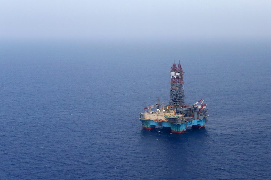
Nate has triggered flooding and landslides in Central America, leaving at least 17 dead in Costa Rica and Nicaragua, and shuttered oil and natural platforms in the Gulf of Mexico. The storm could make landfall in the U.S. as a Category 1 hurricane with winds topping 74 miles (119 kilometers) an hour. Soaking rains across eastern Mississippi and Alabama may damage cotton crops.
Accumulated cyclone energy, a measure of storm power and longevity, set a record in September, according to the U.S. National Hurricane Center, a month that saw Hurricane Maria slam Puerto Rico at Category 4 strength and Hurricane Irma batter Florida with 130 mile per hour winds. All told, 14 storms have formed across the Atlantic this season, killing hundreds in the U.S., Mexico and the Caribbean and causing an estimated $300 billion in damage.
For New Orleans, “the big issue is potentially the rain,” said Chuck Watson, a disaster modeler at Enki Research in Savannah, Georgia. “All of that has to be pumped out since so much of the city is below lake and sea level. The infrastructure isn’t in great shape.”
Nate was about 175 miles southeast of Cozumel, Mexico with top winds of 50 miles an hour, the hurricane center said in an advisory at 11 a.m. New York time. It could be near hurricane strength when it approaches the Yucatan Peninsula later Friday, before entering the Gulf on a path toward Louisiana.
“I am amazed at how fast it is moving,” said Matt Rogers, president of the Commodity Weather Group LLC in Bethesda, Maryland. “It just lifted off Honduras and it is going to make land fall in New Orleans by tomorrow.”
Hurricane warnings are in place from Grand Isle, Louisiana, to the Alabama-Florida border while a storm surge warning is place for much of the Louisiana coast, including New Orleans. While Nate is forecast to strike near where Katrina hit in 2005, there’s a big difference between the storms. Katrina brought a 24- to 28-foot (7.3- to 8.5-meter) storm surge with it that killed 1,800 people and flooded New Orleans. Nate’s surge is forecast to reach only four to seven feet.
Preliminary damage estimates for Nicaragua, Honduras and the rest of Central America stand at about $250 million. Nate could cause another $700 million to $800 million in the U.S., Watson said.
Offshore Platforms
Orange-juice futures rose Thursday. BP Plc, Chevron Corp. and other drillers were evacuating and shutting platforms, and Phillips 66 is said to reduce refining rates at its Alliance plant south of New Orleans. Offshore platforms in the Gulf of Mexico account for about 17 percent of U.S. oil output and 4 percent of gas production. Roughly 45 percent of petroleum refining capacity and 51 percent of gas processing is on the coast.
While energy production may be curtailed, the storm probably won’t be strong enough to do any lasting damage, Rogers said.
“There will definitely be disruption but it is such a short-lived event it will be over by Sunday,” Rogers said. “They will be able to return people back to those platforms Sunday and Monday.”
Nate may dump as much as 6 inches of rain across eastern Mississippi and Alabama, according to hurricane center. That’s “definitely” doing damage to cotton there and slowing harvesting, said Donald Keeney, a meteorologist with MDA Weather Services in Gaithersburg, Maryland.
Onshore winds will probably only be around 40 mph when the storm passes through, which should spare Louisiana sugar cane any major risks, said Drew Lerner, the president of World Weather Inc. in Overland Park, Kansas.
“This isn’t going to be as bad as the other hurricanes we had recently,” Lerner said.
© 2017 Bloomberg L.P
Editorial Standards · Corrections · About gCaptain
This article contains reporting from Bloomberg, published under license.

 Join The Club


