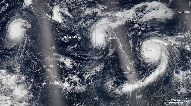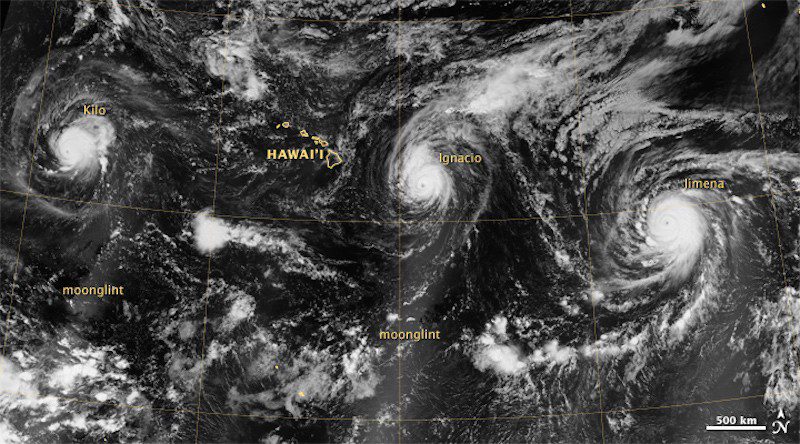
NASA satellites this week captured images of three simultaneous hurricanes over the Pacific Over near Hawaii, the first time in recorded history that three Category 4 storms march across the central and eastern Pacific Ocean at the same exact time.
NASA says that at around the time of the first image, acquired between 9:30 and 13:00 Universal Time on August 30th, Hurricane Kilo had maximum sustained winds of 135 miles per hour and was moving north-northwest posing no threat to land, according to an advisory issued by the Central Pacific Hurricane Center.
Meanwhile, Hurricane Ignacio had similar sustained wind speeds that measured at 140 miles per hour. Unlike Kilo, Ignacio was closer to the Big Island’s mainland but by now it seems to have passed well north of Hawaii.
Finally, Huricane Jimena, the easternmost of the three storms, carried maximum sustained winds of about 130 miles per hour, according to the National Hurricane Center. Jimena is now a Category 3 and forecasts predict it to also move northeast of Hawaii.
This second image below shows the storms about 12 hours later.
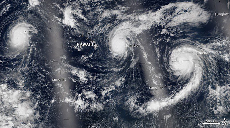
Both images are a mosaic based on data collected during three orbital passes of the Visible Infrared Imaging Radiometer Suite (VIIRS) on the Suomi-NPP satellite.
Now below is an animation of the storms:
Editorial Standards · Corrections · About gCaptain

 Join The Club