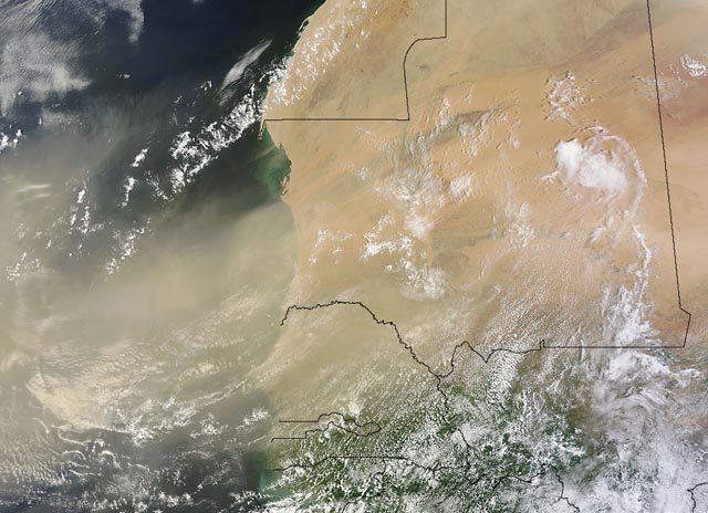
A Saharan dust storm moves out into the Atlantic Ocean on July 30, 2013, image: NASA
This week, NOAA’s Terra/MODIS satellites detected a massive plume of dust moving off the coast of Africa, born from a storm far inland. This plume, called the Saharan Air Layer (SAL), carries with it a particularly high concentration of dust and dry air that NOAA notes, ‘plays an important role in lessening “cyclogenesis” or the formation of hurricanes.’
Using 18 satellite images from NOAA, we created the following animation to show the recent movement of this air mass off the western coast of Africa.
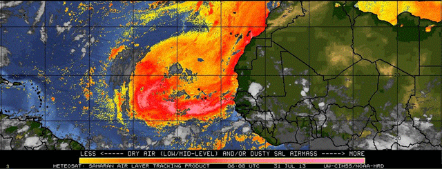
A recently enhanced version of the NOAA NGAC aerosol model show how the plume is expected to travel across the Atlantic Basin.
According to a 2004 study by Jason P. Dunion from the University of Miami, and Christopher Velden from the University of Wisconsin, the “SAL engulfs tropical waves, tropical disturbances, or preexisting tropical cyclones (TCs), its dry air, temperature inversion, and strong vertical wind shear (associated with the midlevel easterly jet) can inhibit their ability to strengthen.”

 Join The Club