A rapidly intensifying weather system, known as a “bomb cyclone,” has developed off the U.S. West Coast, creating perilous conditions for mariners and coastal communities in the Pacific Northwest.
The low pressure has far surpassed the typical criteria for a bomb cyclone, with its central pressure plummeting by an astonishing 59 millibars in just 24 hours.
The National Weather Service Ocean Prediction Center issued a stark warning on social media, underscores the severity of the situation and the potential dangers faced by vessels in the vicinity. “This storm affecting the eastern Pacific intensified 26 mb in just 6 hours and 59 mb in 24 hours! Hurricane Force Winds to 70 kts and waves over 30 feet are expected tonight. Mariners should be avoiding the area!,” the NWS OPC stated.
As of Tuesday midday, significant wave heights of 26 feet were already observed, with forecasts predicting waves to reach up to 36 feet (11 meters). These massive waves, combined with sustained hurricane-force winds of up to 70 knots, are creating treacherous conditions that pose a significant threat to maritime shipping and coastal communities in the region.
24-hour wind & wave forecast
The storm’s intensity is further underscored by its forecasted barometric pressure, expected to plunge to 941 millibars – a pressure equivalent to that of a Category 4 hurricane. This dramatic drop in pressure is a key indicator of the storm’s exceptional power and potential for destruction.
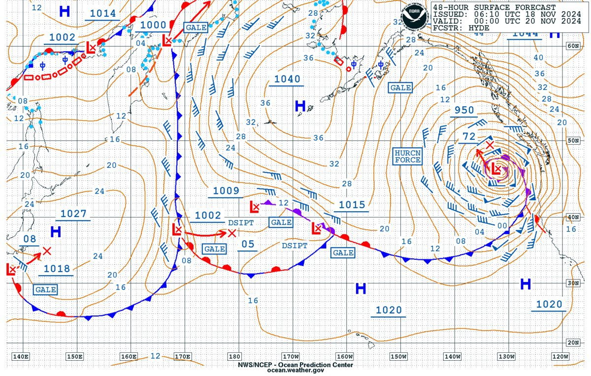
The latest North Pacific High Seas Forecast, issued by the National Weather Service, provides crucial details about the storm’s current position and projected path. The low-pressure system is centered at 43N, 137W, with a pressure of 981 millibars, moving northeast at 15 knots. The forecast warns of winds ranging from 40 to 55 knots and seas of 12 to 21 feet extending within 300 nautical miles of the storm’s core.
We've got a buoy report pretty close to the storm center offshore. And it's about what was expected. Buoy 5 is 300 nautical miles west of Aberdeen – reporting sustained winds 56 mph gusting 74 mph. And pressure 950.5 millibars. #wawxpic.twitter.com/xCaw5VXykm
Perhaps most alarming is the prediction that conditions will worsen as the storm progresses. Winds are expected to reach up to 70 knots, with seas potentially towering to 32 feet within the next 12 hours. The area affected by hurricane-force winds is projected to extend 120 nautical miles south and 180 nautical miles north of the storm center.
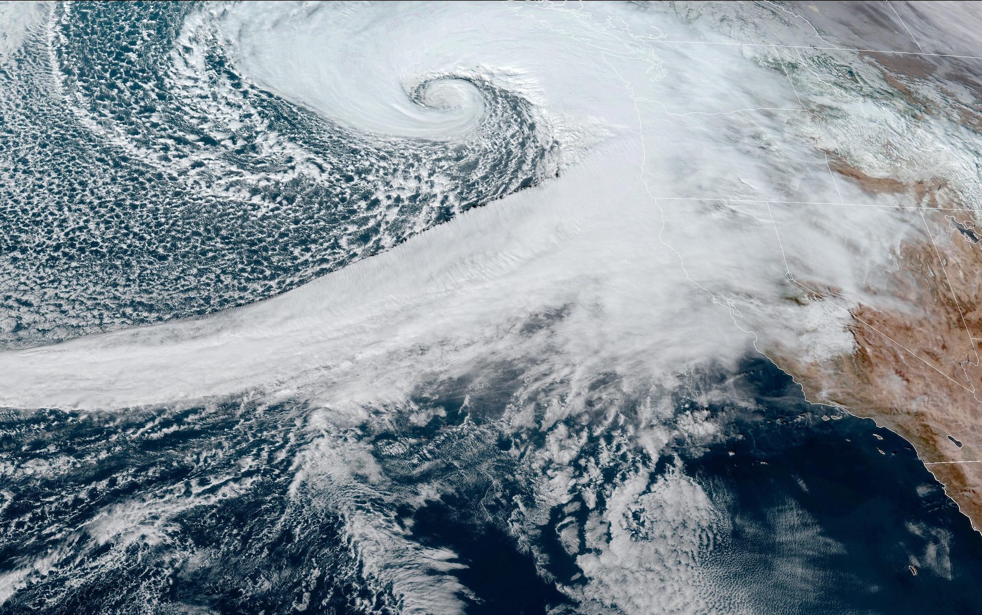
Some amazing satellite imagery of the weather system has been shared on social media:
Tuesday, November 19, 2024, 12:53 PM PDT: An incredible view of the bomb cyclone, getting even more intense over the central Pacific currently right now. Creating a hurricane-like spin-off of Oregon and Washington state simply breathtakingly. #BombCyclone#CAwxpic.twitter.com/a3cm5S6QQD
In response to these extreme conditions, the Ocean Prediction Center and other weather agencies are strongly urging vessels to avoid the affected area.
Unbelievable satellite imagery of the rapidly deepening bomb cyclone off the West Coast and the associated Category 4/5 atmospheric river that will bring enormous amounts of rain to Northern California and southern Oregon. pic.twitter.com/gHmz4T2aOm
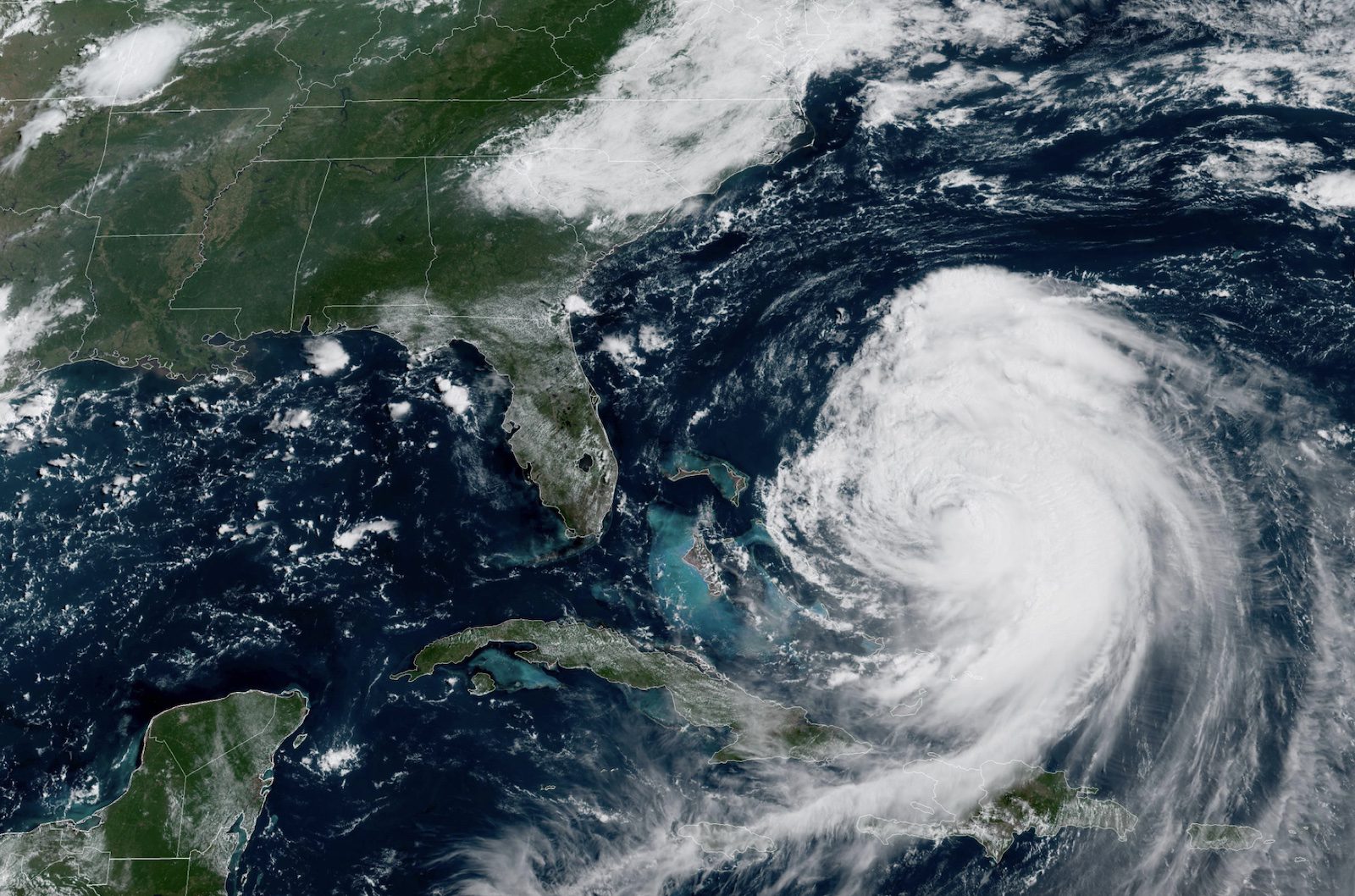
Hurricane Erin is generating dangerous sea conditions across the western Atlantic with forecasted significant wave heights reaching extreme levels as the storm moves between the U.S. East Coast and Bermuda....
A powerful weather system is set to explode off the U.S. West Coast, bringing with it hurricane-force winds and massive wave heights. The rapidly intensifying low-pressure system is expected to...
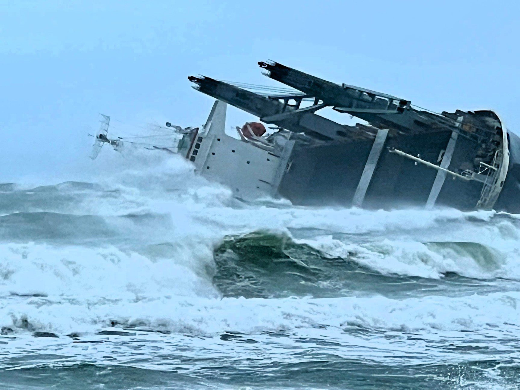
By Alex Longley and Paul Burkhardt (Bloomberg) –Ships sailing around the southern tip of Africa are wrestling with a bout of bad weather that has already run one vessel aground and...
July 13, 2024
Total Views: 9681
Get The Industry’s Go-To News
Subscribe to gCaptain Daily and stay informed with the latest global maritime and offshore news
— just like 105,985 professionals
Secure Your Spot
on the gCaptain Crew
Stay informed with the latest maritime and offshore news, delivered daily straight to your inbox
— trusted by our 105,985 members
Your Gateway to the Maritime World!
Essential news coupled with the finest maritime content sourced from across the globe.

 Join The Club