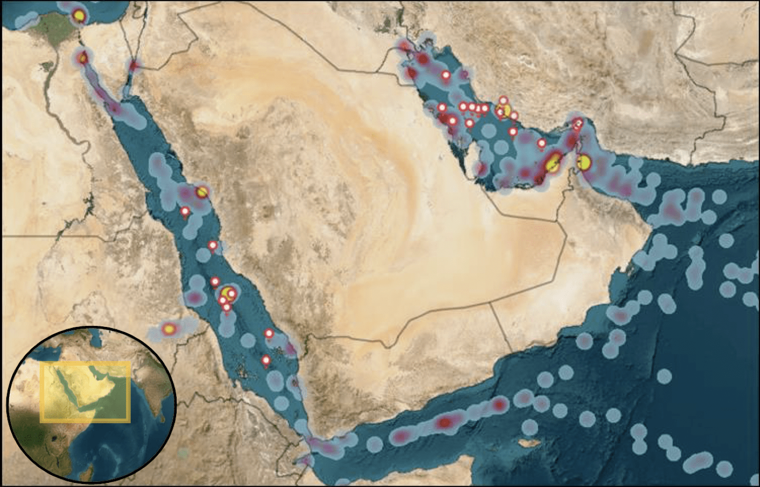
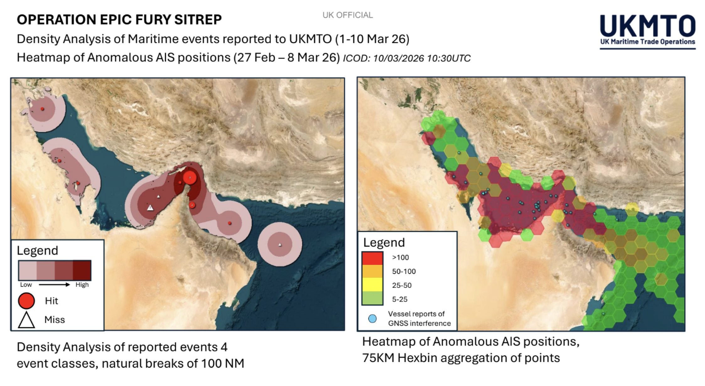
The UK Maritime Trade Operations (UKMTO) has reported a significant increase in GNSS interference from vessels operating in the Gulf region between October 3-7. The disruption, concentrated around Bandar-e-Pars, the Strait of Hormuz, and Port Sudan, has also led to widespread “AIS speed anomalies” throughout the Gulf, Port Sudan, and Suez Canal areas.
Qatar’s Ministry of Transport partially lifted an “unprecedented nationwide maritime navigation suspension” on Monday, now permitting daytime sailing for non-conventional vessels while maintaining nighttime restrictions. The decision follows a complete suspension imposed on October 4, which authorities described as “virtually unheard of.”
Despite the sweeping nature of Qatar’s original order, LNG carriers and other commercial vessels appeared to receive exemptions, with AIS data showing continued operations near Doha and Ras Laffan, according to analysis from Trident Risk Advisors.
Reports from users in Doha described location “drifts” toward Iran, fueling speculation about possible electronic interference or GPS spoofing activity in the region. This aligns with growing concerns about navigation security throughout the Persian Gulf.
The Joint Maritime Information Center (JMIC) had previously issued an advisory on May 19, encouraging vessels transiting the Red Sea and Strait of Hormuz to “continue vigilant watch-standing to include recognizing all GNSS interference” and recommending “not relying entirely on electronic navigation methods and/or autopilot, whilst transiting through areas prone to GNSS interference.”
GPS interference and spoofing have become persistent threats to shipping lanes from the Baltic Sea to the Persian Gulf, raising concerns about “hybrid disruptions” that could present genuine risks to international trade routes and energy supply chains.
Vessels operating within the UKMTO Voluntary Reporting Area experiencing disruptions to electronic navigation systems are strongly encouraged to report incidents, including photographs or videos of affected equipment.
Editorial Standards · Corrections · About gCaptain

 Join The Club