Original Photo Found HERE.
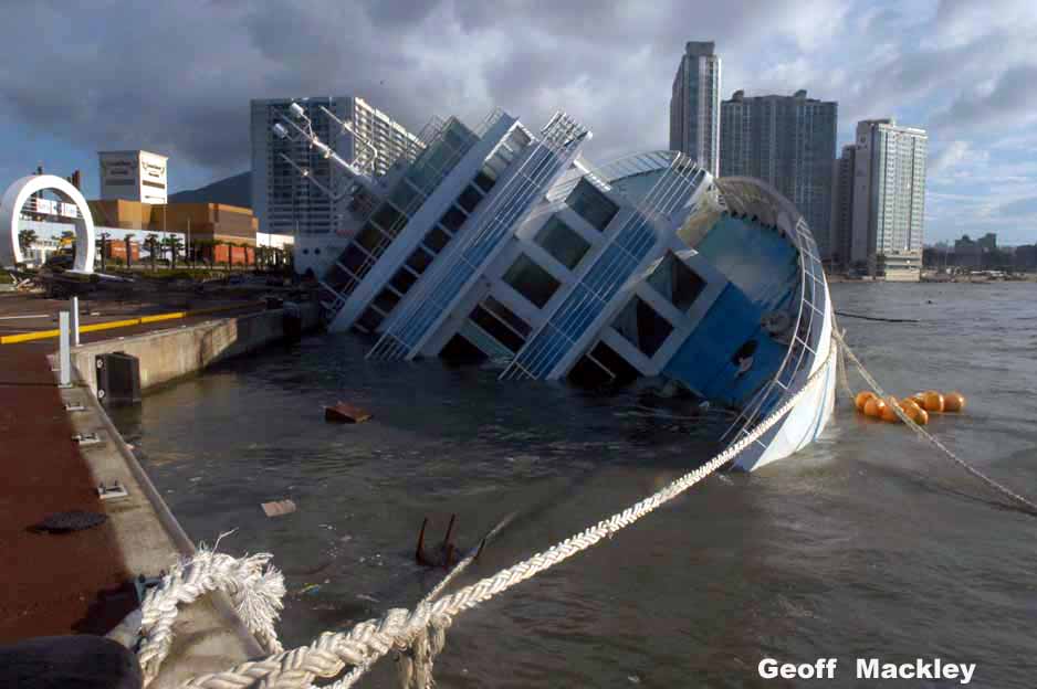
While this is a rather old story, it just came to our attention through one of our many vast searches on the internet. This photo of a cruise ship shaped hotel in the southern port city of Busan, South Korea. The cruise ship capsized against the dock in Typhoon Maemi in September of 2003. USAToday.com has the full story of the typhoon HERE, but the interesting thing is that capsized ship can still be seen on Google Maps.

Clike Map to Interact
While the incident, has since been cleaned up, it is an interesting find none-the-less.
A current picture of the map can be found at maps.live.com (shown below). For those of you that have never used maps.live.com, it has great arial photos that are updated regularly for most major cities. Probably its most notable and unique feature is the Birds Eye view that it provides that is, again, updated regularly for most major cities. It is really an interesting tool to play around with (WARNING: ADDICTING).

Here is an example of an image of maps.live.com’s Birds Eye view. Pictured is gCaptain headquarters.

Updated: February 5, 2026 (Originally published July 3, 2009)
Editorial Standards · Corrections · About gCaptain

 Join The Club