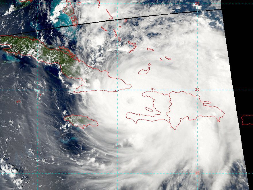
NOAA Satellite image Hurricane Matthew over the Windward Passage
Hurricane Matthew at 2100 UTC has weakened slightly to 120 knots maximum winds due to the interaction of nearby land. Hurricane force winds extend outward 40 NM while 50 knot or higher winds extend outward 50-60 NM. Gale force winds extend out about 150 NM to the southeast and 60 NM to the northwest.
Once Matthew moves into the Bahamas, the environment is favorable for the hurricane to maintain category 4 status for the next 2 days. Some weakening is likely beyond day 3 due to increasing wind sheer.
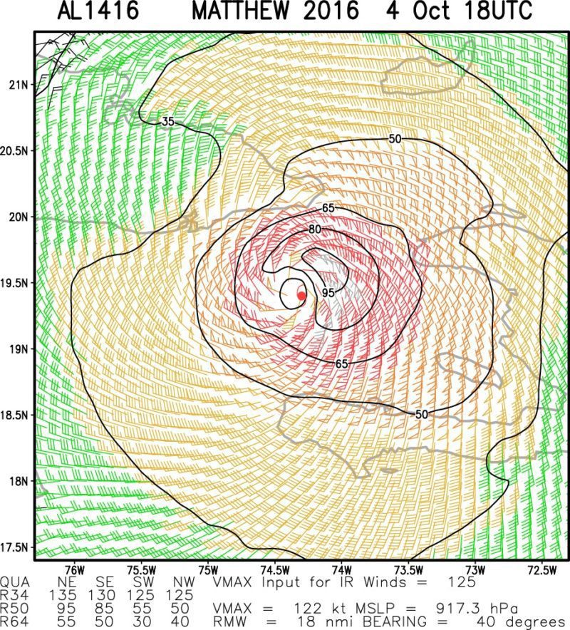
Estimated wind field via http://rammb.cira.colostate.edu/
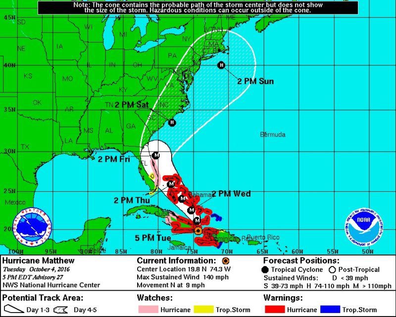
Matthew is moving towards the north at about 8 knots, however, most models show Matthew turning more towards the northwest as it moves across the Bahamas Tuesday and Wednesday then approaches the Florida East Coast during Thursday and Friday. Thereafter, a turn to the north then northeast should bring the center of Matthew near the SC/NC coasts on Saturday.
NOAA NHC Forecast Track
Matthew is likely to produce devastating impacts from storm surge, extreme winds, heavy rains, flash floods, and/or mudslides in portions of the warning areas in Haiti, Cuba, and the Bahamas.
Check out this amazing video showing a crew of NOAA Hurricane Hunters fly through the eye wall and into the eye of Hurricane Matthew aboard a WP-3D Orion aircraft. Credit: CAPT...
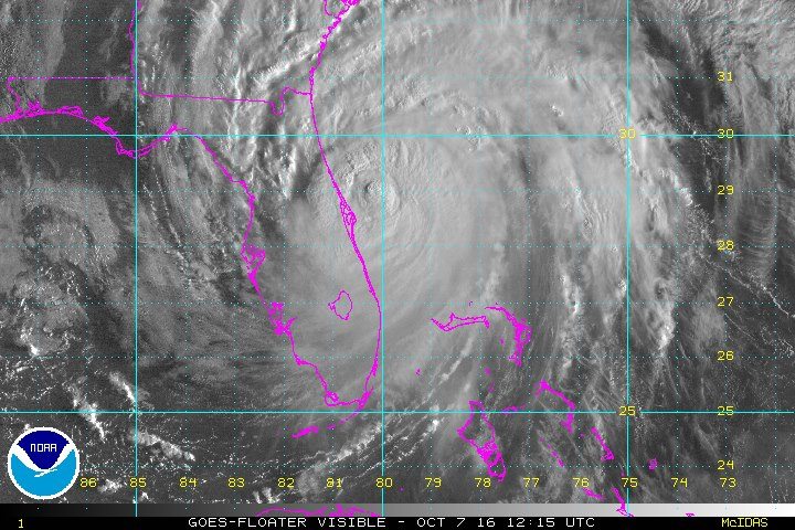
By Joseph Guyler Delva and Scott Malone CHANTAL, Haiti/COCOA BEACH, Fla., Oct 7 (Reuters) – Hurricane Matthew killed more than 800 people and left tens of thousands homeless in its...
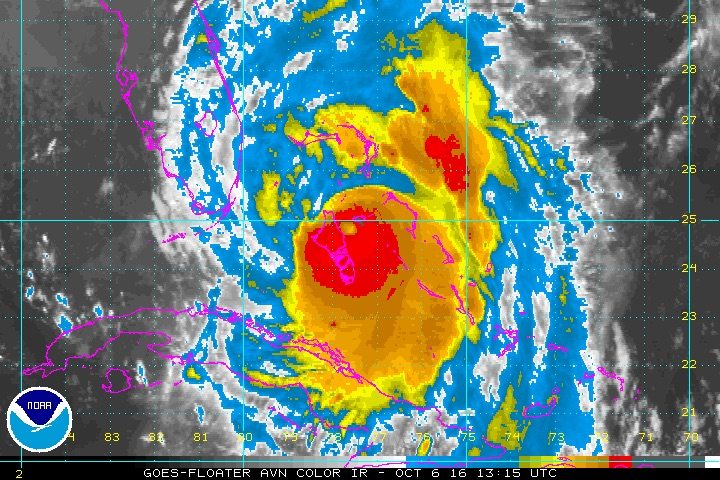
Hurricane Mathew at 11am EDT 1500 UTC is once again gaining strength with max winds now at 120 knots (about 140 mph). Environmental conditions appear favorable for additional intensification today...
October 6, 2016
Total Views: 32
Get The Industry’s Go-To News
Subscribe to gCaptain Daily and stay informed with the latest global maritime and offshore news
— just like 107,249 professionals
Secure Your Spot
on the gCaptain Crew
Stay informed with the latest maritime and offshore news, delivered daily straight to your inbox
— trusted by our 107,249 members
Your Gateway to the Maritime World!
Essential news coupled with the finest maritime content sourced from across the globe.

 Join The Club