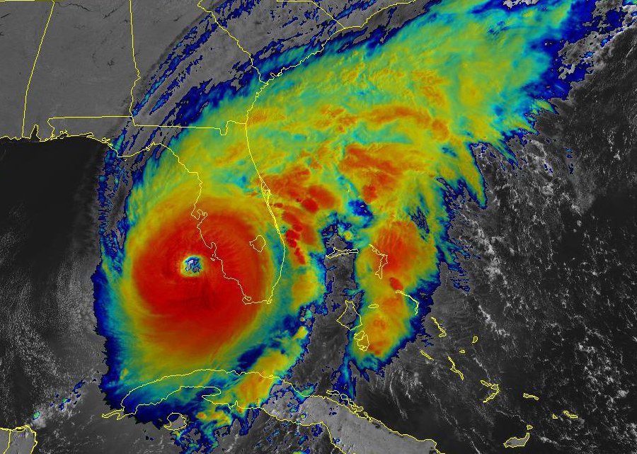
Hurricane Ian made landfall Thursday at approximately 3:05 p.m. EDT near the island of Cayo Costa, Florida as an extremely dangerous Category 4 hurricane with maximum sustained winds at 150 mph, according to the National Hurricane Center. It’s the fifth most-powerful storm to ever hit the U.S. mainland.
Data from an Air Force Reserve reconnaissance aircraft indicated the minimum central pressure was estimated at 940 mb at landfall.
A second landfall took place at 4:35 p.m. EDT just south of Punta Gorda near Pirate Harbor with sustained winds estimated 145 mph. The storm was continuing to move to the north-northeast at 9 mph.
Maximum winds before landfall were reported as high as 155 mph just off the Florida Peninsula.
Forecasts have been calling for powerful hurricane-force winds, catastrophic flooding and life-threatening storm surge.
Storm chasers and reporters have been on the ground tracking the storm and capturing incredible footage. Meteorologist Reed Timmer, one of the social media’s most popular chasers, has been getting after it per usual.
Josh Morgerman, a “field dude” for Weather Nation, has also been on the ground “getting raked” in Punta Gorda, Florida.
Here’s another look from near the eye wall.
Some major flooding has been reported in the Naples and Fort Meyers areas, among other places.
Here you can see how fast the storm moved in.
And how bad it got.
Meanwhile a shark was spotted on the flooded streets of Fort Myers. Believe it or not, this actually appears to be real.
Some yachts were also seen floating down the street.
I’m not sure if this yacht captain is a brave soul or incredibly stupid.
More experienced seamen aren’t taking any chances.
Hurricane hunter Nick Underwood said today’s flight into Ian was the worst he’s seen.
Power crews were on standby ready to get to work. I don’t know how many are without power but it has to be a lot.
Apparently someone left some high-rise cranes standing in Port Charlotte, which got hit really bad.
Just look at this monster.
Oh… and there were flamingos.
With the storm continuing to move inland, we’re just now getting a sense of the amount of destruction taking place. Heed the warnings, listen to officials, and donate time or money where you can.
Tags:
Updated: November 30, 2023 (Originally published September 28, 2022)
Editorial Standards · Corrections · About gCaptain

 Join The Club