Join The Club


Interesting
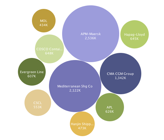
Container Shipping Companies – The Ten Largest Visualized
UDPATED: January 2012 The data visualization above represents the worlds 10 largest container shipping companies by TEU capacity. WORLD TEU CAPACITY: 15,899,687 For those who prefer more traditional data we...