A powerful and rapidly intensifying storm system over the North Atlantic is generating hurricane-force winds and enormous seas, prompting urgent warnings from U.S. forecasters for mariners operating in the region.
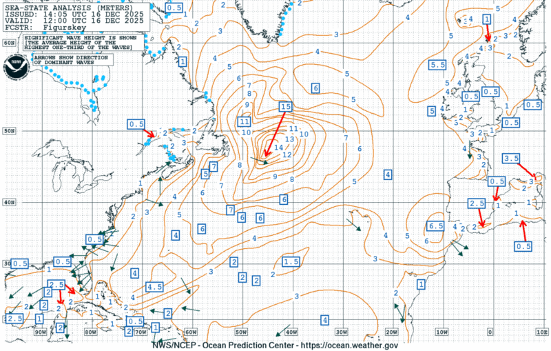
As of 1200 UTC December 16, the storm’s primary center was positioned near 52°N 43°W with an intense low pressure reading of 938 millibars, moving northeast at 30 knots. The system is producing winds reaching 60 to 80 knots within a large radius around the center, with seas building to 15 meters—approximately 49 feet.
The system is already responsible for approximately 45 containers lost overboard from a ONE containership, forcing the vessel to Las Palmas in the Canary Islands.
The National Weather Service Ocean Prediction Center in Washington has issued a hurricane force wind warning for the affected region. “Between 60 NM and 300 NM SE and 360 NM S quadrants and between 90 NM and 240 NM W quadrant winds 60 to 80 KT. Seas 9 to 15 M,” the warning states.
A hurricane-force low pressure rapidly intensified across the Atlantic over the past couple of days; time series of GOES-E RGB air mass images taken from Dec 15 18z (963 mb), Dec 16 00z (949 mb), Dec 16 06z (939 mb), and Dec 16 12z (938 mb). pic.twitter.com/MQqAmzKYJJ
Storm-force winds between 45 and 60 knots are affecting a broader area from 43°N to 53°N, east of 50°W, with seas reaching 12 meters or roughly 39 feet.Additional gale-force conditions extend across much of the Gulf of Saint Lawrence and surrounding waters.
Forecasters expect the system to continue moving northeast and only slowly weaken over the next 24 hours.By December 17, the complex low is predicted to split into two centers—one east of the area near 60°N 29°W at 942 millibars and a new second center at 58°N 39°W with 950 millibars.
Sea State Analysis. Updated: Tue, 16-Dec-2025 14:06:42 UTC
The Ocean Prediction Center has also issued heavy freezing spray warnings for vessels operating in the region. Moderate to heavy freezing spray conditions are expected within the Gulf of Saint Lawrence and along portions of the Canadian coast, with light to moderate freezing spray extending across a wider area including waters off Greenland.
Dense fog is creating additional hazards, with visibility occasionally dropping below one nautical mile from 45°N to 56°N east of 60°W and north of 60°N between the west Greenland coast and 63°W.
The forecast notes that “individual waves may be more than twice the significant wave height,” underscoring the extreme danger to vessels caught in the storm’s path.
This intense winter storm highlights what forecasters are calling “the other hurricane season”—the period when extratropical cyclones over the North Atlantic can rival tropical systems in their intensity and destructive power.
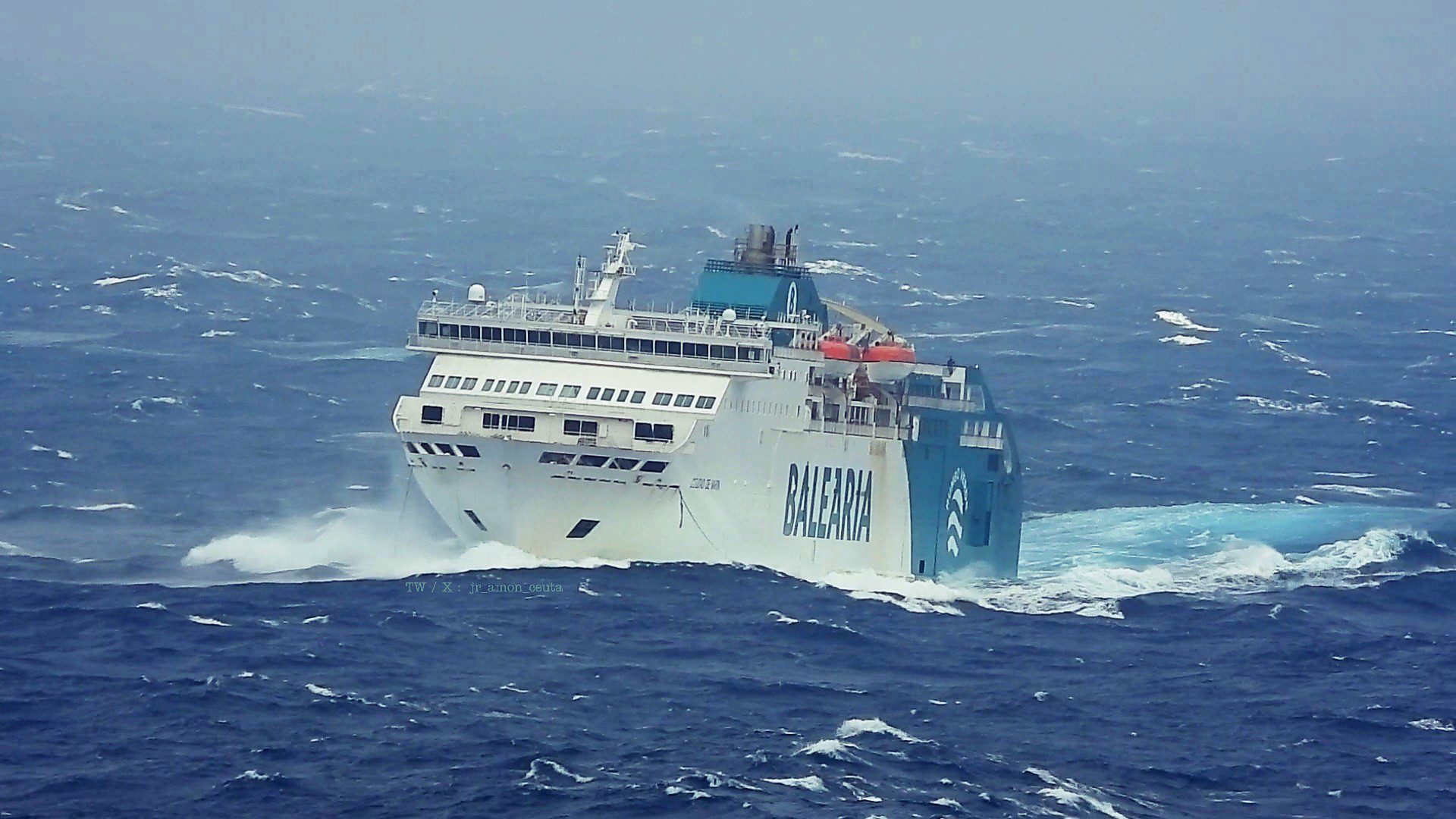
A Balearia ferry struggled through severe weather conditions over the weekend while attempting to cross the Strait of Gibraltar, ultimately abandoning its journey and returning passengers to port after several...
By Danielle Bochove Jul 24, 2025 (Bloomberg) –The world’s oceans experienced a staggering amount of warming in 2023, as vast marine heat waves affected 96% of their surface, breaking records for intensity, longevity...
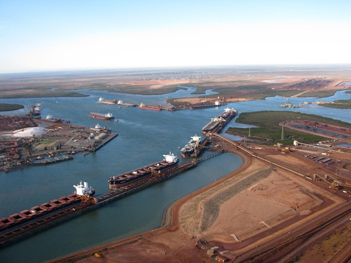
Severe Cyclone Zelia has made landfall near Australia’s iron ore export hub, bringing heavy rainfall and damaging wind gusts, with the system threatening big mines and crucial rail links as it tracks inland.
February 14, 2025
Total Views: 488
Get The Industry’s Go-To News
Subscribe to gCaptain Daily and stay informed with the latest global maritime and offshore news
— just like 107,272 professionals
Secure Your Spot
on the gCaptain Crew
Stay informed with the latest maritime and offshore news, delivered daily straight to your inbox
— trusted by our 107,272 members
Your Gateway to the Maritime World!
Essential news coupled with the finest maritime content sourced from across the globe.

 Join The Club