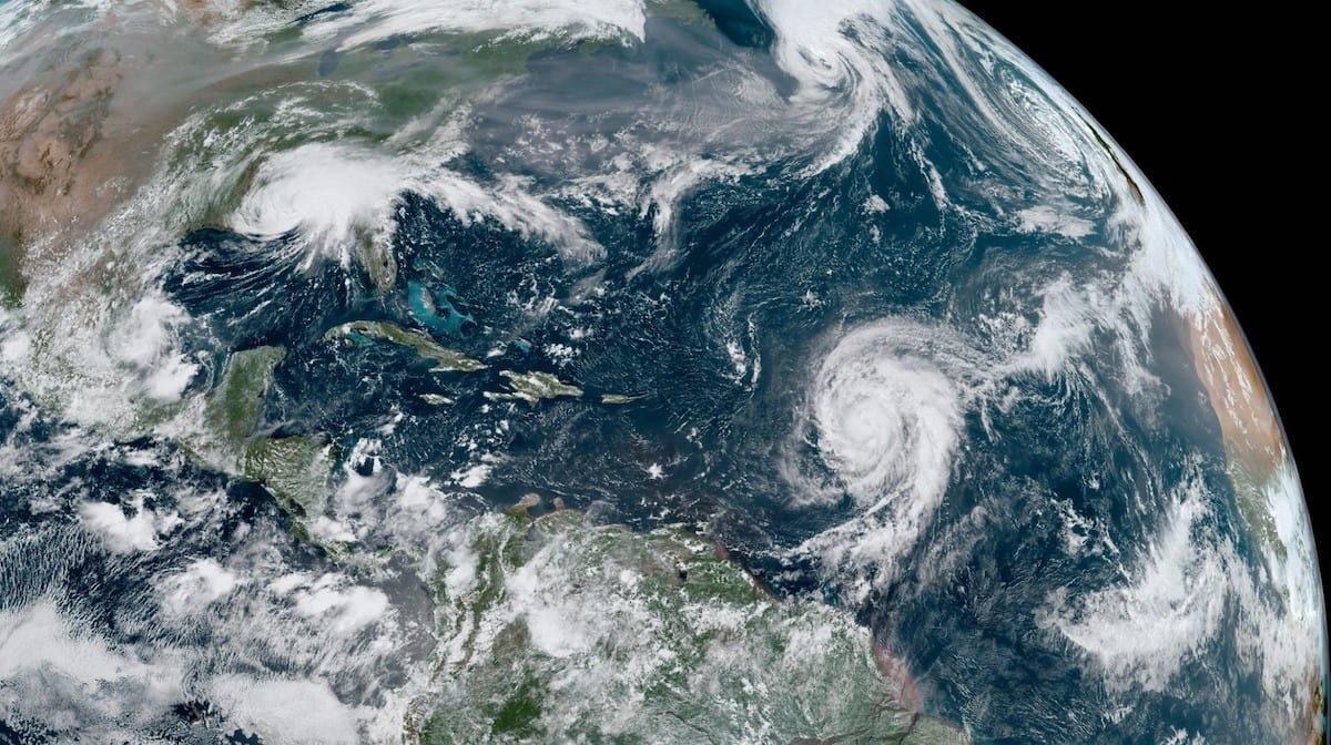
GOES 16 full disk image of hurricanes Katia, Irma and Jose captured September 8, 2017. Photo: NOAA
By Brian K. Sullivan (Bloomberg) — The Atlantic hurricane season may have gotten off to an early start this year, but it’ll probably end with a whimper — at least when it comes to the total number of storms.
Twelve named storms are likely to form in 2018, fewer than last year’s 17 and below the 1981-2010 average, according to a forecast Thursday from Colorado State University. That reduces the chance of Gulf of Mexico disruptions for energy and agriculture. But the outlook is a slight increase from July’s 11 and comes as the Atlantic Basin is about to enter its most active period.
While the forecast predicts the number of storms, it can’t tell where individual ones will strike. Even a season with few tropical storms can cause major damage, such as in 1992 when Hurricane Andrew devastated Florida and was one of only six named that year. A storm gets a name when its sustained winds reach tropical-storm strength of 39 miles (63 kilometers) per hour.
“With all of our seasonal forecasts, we can still have a nasty hurricane,” Phil Klotzbach, who co-authored the Colorado State report with Michael Bell, said in an interview. “People still need to prepare for every hurricane season regardless of our seasonal forecasts.”
Three storms have formed in the Atlantic so far this year. Two — Beryl and Chris — became hurricanes. Typically, the third named storm doesn’t form until Aug. 13, and the second hurricane doesn’t appear until Aug. 28, according to 1966-2009 averages compiled by the National Hurricane Center in Miami. So only nine more are likely to appear before the season ends Nov. 30, with three becoming hurricanes and one a major system with winds of 111 mph or more.
Early Activity
Despite the early burst of activity — Subtropical Storm Alberto formed before the official June 1 start to the season — the Atlantic waters have been cooler than normal, robbing potential storms of the fuel they need to develop. Tropical storms and hurricanes depend on warm water. In addition, there have been several large swirls of dry African air that have kept the atmosphere across the Atlantic stable and can prevent thunderstorms from building.
The cold water shows no sign of abating, Klotzbach said. And if El Nino forms in the Pacific, that could increase wind shear across the Atlantic, making it even harder for storms to form. Shear can rip storms apart.
“The tropical Atlantic remains cooler than normal, and there is a relatively high potential that a weak El Nino develops in the next several months,” according to the report. “The probability for major hurricanes making landfall along the U.S. coastline and in the Caribbean is below normal due to the forecast for a below-normal season.”
Peak Season
But the most active time in the Atlantic season is around the corner. It starts Aug. 20 and peaks around Sept. 10. During this time, storms typically form in the ocean between the Caribbean and Cabo Verde off the coast of Africa — an area called the main development region, where the bulk of history’s most ferocious hurricanes were born.
Last year, the U.S. was hit by three Category 4 storms that virtually destroyed Puerto Rico’s electric grid, flooded Texas with record rains and ripped Florida, sending the sea into the streets of Miami. The number of deaths is still uncertain and the storms racked up losses totaling more than $200 billion, the most ever.
Atlantic storms are closely watched by energy and agricultural traders because of the potential for supply disruptions and demand destruction. Almost 20 percent of America’s oil comes from the storm-exposed Gulf of Mexico, based on Energy Information Administration data. The hurricane-vulnerable coastline also accounts for 45 percent of U.S. oil refining capacity and more than half of natural-gas processing capacity.
On the agricultural side, Florida — the world’s second-largest producer of orange juice — is particularly vulnerable to Atlantic storms. But there’s one bright spot for farmers: The remnants of these tropical systems could bring much-needed rain to crops in the Great Plains and Midwest.
© 2018 Bloomberg L.P
Editorial Standards · Corrections · About gCaptain
This article contains reporting from Bloomberg, published under license.

 Join The Club


