Photo of AIS satellite by The Danish Maritime AuthorityThe maritime potential for growth in the Arctic regions as a consequence of, inter alia, the melting of the ice and increased commercial navigation in Arctic waters requires enhanced focus on safety of navigation. The growth plan for the Blue Denmark states that the Government will introduce a pilot project on satellite based AIS monitoring of ship traffic in Arctic waters. On Monday 25 February 2013, a satellite will be launched in collaboration between the Danish Maritime Authority and the University of Aalborg.
Today, all large ships are fitted with AIS (Automatic Identification System) equipment procuring information about other ships’ routes, course, speed, etc. It is the expectation that satellite based data can secure more high-quality information from ships in Arctic regions. At the same time, it could also become less expensive to quality assure the data in the longer term.
”There is no doubt that there are great possibilities of enhancing safety of navigation in Arctic regions by means of AIS data”, says Deputy Director-General of the Danish Maritime Authority Francis Zachariae.”We have chosen to collaborate with the University of Aalborg because we would like to strengthen the development of satellite based AIS data.”
A number of tests have already been made with satellite based data. With the launching of the satellite, the University of Aalborg and the Danish Maritime Authority take the next step in the development efforts.
Facts:
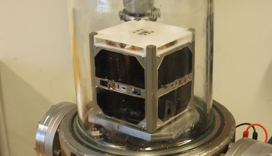
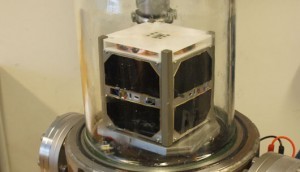
• The satellite has been constructed by a group of students from the University of Aalborg.
• The satellite as such measures only 10x10x10 cm and weighs less than 1 kg.
• It will be launched into space by means of a rocket sent up from Chennai in India by the Indian Space Research Organisation (ISRO).
• It is expected that the satellite will be launched on Monday 25 February 2013 at 13.22 Danish time.
Danderyd, Sweden – True Heading, leading manufacturer of Automatic Identification System (AIS) solutions, GPS compasses and app navigation, announced today that it has supplied an AIS Aid to Navigation (ATON)...
Kyushu University has announced that it has established a new Department of Ocean Energy Resources with support from Tokyo-based classification society ClassNK. This new department will join the Graduate Faculty...
exactEarth has teamed up with the Marine Exchange of Alaska (MXAK) to form the Alaska vessel tracking alliance which is built on the MXAK PacTracs product offering. PacTracs is a...
July 2, 2013
Total Views: 115
Get The Industry’s Go-To News
Subscribe to gCaptain Daily and stay informed with the latest global maritime and offshore news
— just like 105,296 professionals
Secure Your Spot
on the gCaptain Crew
Stay informed with the latest maritime and offshore news, delivered daily straight to your inbox
— trusted by our 105,296 members
Your Gateway to the Maritime World!
Essential news coupled with the finest maritime content sourced from across the globe.

 Join The Club