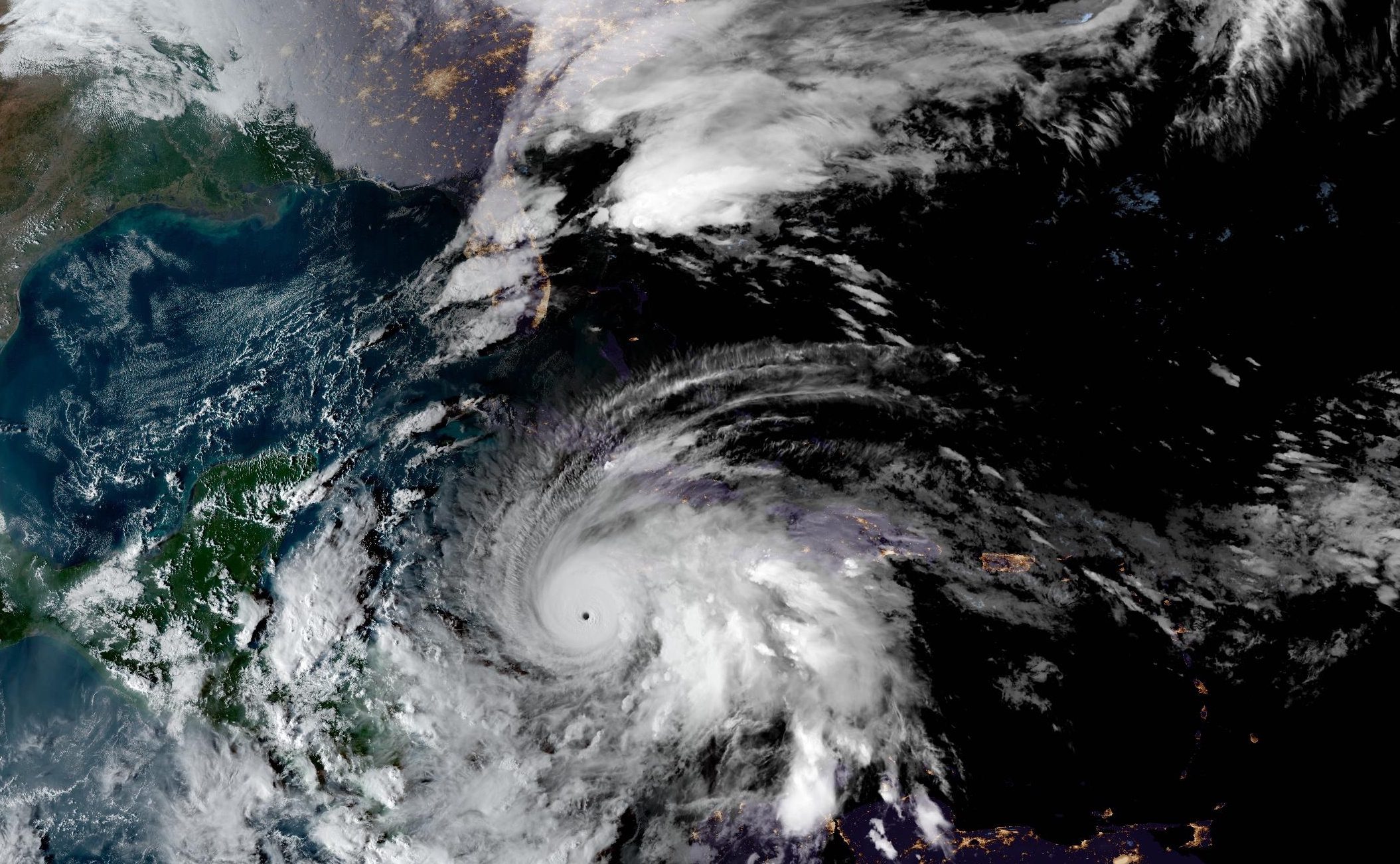
Hurricane Melissa intensified to a Category 5 storm with maximum sustained winds of 175 mph as of Monday evening, positioning the extremely dangerous cyclone approximately 140 miles southwest of Kingston, Jamaica, according to the National Hurricane Center’s 5 PM EDT advisory.
The hurricane’s central pressure has fallen to 906 millibars, among the lowest pressures ever recorded in an Atlantic hurricane. Air Force Reserve Hurricane Hunter aircraft measured flight-level winds of 161 knots and surface winds supporting estimates of 155 knots in the northeastern eyewall.
NHC forecasters warned that “catastrophic and life-threatening winds, flooding, and storm surge” are expected on Jamaica tonight and early Tuesday. The agency stated that “tropical storm conditions are occurring in Jamaica, and catastrophic and life-threatening hurricane-force wind conditions are expected to begin tonight and continue into Tuesday.”
The forecast discussion emphasized that “even with an eyewall replacement cycle it is unlikely that Melissa will weaken significantly before reaching Jamaica, and there is no practical difference in Melissa making landfall at category 4 or 5 intensity, since both categories produce catastrophic wind damage.”
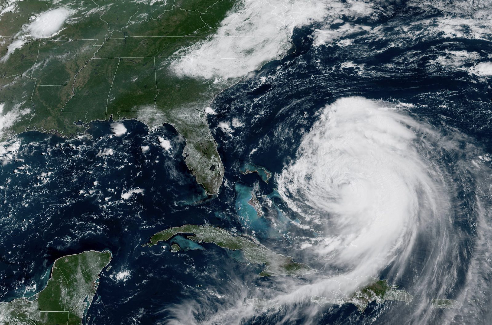
Hurricane warnings are in effect for Jamaica, Cuban provinces of Granma, Santiago de Cuba, Guantanamo, and Holguin, as well as the Southeastern and Central Bahamas.Tropical storm warnings cover Haiti, the Cuban province of Las Tunas, and the Turks and Caicos Islands.
Rainfall totals of 15 to 30 inches are expected across portions of Jamaica, with localized storm totals potentially reaching 40 inches. The NHC warned that “catastrophic flash flooding and numerous landslides are likely.”
Storm surge along Jamaica’s south coast could reach 9 to 13 feet above ground level near and east of where the center makes landfall, accompanied by large and destructive waves. Eastern Cuba faces potential surge heights of 7 to 11 feet above normal tide levels late Tuesday or Wednesday.
As of Monday afternoon, Melissa was moving northwest at 3 mph but is expected to turn northward Monday evening, then northeastward on Tuesday with increasing forward speed. The forecast track projects the core moving near or over Jamaica late tonight and Tuesday, across southeastern Cuba Tuesday night, and across the southeastern or central Bahamas on Wednesday.
The system could reach the vicinity of Bermuda by Thursday night and is expected to transition to an extratropical cyclone over the north Atlantic.
Hurricane-force winds currently extend outward up to 30 miles from the center, while tropical-storm-force winds extend outward up to 195 miles.The next complete advisory is scheduled for 11 PM EDT.
Editorial Standards · Corrections · About gCaptain

 Join The Club