Foreign Minister of El Salvador Jaime Miranda (L) talks with Jose Salvador Alvarenga as the latter arrives at Comalapa airport in San Luis Talpa on the outskirts of San Salvador February 11, 2014. REUTERS/Jorge Cabrera
By Surfline/Buoyweather Chief Meteorologist Mark Willis
By now you have likely seen the media coverage of Jose Salvador’s story. If not, Jose is the famous shark fisherman that washed up on the shores of the Marshall Islands just days ago. It is estimated that he spent the last ~13 months at sea, but we don’t know for sure. When the Buoyweather meteorology team heard the news that Jose encountered strong north winds that blew him off course after departing from Paredon Viejo (within the Gulf of Tehuantepec), we immediately thought of one thing: The infamous “Tehuantepecer”.
What is a “Tehuantepecer”?
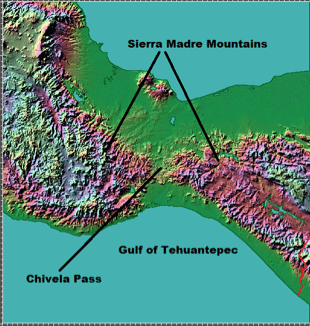
Topography of the Isthmus of Tehuantepec showing the Chivela Pass, Sierra Madre Mountains, and the Gulf of Tehuantepec. Image courtesy of John Hopkins Applied Physics Laboratory
Simply put, a “Tehuantepecer” is one of the most amazing displays of wind in the world. The term is used to describe a phenomenon that brings a narrow area of strong northerly winds to the Gulf of Tehuantepec. These wind events occur when cold fronts from the Gulf of Mexico allow northerly winds to funnel through the 40-km wide Chivela Pass, a narrow gap in the Sierra Madre Mountains in southeastern Mexico.
The “gap flow” associated with a Tehuantepecer typically produces around 12 gale force (greater than or equal to 34kts) wind events in the Gulf of Tehuantepec each cold season, most of which occur between November and March. In addition, there are typically around 6 storm force (greater than or equal to 50kts) events each year (Brennan et al., 2010).
Archived Weather Charts during the Dates in Question
Every meteorologist loves looking at chart archives during past weather events, especially when they start getting media attention like this situation. So, we decided to take a gander at Buoyweather’s historical chart archives during the two time frames that continue to be quoted in the media in reference to when the fishermen went missing: November 17-19, 2012 or December 21, 2012.
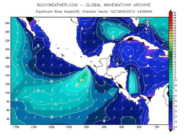
November 17-19, 2012: “Tehuantepecer 1”
Buoyweather.com historical wave height chart for November 19, 2012 showing an area of 10-15ft seas in the Gulf of Tehuantepec.
Our archives suggest that a low end “Tehuantepecer” event occurred during this time. A strong area of high pressure that built south from the eastern half of the United States and through the Gulf of Mexico led to a narrow area of 25-35kt N winds through the Gulf of Tehuantepec during November 17-19, 2012. This was also confirmed by ASCAT satellite observed winds. Buoyweather wave data suggests that the N winds produced very short period, steep waves in the 10-15ft range during this time. In addition, a Gale Warning (issued by the National Hurricane Center’s Tropical Analysis and Forecast Branch or NHC TAFB) was in effect for this area during this time.
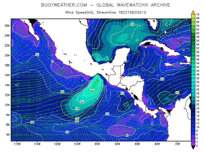
December 21, 2012: “Tehuantepecer 2”
Buoyweather.com historical wind speed and streamline chart from December 21, 2012 showing an area of 35-50kt N winds through the Gulf of Tehuantepec.
Archived weather charts during the second date of interest (December 21, 2012) revealed an even stronger “Tehuantepecer” event. This event was associated with a strong area of high pressure (~1033mb) that built over South Texas behind a cold front that pushed through the Gulf of Mexico. The further south position of the post-frontal high-pressure system was key in making this event stronger than “Tehuantepecer 1” in November. While satellite observations were not readily available in this region on the 21st, Buoyweather chart archives suggested that an area of strong gale to low end storm force winds (40-50kt) were blowing through the Gulf of Tehuantepec during this time. In addition, NHC TAFB had a Storm Warning in effect on the 21st.
Did a “Tehuantepecer” lead to Jose Salvador’s Mayday?
Well, we don’t know for sure and we may never know the answer to that question. However, we are fairly confident that there were potentially very dangerous “Tehuantepecer” North wind events that occurred on both November 17-19, 2012 and December 21, 2012. These events are enough to impact any mariner, especially the storm force event on the 21st.
Tags:
Updated: February 19, 2014 (Originally published February 11, 2014)
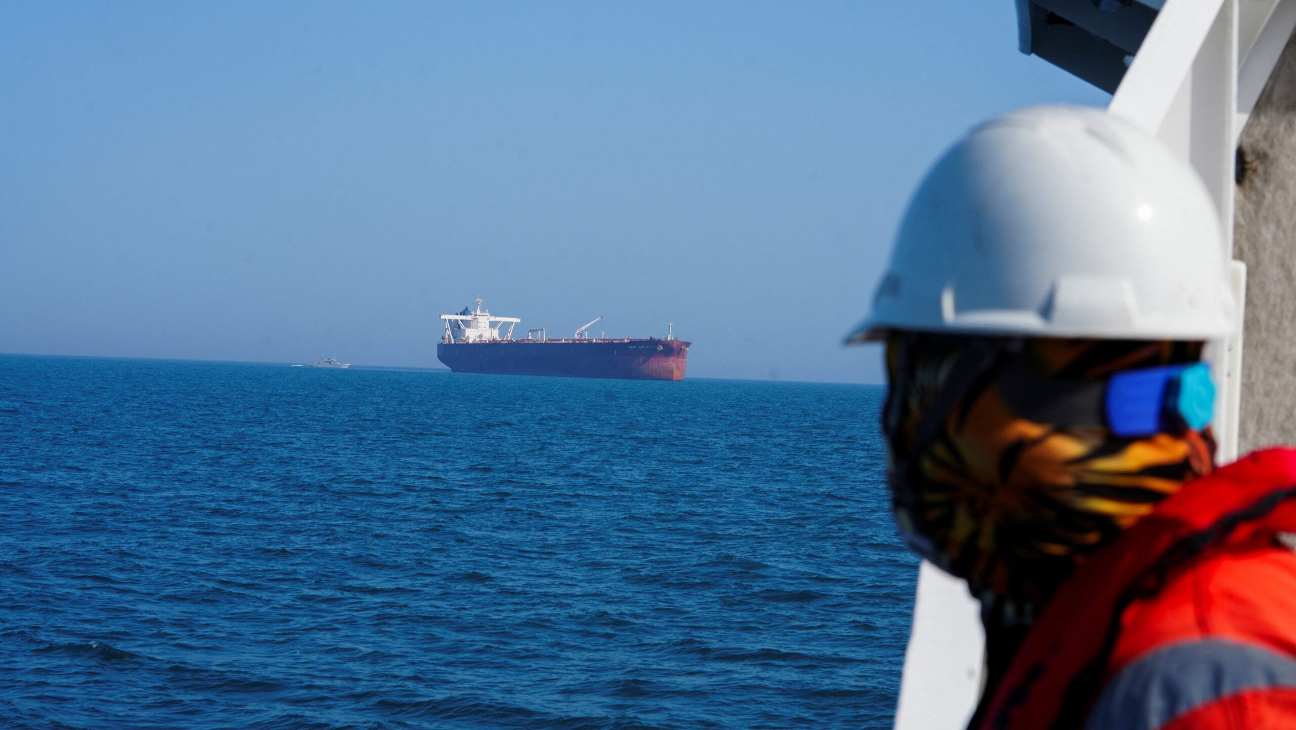
American forces have counted nearly 1,000 commercial vessel transits in and out of the Strait of Hormuz in the last two months, according to an official familiar with US Central Command operations, a figure that’s higher than private sector estimates that rely mostly on ship transponders.
The Trump administration on Friday imposed a new round of sanctions targeting an international network accused of smuggling Iranian liquefied petroleum gas (LPG) and laundering revenue through shadow banking channels,...
At nearly 40 years old, Lars Jensen’s Volkswagen camper van appeals to him mostly for its lack of modern features. The vehicle he calls “Sally” is just the right rig to drive around Africa over the next 18 months to explore the world’s most promising supply chain frontier.
June 5, 2026
Total Views: 725
Get The Industry’s Go-To News
Subscribe to gCaptain Daily and stay informed with the latest global maritime and offshore news
— just like 105,296 professionals
Secure Your Spot
on the gCaptain Crew
Stay informed with the latest maritime and offshore news, delivered daily straight to your inbox
— trusted by our 105,296 members
Your Gateway to the Maritime World!
Essential news coupled with the finest maritime content sourced from across the globe.

 Join The Club


