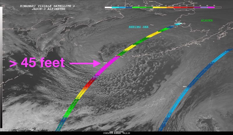
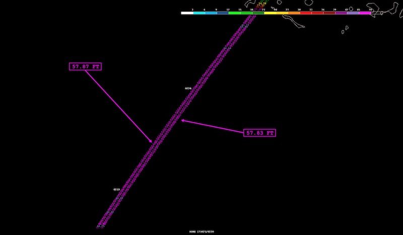
Significant wave height values detected by the altimeter instrument flying aboard Jason-3. The pass detected a nearly 400 nm long swath of phenomenal seas greater than 45 feet, with highest embedded significant wave height values to 57.8 feet (17.6 meters)!
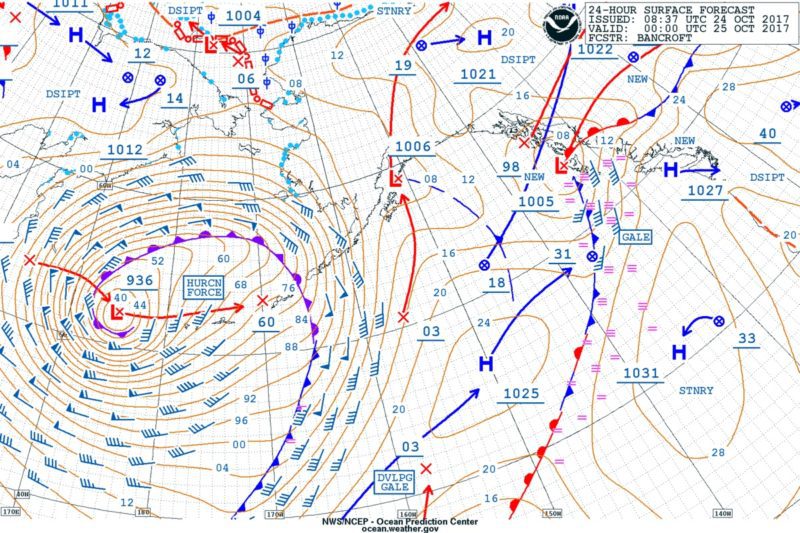
A hurricane-force low-pressure system in the northwestern Pacific Ocean is living up to the hype, generating massive heights measured at over 57 feet!
Following up on forecasts calling for 55 ft. (17 m) wave heights, the National Weather Service’s Ocean Predication Center reported Wednesday that satellite altimeter readings have shown actual significant wave heights of greater than 45 feet over an enormous 400 nm swath of ocean, with the highest wave height recorded at 57.87 feet (that’s 17.6 meters!).
“While this is certainly not an everyday storm, it is worth mentioning we do see these kind of extreme significant wave height values (primarily measured by altimeter instruments, but occasionally by buoys) a few times per season over both the N Pacific and N Atlantic basins,” the NWS said in its update on Wednesday.
Remember, significant wave height is the average height of the highest one-third of waves, so individual wave heights are likely much taller. The highest significant wave height ever recorded was 19 meters(62.3 feet!), as measured by a buoy in the North Atlantic in 2013. A committee of the World Meteorological Organization confirmed the new world record last year.
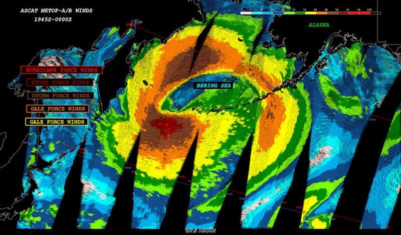
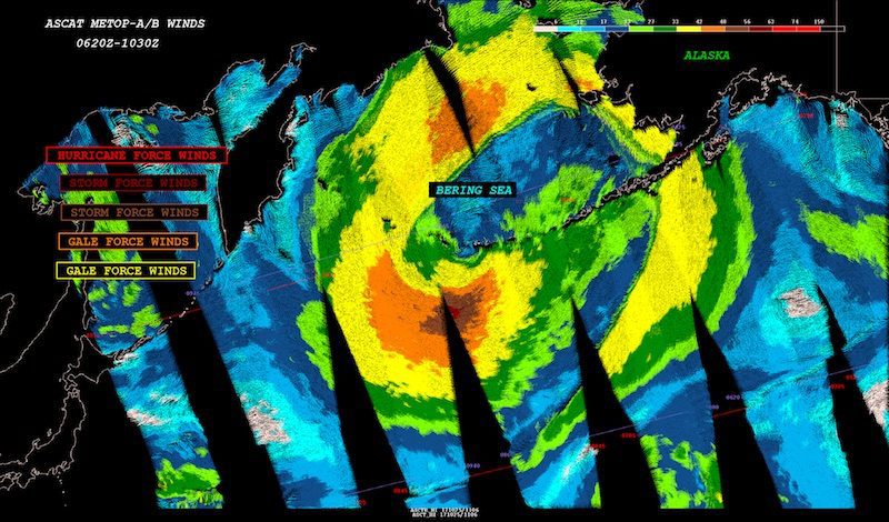
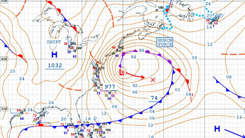
Instruments flying aboard the Jason-3 satellite also ‘measure’ ocean surface wind speed and direction. The two ASCAT images below help illustrate the sprawling size, intensity, structure, and movement of the hurricane force low, located in the NW Pacific Ocean and the Bering Sea.
“This system developed as a rapidly intensifying extratropical cyclone over the past few days, and was enhanced by the absorption of post-tropical cyclone Lan,” the NWS said on Tuesday.
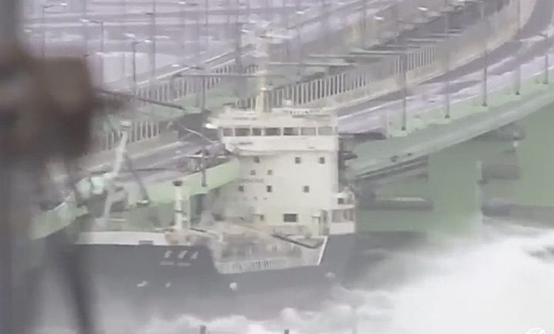
A tanker smashed into the bridge linking Japan’s Kansai International Airport with the mainland on Tuesday as a powerful typhoon slammed Japan’s western coast. The tanker, named Houn Maru, was...
Check out this a new time-lapse video released by NOAA showing the four back-to-back nor’easter winter storms that impacted the U.S. East Coast in March 2018. The video was captured...
Lee Chesneau is a senior marine meteorologist, lecturer, & a graduate from the University of Wisconsin (Madison). Lee has had a distinguished career with NOAA’s National Weather Service (NWS), NOAA...
March 7, 2018
Total Views: 153
Get The Industry’s Go-To News
Subscribe to gCaptain Daily and stay informed with the latest global maritime and offshore news
— just like 107,344 professionals
Secure Your Spot
on the gCaptain Crew
Stay informed with the latest maritime and offshore news, delivered daily straight to your inbox
— trusted by our 107,344 members
Your Gateway to the Maritime World!
Essential news coupled with the finest maritime content sourced from across the globe.

 Join The Club