With the 100 year Anniversary of the sinking of the RMS Titanic upon us, there is no shortage of “Remembering the Titanic” blog posts, galleries, movies and even reenactments to help you get your 100-year fix of the Titanic tragedy. gCaptain, of course, is no different… and lucky for us neither is Google!
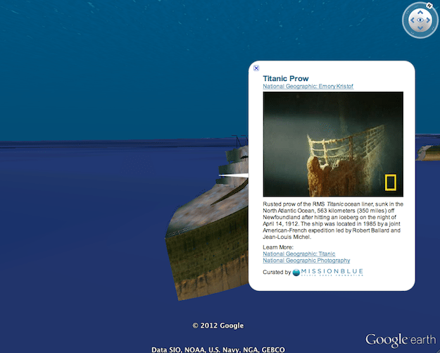
Using data from National Geographic and NOAA, Google has released an updated 3D-Model of the infamous shipwreck as it rests on the bottom of the North Atlantic in Google Earth. Included in the update is a fully interactive tour of the ship included with photos, video and descriptions of the wreck site in true Google Earth fashion.
Fom your Google Earth search bar, just search “titanic” and get started the tour.
Not sure how to use the tour function? Kurt’s Weblog has you covered. For those of you that don’t have access to Google Earth right now, start off by watching this video.
The Google Earth Titanic project was created in partnership with National Geographic, the Institute for Exploration, the Center for Ocean Exploration at the University of Rhode Island and Jim Delgado at the National Oceanographic and Atmospheric Administration (NOAA)’s Office of Exploration and Research.
Cheers to everyone that is making this year’s anniversary of the Titanic sinking so memorable.
What is the definition of misery? Answer: Seasickness One of the first questions I get asked when a landlubber finds out I work at sea is, “Do you get seasick?” In...
Containerization is the reason we have a thriving global marketplace, but where did it all begin? The idea of it was actually conjured up on a busy dock in Hoboken,...
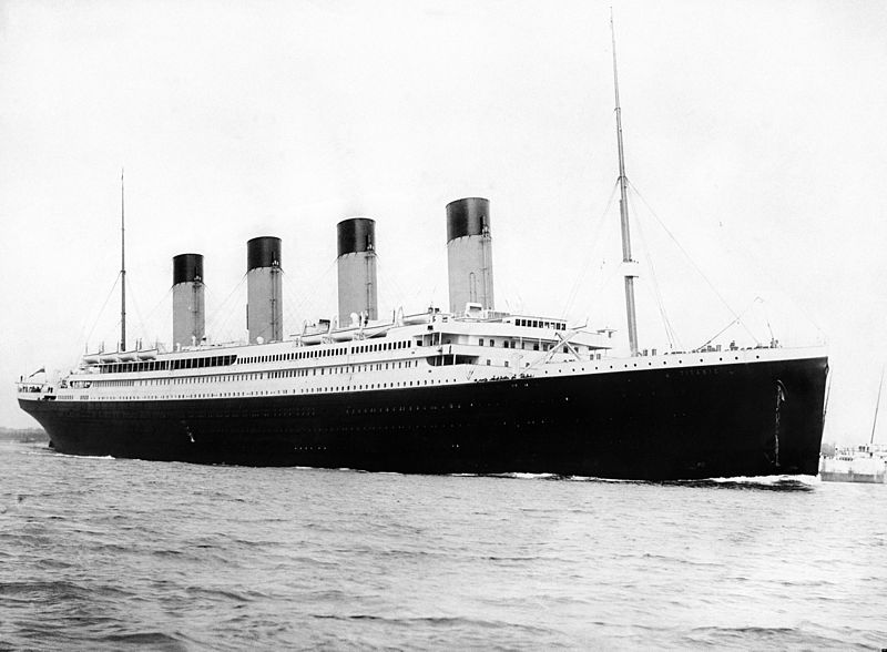
When the RMS Titanic was constructed it was considered a marvel of modern engineering. So how did the supposedly unsinkable ship sink within hours of hitting an iceberg during its...
January 3, 2017
Total Views: 275
Get The Industry’s Go-To News
Subscribe to gCaptain Daily and stay informed with the latest global maritime and offshore news
— just like 105,332 professionals
Secure Your Spot
on the gCaptain Crew
Stay informed with the latest maritime and offshore news, delivered daily straight to your inbox
— trusted by our 105,332 members
Your Gateway to the Maritime World!
Essential news coupled with the finest maritime content sourced from across the globe.

 Join The Club