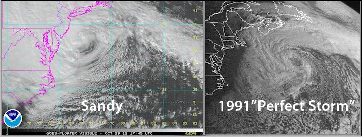
“Sandy”, left, approaching landfall Monday afternoon 29 October. “Perfect Storm” right, at 12 UTC October 30 1991
With the center of Hurricane Sandy approaching the East Coast, many are reminded of the October 1991 storm that would eventually become known as “The Perfect Storm” and immortalized in the best selling book and movie of the same name.
For days, forecasters have been comparing the two storms, but now it seems like “Sandy” is telling a story all its own. Here’s a comparison of wave conditions collected offshore Delaware today.
NOAA buoy 44009. Sandy is shown in red while the “Perfect Storm” is in blue. (x-axis=Days since 10/23, y-axis=wave height in meters). Click for high-res
Granted, the path of the “1991 Perfect Storm” and “Sandy” are slightly different and therefore a comparison of a single buoy off the coast of Delaware is not exactly comparing apple to apples, but check out these numbers below.
1991 “Perfect Storm” Wave Heights
On October 30, 1991, a buoy located 425 km (264 mi) south-southeast of Halifax reported a peak wave height of 30.5 m, or 100 ft., representing the highest wave height ever measured on the Scotian Shelf. Further south, a buoy located East of Cape Cod reported maximum sustained winds of 56 mph with gusts to 75 mph, and a significant wave height (meaning the average height of the highest waves) of 39 feet, or 12 meters, on October 30, 1991.
Sandy Wave Heights
Oct 29, 2012 21Z wind/wave analysis has indicated 47 ft sea heights (again meaning the average height of the highest waves) associated with Hurricane Sandy. The storm is now even being declared the Atlantic’s Ocean’s biggest-ever tropical storm.
As of 2PM EDT Sandy was near 38.3N/73.1W and was accelerating towards the northwest at 24 knots (27mph) with max winds of 80 knots (90mph) and a minimum pressure of 940MB. Sandy deepened earlier today as it moved across the northern limit of the Gulf Stream and since has started to accelerate towards the northwest and will likely make landfall near Atlantic City, NJ late this afternoon or early this evening.
Hurricane force winds extend out about 160NM to the southwest while gale force winds extend out up to 420NM from the center. Gale force winds were already occurring from southern New England across Long Island Sound and Long Island southward along the coasts of NJ, Delaware, eastern Virginia including the Delaware and Chesapeake Bays. Hurricane force winds could reach portions of the Middle Atlantic states including New York City and Long Island by late this afternoon. NOAA OPC wave analysis indicted waves associated with Sandy of up to 43 feet.
Here’s a photo of a wave seen today in Cape May, NJ.
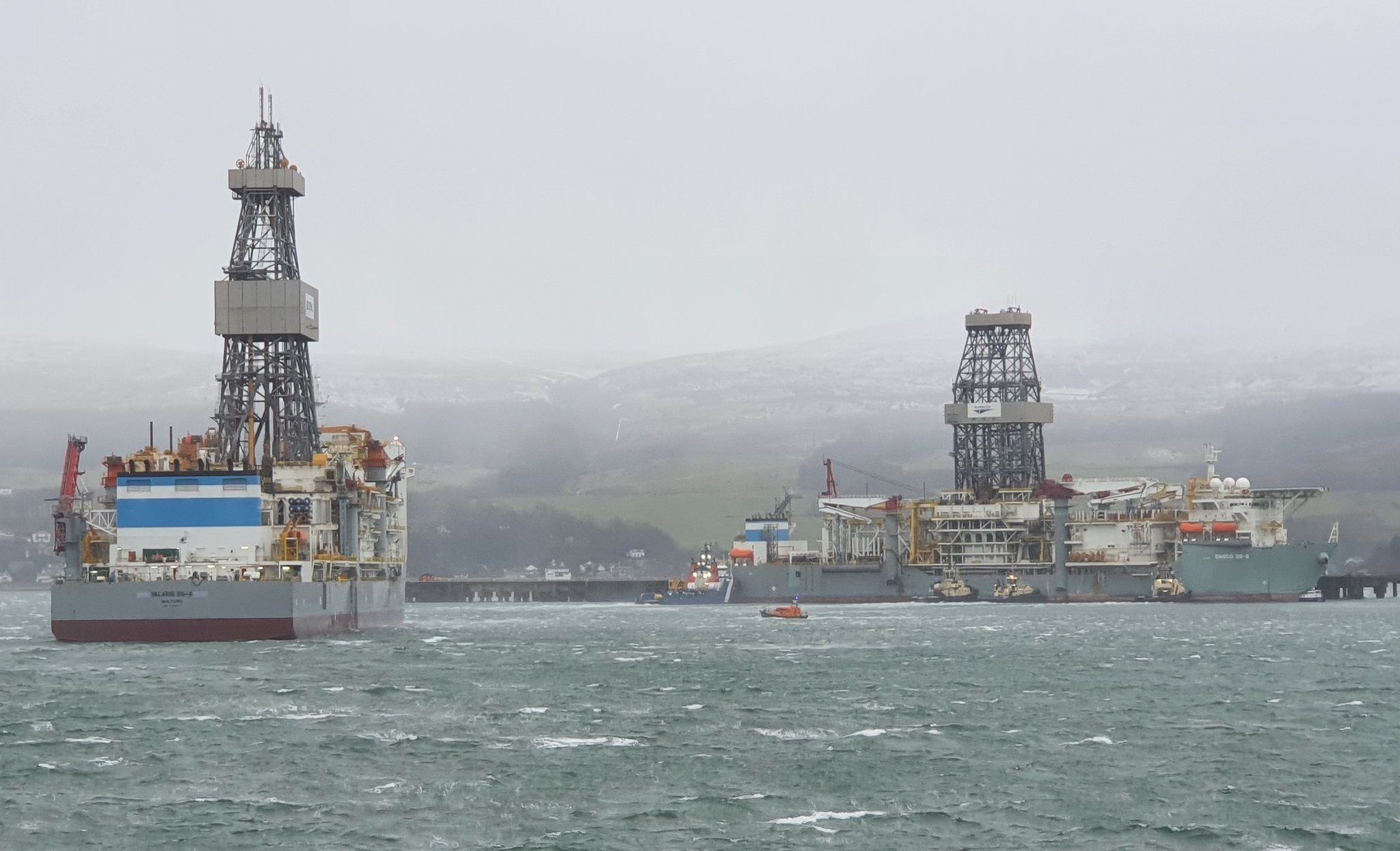
A drill ship broke its moorings at a terminal in southwest Scotland on Tuesday night and drifted into a channel before its crew was able to drop anchor and restore...
Editor’s NOTE: With Hurricane Sandy currently over Cuba and threatening Florida and the U.S. East Coast, here is a look at some of the top websites for tracking hurricanes as picked...
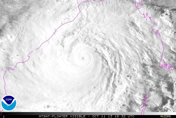
Tens of thousands fled their homes in coastal areas of eastern India and moved to shelters on Friday, bracing for the fiercest cyclone to threaten the country since a devastating storm killed 10,000 people 14 years ago.
October 11, 2013
Total Views: 45
Get The Industry’s Go-To News
Subscribe to gCaptain Daily and stay informed with the latest global maritime and offshore news
— just like 104,436 professionals
Secure Your Spot
on the gCaptain Crew
Stay informed with the latest maritime and offshore news, delivered daily straight to your inbox
— trusted by our 104,436 members
Your Gateway to the Maritime World!
Essential news coupled with the finest maritime content sourced from across the globe.

 Join The Club


![Top Hurricane Tracking Sites [Ranked]](https://gcaptain.com/wp-content/uploads/2012/08/699900main_sandy_360.jpeg)